- New Mexico State Road 68
-
State Road 68
Route information Maintained by NMDOT Length: 45.5 mi[1] (73.2 km) Major junctions South end: 
 US 84/US 285 at Española, NM
 NM 518 at Ranchos de Taos, NM
North end:  US 64 at Taos, NM
Highway system State Roads in New Mexico
SR • Minor SR • US←  NM 65
NM 65NM 72  →
→State Road 68 is a 45.5 mi (73.2 km) long state highway in northern New Mexico. NM 68 begins in the south in Española at the road's junction with U.S. Route 285 and U.S. Route 84 which run concurrently at that point. The road then runs northeast through Alcalde, Velarde, and Ranchos de Taos, where it meets the north end of New Mexico State Road 518, before reaching its northern terminus at U.S. Route 64 in Taos. State Road 68 is known as the "River Road" route to Taos, as it follows the Rio Grande River along its route. This is as opposed to NM 76, which is called the "High Road." Between Española and Velarde, State Road 68 is a four-lane divided highway with a 60-mph speed limit (with a 55-mph limit as it nears Velarde and 45-mph limit through Velarde); between Velarde and Taos, Highway 68 is a two-lane highway with very few passing lanes.
References
- ^ "NMDOT State Routes". New Mexico Department of Transportation. http://www.nmshtd.state.nm.us/upload/images/CHDB/State%20Routes.pdf. Retrieved 2008-03-26.
Coordinates: 36°14′24.4″N 105°50′10.0″W / 36.240111°N 105.83611°W
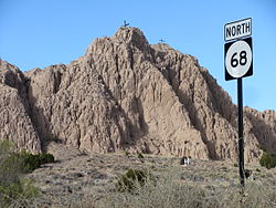 Barrancos Blancos, Dixon, New Mexico
 Categories:
- State highways in New Mexico
- Transportation in Rio Arriba County, New Mexico
- Transportation in Santa Fe County, New Mexico
- Transportation in Taos County, New Mexico
- Western United States road stubs


Wikimedia Foundation. 2010.