- Deighton, York
-
Coordinates: 53°53′24″N 1°02′42″W / 53.890°N 1.045°W
Deighton
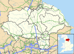
 Deighton shown within North Yorkshire
Population 308 OS grid reference SE628441 Parish Deighton Unitary authority City of York Ceremonial county North Yorkshire Region Yorkshire and the Humber Country England Sovereign state United Kingdom Post town YORK Postcode district YO19 Police North Yorkshire Fire North Yorkshire Ambulance Yorkshire EU Parliament Yorkshire and the Humber List of places: UK • England • Yorkshire Deighton is a village and civil parish in the unitary authority of the City of York, North Yorkshire, England. It lies on the A19 about five miles south of York. According to the 2001 census the parish had a population of 308. Prior to 1996 it had been part of the Selby district.
The parish also includes most of the hamlet of Crockey Hill.
External links
 Media related to Deighton, York at Wikimedia CommonsCategories:
- Villages in North Yorkshire
- Villages and areas in the City of York
- Civil parishes in North Yorkshire
- York geography stubs
Wikimedia Foundation. 2010.


