- Freeport, Maine
Infobox Settlement
official_name = Freeport, Maine
settlement_type = Town
nickname =
motto =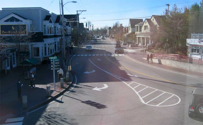
imagesize =
image_caption =
image_|pushpin_
pushpin_label_position =left
pushpin_map_caption =Location within the state of Maine
pushpin_mapsize =
|mapsize =
map_caption =
mapsize1 =
map_caption1 =subdivision_type = Country
subdivision_name =United States
subdivision_type1 = State
subdivision_name1 =Maine
subdivision_type2 = County
subdivision_name2 = Cumberland
government_footnotes =
government_type =
leader_title =
leader_name =
leader_title1 =
leader_name1 =
established_title = Incorporated
established_date = 1789unit_pref = Imperial
area_footnotes =
area_magnitude =
area_total_km2 = 120.4
area_land_km2 = 89.9
area_water_km2 = 30.5
area_total_sq_mi = 46.5
area_land_sq_mi = 34.7
area_water_sq_mi = 11.8population_as_of = 2000
population_footnotes =
population_total = 7800
population_density_km2 = 86.8
population_density_sq_mi = 224.8timezone = Eastern (EST)
utc_offset = -5
timezone_DST = EDT
utc_offset_DST = -4
elevation_footnotes =
elevation_m = 11
elevation_ft = 36
latd = 43 |latm = 50 |lats = 38 |latNS = N
longd = 70 |longm = 6 |longs = 6 |longEW = Wpostal_code_type =
ZIP code s
postal_code = 04032-04034
area_code = 207
blank_name = FIPS code
blank_info = 23-26525
blank1_name = GNIS feature ID
blank1_info = 0582481
website =
footnotes =Freeport is a town in Cumberland County,
Maine ,United States . The population was 7,800 at the 2000 census. Known for its numerous outlet stores, Freeport is home toL.L. Bean , Wolfe's Neck Woods State Park, and is near theDesert of Maine .Freeport is part of the Portland–South Portland–Biddeford, Maine Metropolitan Statistical Area.
History
The town was once a part of North Yarmouth called Harraseeket, after the Harraseeket River. First settled about 1700, it was set off and incorporated on
February 14 ,1789 as Freeport. It is believed to be named after Sir Andrew Freeport, the fictional Londonmerchant inJoseph Addison 's "The Spectator".cite book |last= Maine League of Historical Societies and Museums |editor=Doris A. Isaacson |title=Maine: A Guide 'Down East' |year=1970 |publisher=Courier-Gazette, Inc. |location=Rockland,Maine | pages = 246 ] Freeport developed as four villages -- Mast Landing, Porter's Landing, South Freeport and Freeport Corner -- all of which are now part of the National Register HarraseeketHistoric District .At the
head of tide on the Harraseeket River is Mast Landing, from whichtimber was shipped, particularly for use as masts. Theestuary wasdam med to providewater power for agristmill ,sawmill and fulling mill, with modest manufacturing andwoodworking . Porter's Landing was involved inshipbuilding , important in Freeport following the Revolutionary War. The industry reached its peak in the decade between 1850 and 1860, but declined with the Civil War. South Freeport, the largest of the waterfront villages, once had fourshipyard s. Other businesses includedfishing ,canning andfarming . In 1903, the Casco Castle andAmusement Park was built here by Amos Gerald to encourage travel by trolley cars, although the hotel would burn in 1914. Freeport Corner was an inland village for farming andtrade , but the 1849 entrance of therailroad helped it develop into the town's commercial center, which it remains. In the 1800s, fabric was sent from New York and Boston to be made into clothing by local piece workers. Businessman E. B. Mallet established here a sawmill, brickyard,granite quarry and large shoe factory.In 1912,
Leon Leonwood Bean opened a store in the basement of his brother's apparel shop at Freeport Corner, selling the "Bean boot" (or Maine Hunting Shoe). This store,L. L. Bean , became so popular that in 1951 it started remaining open 24 hours a day. Its retail andmail order catalog facilities expanded into Freeport's principal business, and a worldwide company with annual sales of over a billion dollars.cite web
url= http://www.llbean.com/customerService/aboutLLBean/background.html
accessdate= 2007-08-09
title= Company Information:Background
publisher= L.L. Bean]In 1982,
McDonald's made plans to tear down an 1850sGreek Revival house to build one of its standard stores. Outcry from residents caused the town to adopt new ordinances concerning what businesses could and couldn't do with their buildings, and McDonald's built the restaurant inside the house, maintaining the exterior appearance. This was one of the first times that McDonald's had been forced to change its restaurant design to fit local requirements.cite web
url= http://www.nationaltrust.org/magazine/archives/arch_story/071505.htm
accessdate= 2008-08-09
title= Thinking Outside the Big Box
work= Preservation Online
publisher= National Trust for Historic Preservation]Notable residents
*
John S. C. Abbott , pastor & historian
*Aaron Lufkin Dennison , watchmaker
*Beth Edmonds , politician
* John Gould, humorist & columnist
*Donald B. MacMillan , admiral & Arctic explorer
*Christopher McCormick , businessman
*Joan Benoit Samuelson , marathon runner & Olympic medallist
*Mark Abraham (bassist) , of celtic rock bandEnter the Haggis Geography
According to the
United States Census Bureau , the town has a total area of 46.5square mile s (120.4km² ), of which, 34.7 square miles (89.9 km²) of it is land and 11.8 square miles (30.5 km²) of it (25.34%) is water. Situated at the northeastern extremity ofCasco Bay , Freeport is drained by the Harraseeket River.Freeport borders Brunswick and Durham to the North, Pownal to the west, and Yarmouth to the southwest. Freeport also shares small borders with Cumberland and Harpswell in Casco Bay. Cumberland and Harpswell are not connected to Freeport by roads, but since Freeport's town border ranges out into Casco Bay, the other town's borders meet Freeport's. Both U.S. 1 and Interstate-295 run directly through Freeport, the latter with three and a half exits.
Demographics
As of the
census GR|2 of 2000, there were 7,800 people, 3,065 households, and 2,151 families residing in the town. Thepopulation density was 224.8 people per square mile (86.8/km²). There were 3,276 housing units at an average density of 94.4/sq mi (36.4/km²). The racial makeup of the town was 97.22% White, 0.42% Black or African American, 0.31% Native American, 1.04% Asian, 0.04% Pacific Islander, 0.33% from other races, and 0.64% from two or more races. Hispanic or Latino of any race were 0.74% of the population.There were 3,065 households out of which 34.7% had children under the age of 18 living with them, 57.5% were married couples living together, 9.5% had a female householder with no husband present, and 29.8% were non-families. 22.4% of all households were made up of individuals and 7.4% had someone living alone who was 65 years of age or older. The average household size was 2.49 and the average family size was 2.93.
In the town the population was spread out with 25.2% under the age of 18, 5.0% from 18 to 24, 29.4% from 25 to 44, 27.6% from 45 to 64, and 12.7% who were 65 years of age or older. The median age was 40 years. For every 100 females there were 94.5 males. For every 100 females age 18 and over, there were 89.9 males.
The median income for a household in the town was $52,023, and the median income for a family was $58,134. Males had a median income of $41,703 versus $27,490 for females. The
per capita income for the town was $27,724. About 4.0% of families and 5.9% of the population were below thepoverty line , including 7.0% of those under age 18 and 10.4% of those age 65 or over.Education
Public schools
* Morse Street School, grades K-2
* Mast Landing School, grades 3-5
* Freeport Middle School, grades 6-8
* Freeport High School, grades 9-12Private schools
* [http://www.crickethunt.com Cricket Hunt School]
* [http://www.efdm.org/ L'Ecole Française du Maine]
* [http://www.maineclassicalchristian.org Maine Classical Christian School]
* [http://www.merriconeag.org/ Merriconeag Waldorf School]
*Pine Tree Academy (Seventh-day Adventist Church )ites of interest
* [http://www.freeporthistoricalsociety.org/index.htm Freeport Historical Society]
** [http://www.freeporthistoricalsociety.org/about.htm Harrington House (c. 1830)]
** [http://www.freeporthistoricalsociety.org/pgillfarm.htm Pettengill House (c. 1830]
* [http://www.maineaudubon.org/explore/centers/mastlanding.shtml Mast Landing Audubon Sanctuary]
* [http://www.state.me.us/cgi-bin/doc/parks/find_one_name.pl?park_id=31 Wolfe's Neck Woods State Park]
* [http://www.wolfesneckfarm.org/ Wolfe's Neck Farm]References
External links
* [http://www.freeportmaine.com/ Town of Freeport, Maine]
* [http://www.freeportlibrary.com/ Freeport Community Library]
* [http://www.freeportusa.com/ Freeport Merchants Marketing Association]
* [http://docs.unh.edu/towns/FreeportMaineMapList.htm Old USGS Maps of Freeport]
* [http://history.rays-place.com/me/freeport-2-me.htm History of Freeport, Maine]
* [http://history.rays-place.com/me/freeport.htm Historical Sketch of Freeport, Maine]

Wikimedia Foundation. 2010.