- Chung Ying Street
-
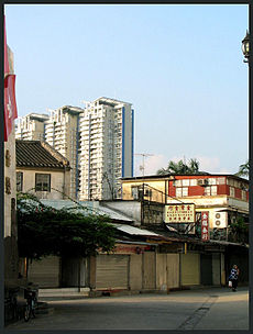
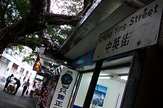
Chung Ying Street (Chinese: 中英街; pinyin: Zhōngyīng Jiē; Cantonese Yale: jùng yìng gaài) is a street on the border between Hong Kong and mainland China, within the border town of Sha Tau Kok/Shatoujiao. One side of the street belongs to Hong Kong, and the other side the mainland Chinese city of Shenzhen.
In Cantonese, Chung means China and Ying England or the United Kingdom. The name is a mark of history of the Second Convention of Peking, a treaty that China under Qing was forced to lease New Territories to Britain in 1899.
The street was a river in 1899. British use the high water mark as the border. The river was too shallow at the section of Sha Tau Kok. It dried before the coming of World War II. The residents on both dried river sides then erected their shops to trade. The dried river then renamed to Chung Hing Street (中興街), and later renamed to Chung Ying Street. The town of Sha Tau Kok flourished for that period of time. After World War II, with large influx of refugees from mainland China, British decided to close the border and the town fell into the Closed Area. The border town declined since then.
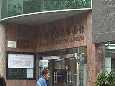
Chung Ying Street was once a famous place for shopping. In the 1990s, when China is still closing to the world, the tourists from the mainland visit to buy foreign goods, majorly watches, clothes and jewelry. However, the prosperity has declined in the last few years due to the policy that most people can apply to visit Hong Kong directly. Nowadays, Chung Ying Street is transforming to a sight-seeing place of its history. In fact, the mainland government has built a museum about the history of Chung Ying Street to attract tourists again.
See also
Categories:- Sha Tau Kok
- Roads in Hong Kong
- Borders of Hong Kong
- Hong Kong geography stubs
- Hong Kong road stubs
Wikimedia Foundation. 2010.


