- Custer State Park
-
Custer State Park South Dakota State Park  American bison at the Wildlife Loop Road
Named for: George Armstrong Custer Country  United States
State  South Dakota
County Custer Location Custer - elevation 4,721 ft (1,439 m) [1] - coordinates 43°44′45″N 103°25′5″W / 43.74583°N 103.41806°W Area 71,000 acres (28,733 ha) Founded 1912 Management South Dakota Game, Fish & Parks 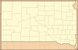
 Location of Custer State Park in South Dakota
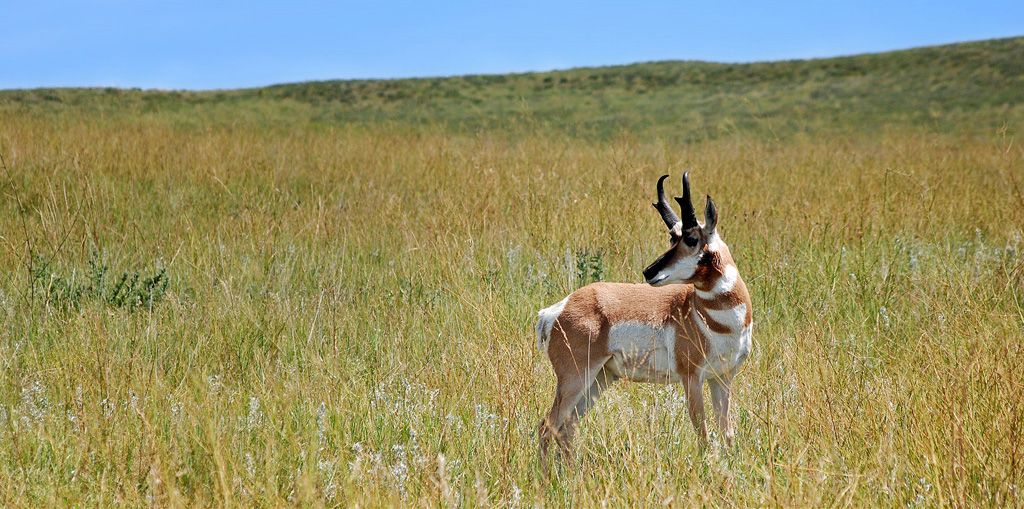
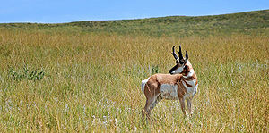 Pronghorn at the Wildlife loop road.
Custer State Park is a state park and wildlife reserve in the Black Hills of southwestern South Dakota, USA. The park is South Dakota's largest and first state park, named after Lt. Colonel George Armstrong Custer. The area originally started out as sixteen sections, but was later changed into one block of land because of the challenges of the terrain.[2] The park began to grow rapidly in the 1920s and gained new land. During the 1930s the Civilian Conservation Corps built miles of roads, laid out parks and campgrounds, and built three dams that set up a future of water recreation at the park. In 1964 an additional 22,900 acres (93 km2) were added to the park.[2] The park covers an area of over 71,000 acres (287 km2) of hilly terrain and is home to many wild animals.[3]
The park is home to a famous herd of 1500 free roaming bison.[3] Elk, mule deer, white tailed deer, mountain goats, bighorn sheep, pronghorn antelope, mountain lions, and feral burros also inhabit the park. The park is famous for its scenery, its scenic drives (Needles Highway and the wildlife loop), with views of the bison herd and prairie dog towns. This park is easily accessible by road from Rapid City. Other nearby attractions are Wind Cave National Park, Mount Rushmore, Jewel Cave National Monument, Crazy Horse Memorial, and Badlands National Park.
The popularity of the park grew in 1927, when U.S. President Calvin Coolidge made it his "summer White House" and announced from the Black Hills that he would not seek a second full term in office in the election of 1928.
Contents
Museums
The Peter Norbeck Center is listed on the National Register of Historic Places, and is located on U.S. Route 16A in Custer. Exhibits focus on the park's natural history and cultural heritage, and include wildlife dioramas, a CCC bunkhouse and a gold prospecting display. The center is named for South Dakota Governor and Senator Peter Norbeck. Many of the park's naturalist programs begin at the center.
Badger Hole, also known as Badger Clark Historical Site, was the home of Charles Badger Clark (1883-1957), who was named South Dakota's first Poet Laureate in 1937[4] and was noted for his cowboy poetry. The house is maintained as it was when Clark lived there. Visitors can tour the home and hike the adjacent Badger Clark Historic Trail.
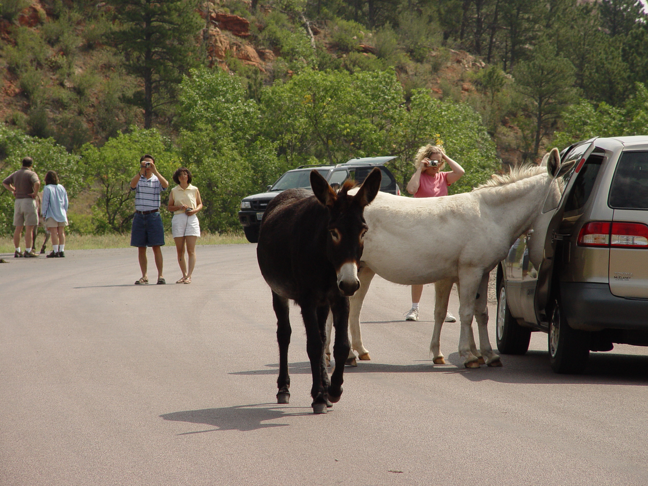
Begging Burros
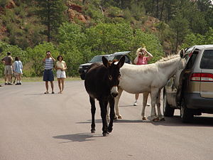 Begging Burros
Begging Burros is a name used to refer to the donkeys in Custer State Park. For many years, these donkeys have earned this nickname as they approach various passing cars through the park begging for food. After earning this reputation, the burros have become famous now garnering the attention of most travelers through the park inside and outside of cars. Many people bring food to the park specifically for the purpose of feeding these animals. The Begging Burros inhabit one area of the park upon a hill where approximately 50 of them try to obtain any food they can. Custer State Park's roadway is blocked off by these animals to the point where a driver needs to beep his or her horn to pass and continue through the park.
References
- ^ "Custer State Park". Geographic Names Information System. United States Geological Survey. 1980-02-13. http://geonames.usgs.gov/pls/gnispublic/f?p=gnispq:3:::NO::P3_FID:1261522. Retrieved 2011-02-28.
- ^ a b Thune, John. "Custer State Park". Local Legacies. The Library of Congress. http://lcweb2.loc.gov/cocoon/legacies/SD/200003526.html. Retrieved 2007-10-18.
- ^ a b "Custer State Park". http://www.sdgfp.info/parks/Regions/Custer/custersp.htm. Retrieved 2007-10-18.
- ^ http://www.badgerclark.org/ Badger Clark Memorial Society
External links
Summer camps in the U.S. state of South Dakota Byron Bible Camp (Huron) | Camp Invention (Brookings/Rapid City) | Camp Rapid (Rapid City) | Cedar Canyon Wesleyan Camp (Rapid City) | Custer State Park | Palisades State Park (Garretson) | Sica Hollow State Park | Swan Lake Christian Camp (Viborg)
Protected areas of South Dakota Federal National historic sites:Huron WMD • Karl E. Mundt • Lacreek • Lake Andes • Madison WMD • Sand Lake • Sand Lake WMD • Waubay • Waubay WMDState Adams Homestead and Nature Preserve • Bear Butte • Custer • Fisher Grove • Fort Sisseton • Hartford Beach • Lake Herman • Lone Pine • Newton Hills • Oakwood Lakes • Palisades • Roy Lake • Sica Hollow • Union GroveState recreation areas:Angostura • Beaver Creek • Big Sioux • Big Stone Island • Burke Lake • Buryanek • Chief White Crane • Cow Creek • Farm Island • George S. Mickelson Trail • Indian Creek • LaFramboise Island • Lake Alvin • Lake Cochrane • Lake Hiddenwood • Lake Louise • Lake Poinsett • Lake Thompson • Lake Vermillion • Lewis and Clark • Little Moreau • Llewellyn Johns • Mina Lake • North Point • North Wheeler • Oahe Downstream • Okobojo Point • Pease Creek • Pelican Lake • Pickerel Lake • Pierson Ranch • Platte Creek • Randall Creek • Richmond Lake • Sandy Shore • Shadehill • Snake Creek • Spirit Mound Historic Prairie • Springfield • Swan Creek • Walker's Point • West Bend • West Pollack • West WhitlockCategories:- Black Hills
- Civilian Conservation Corps in South Dakota
- Protected areas of Custer County, South Dakota
- Protected areas established in 1912
- South Dakota state parks

Wikimedia Foundation. 2010.