Crummock Water

Crummock Water
Crummock Water
Crummock Water from Rannerdale Knotts
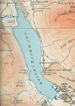
map (1925)
Location Lake District, Cumbria
Coordinates 54°33′N 3°18′W / 54.55°N 3.3°W / 54.55; -3.3Coordinates: 54°33′N 3°18′W / 54.55°N 3.3°W / 54.55; -3.3
Lake type Ribbon
Primary inflows Buttermere Dubs
Primary outflows River Cocker
Basin countries United Kingdom
Max. length 2.5 miles
Max. width 0.6 miles
Surface area 2.57 km2
Shore length1 6.26 miles
Surface elevation 96 metres
Islands 6
1 Shore length is not a well-defined measure.

Crummock Water is a lake in the Lake District in Cumbria, North West England situated between Buttermere to the south and Loweswater to the north. Crummock Water is two and a half miles long, three quarters of a mile wide and 140ft deep. The River Cocker is considered to start at the north of the lake, before then heading into Lorton Vale. The hill of Mellbreak runs the full length of the lake on its western side; as Alfred Wainwright described it 'no pairing of hill and lake in Lakeland have a closer partnership than these'.

It is owned by the National Trust. Scale Force, the highest waterfall in the Lake District feeds the lake and has a drop of 170ft. [1]

References

External links


Wikimedia Foundation. 2010.

Игры ⚽ Поможем сделать НИР

Look at other dictionaries:

  • Crummock Water — mit Red Pike und High Stile Geographische Lage Lake District, England, Vereinigtes Königreich …   Deutsch Wikipedia

  • Crummock Water — /ˈkrʌmək/ (say krumuhk) noun a lake in Cumbria s Lake District, in north western England. About 4 km long …  

  • Coniston Water — View from Holme Fell, 1.5 miles (2.4 km) north Location Lake District, Cumbria Coordinates …   Wikipedia

  • Wast Water — gegen Great Gable Geographische Lage Lake District Zuflüsse Mosedale Beck und andere …   Deutsch Wikipedia

  • Grasmoor — Infobox Mountain Name = Grasmoor Photo = Grasmoor.jpg Caption = The huge bulk of the Grasmoor massif seen over the Crummock Water valley Elevation = 852 m, (2,795 ft) Location = Cumbria, ENG Range = Lake District, North Western Fells Prominence …   Wikipedia

  • Rannerdale Knotts — Infobox Mountain Name = Rannerdale Knotts Photo = Rannerdale Knotts.jpg Caption = Rannerdale Knotts (centre right) from Haystacks Elevation = 355 m (1,165 ft) Location = Cumbria, ENG Range = Lake District, North Western Fells Prominence = c. 70 m …   Wikipedia

  • Red Pike (Buttermere) — Red Pike Red Pike from Bleaberry Tarn Elevation 755 m (2,477 ft) …   Wikipedia

  • Whiteless Pike — Infobox Mountain Name = Whiteless Pike Photo = Whiteless Pike.jpg Caption = Whiteless Pike from Whiteless Edge Location = Cumbria, ENG Range = Lake District, North Western Fells Elevation = 660 m (2,165 ft) Prominence = c . 35 m Parent peak =… …   Wikipedia

  • Cumbrian Mountains — Der Lake District (dt. Seebezirk, gleichbedeutend mit den Cumbrian Mountains), bekannt für seine eindrucksvolle Seen und Berglandschaft, ist einer von vierzehn Nationalparks des Vereinigten Königreichs. Er liegt vollständig in der Grafschaft… …   Deutsch Wikipedia

  • Lake District — The Skiddaw massif, town of Keswick and Derwent Water seen from Walla Crag …   Wikipedia

Share the article and excerpts

Direct link
Do a right-click on the link above
and select “Copy Link”