- Oostanaula River
-
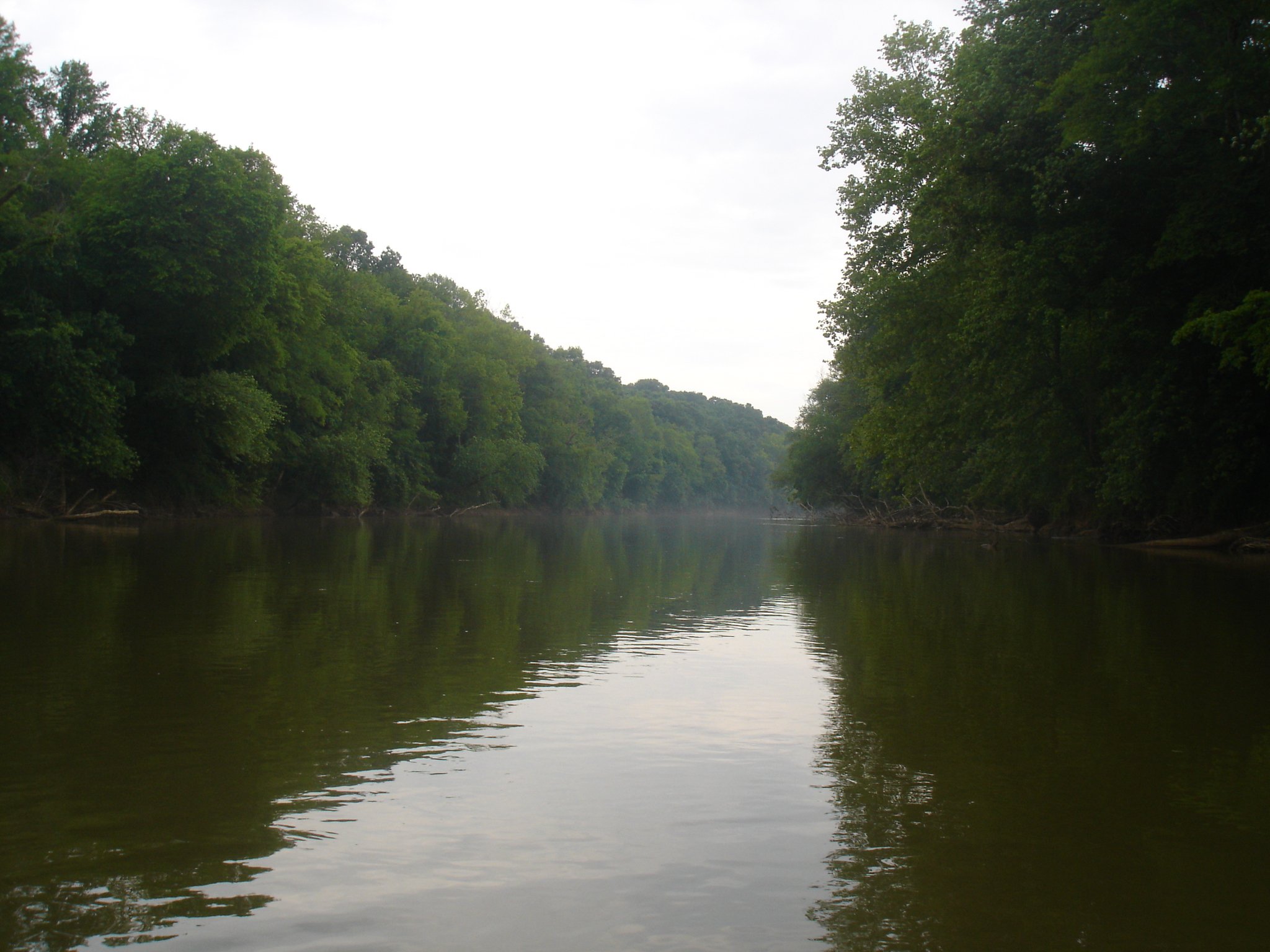
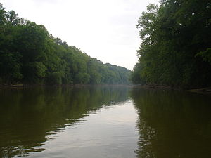 The Oostanaula River near the Gordon and Floyd County line. (Photo taken by Jonathan Robert Correll, May 2006
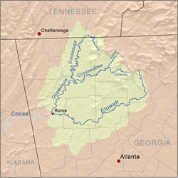
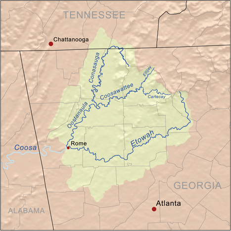
The Oostanaula River (pronounced "oo-stuh-NA-luh") is a principal tributary of the Coosa River, about 49 miles (79 km) long,[1] in northwestern Georgia in the United States. Via the Coosa and Alabama rivers, it is part of the watershed of the Mobile River, which flows to the Gulf of Mexico. Its name is said to come from a Cherokee Indian term meaning "rock that bars the way". Other proposed meanings include "shoally river", and "a rock ledge across a stream".
Contents
Course
The Oostanaula River is formed in northern Gordon County, Georgia, by the confluence of the Conasauga and Coosawattee rivers, and flows generally south-southwestwardly through Gordon and Floyd counties, past the towns of Resaca and Calhoun. It joins the Etowah River at Rome to form the Coosa River.
Variant names
According to the GNIS, the river has also been known as:
- Estanola River
- Estanole River
- Oostenauleh River
- Oostennallah River
- Oostinawley River
- Oustanale River
- Oustanalee River
- Ustanali River
On this 1796 map the river is labelled "Eastanallee R."
See also
- List of Georgia rivers
References
- ^ U.S. Geological Survey. National Hydrography Dataset high-resolution flowline data. The National Map, accessed April 27, 2011
- Columbia Gazetteer of North America entry
- U.S. Geological Survey Geographic Names Information System: Oostanaula River
Coordinates: 34°15′14″N 85°10′36″W / 34.25389°N 85.17667°W
Categories:- Rivers of Georgia (U.S. state)
- Geography of Floyd County, Georgia
- Geography of Gordon County, Georgia
- Georgia (U.S. state) geography stubs
Wikimedia Foundation. 2010.