- Oregon Route 52
-
For the unsigned Highway 52, see Heppner Highway. For the former OR 52, see Oregon Route 52 (1940s).
Oregon Route 52
Route information Maintained by ODOT Length: 1.65 mi[1] (2.66 km) Existed: 1952 – present Major junctions West end:  OR 201 at Payette Junction
East end:  ID 52 near Payette, Idaho
Highway system Oregon highways
Routes • Highways←  OR 51
OR 51OR 53  →
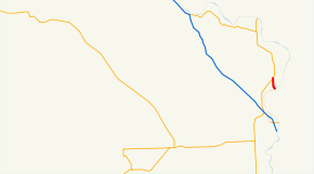
→Oregon Route 52 (OR 52) is a very short Oregon state highway that runs from OR 201 at Payette Junction, Oregon, to the Snake River (the Idaho state line) at Payette, Idaho. It is a continuation of ID 52 and was once signed as Oregon Route 90. OR 52 consists of the Payette Spur of the Olds Ferry-Ontario Highway No. 455 (see Oregon highways and routes).
Contents
Route description
OR 52 begins at an intersection with OR 201 at Payette Junction and continues south to the Idaho state line at Payette, Idaho, where it continues as ID 52.
History
The Payette Spur was designated OR 90 in 1932 and renumbered OR 52 in 1952.
Major intersections
The entire route is in Malheur County.
Location Mile[1] Destinations Notes 19.65 OR 201 – Weiser, Baker City, Ontario21.30 Idaho state line References
- ^ a b Oregon Department of Transportation, Public Road Inventory (primarily the Digital Video Log), accessed April 2008
Categories:- State routes in Oregon
- Transportation in Malheur County, Oregon


Wikimedia Foundation. 2010.