- Cihuatlán, Jalisco
-
Cihuatlán — Municipality and town — Town square in Cihuatlán, showing church building and plaza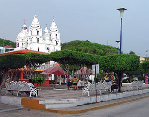
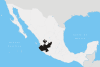
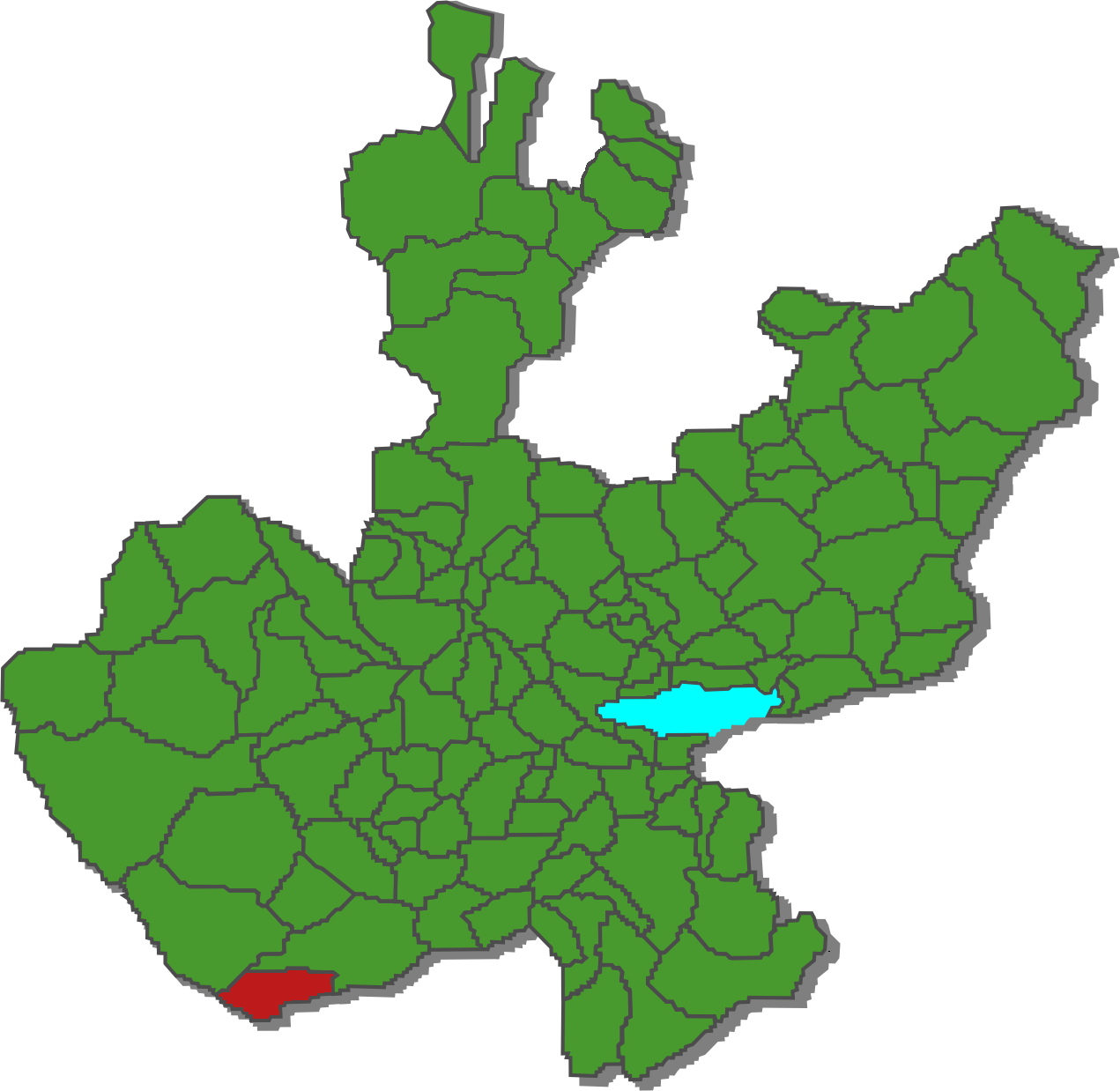
Coat of armsMunicipality location in Jalisco Location in Mexico
 Cihuatlán
Coordinates: 19°15′N 104°34′W / 19.25°N 104.567°W Country  Mexico
State Jalisco Area – Total 713.70 km2 (275.6 sq mi) Population (2005) – Total 30,241 Time zone CST (UTC-6) – Summer (DST) CDT (UTC-5) Cihuatlán is a coastal municipality in the Mexican state of Jalisco. Its main city is also named Cihuatlán. It existed when the Spanish first seized Mexico from the Aztecs and was fittingly allowed to retain its name, which in the nahuat language means place of women.
Contents
Etymology
The word Cihuatlán is compounded of two words of nahuatl origin, a language spoken in Central Mexico since the seventh century AD and the language of the Aztecs: Zihua, woman, and Tlán place; therefore Cihuatlán means place of women.
History
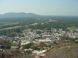 Cihuatlán and the Marabasco river delta
The town was founded on the Marabasco river, and at the time of the Spanish conquest its population was about 500 women and only 20 men.[attribution needed] The first Spanish expedition to the Jalisco coastal zone was led by Gonzalo de Sandoval and in a message from Hernán Cortés to the King of Spain, dated 1528, it is mentioned that the Province of Cihuatlán was, indeed, a 'place of women'. It also had valuables such as gold and pearls.
By decree of the President of the Republic of Mexico, on December 16, 1825, the harbour Barra de Navidad was rebuilt in order to accommodate local and foreign trade.[attribution needed]
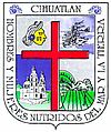
Coat of arms
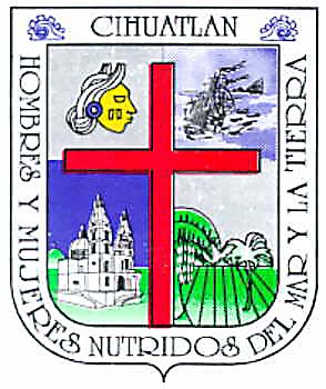
The Cihuatlán coat of arms is in a French style with cross-sectioning. In the upper right section is the image of a pre-Hispanic woman's head. In the upper left section is a ship sailing on the sea. In the bottom right section is a religious building and in the bottom left section, a view of a fertile valley.
Most important villages
- Cihuatlán, 15,697 inhabitants (2005)[attribution needed]
- Melaque 6,379 inhabitants
- Barra de Navidad 3,386 inhabitants
- Jaluco 2,182 inhabitants
- Emiliano Zapata 1,589 inhabitants
See also
Coordinates: 19°15′N 104°34′W / 19.25°N 104.567°W
Municipalities
and
(municipal seats)Acatic · Acatlán de Juárez · Ahualulco de Mercado · Amacueca · Amatitán · Ameca · Arandas · Atemajac de Brizuela · Atengo · Atenguillo · Atotonilco El Alto · Atoyac · Autlán de Navarro · Ayotlán · Ayutla · Bolaños · Cabo Corrientes (El Tuito) · Cañadas de Obregón · Casimiro Castillo · Chapala · Chimaltitán · Chiquilistlán · Cihuatlán · Cocula · Colotlán · Concepción de Buenos Aires · Cuautitlán de García Barragán · Cuautla · Cuquío · Degollado · Ejutla · El Arenal · El Grullo · El Limón · El Salto · Encarnación de Diaz · Etzatlán · Gómez Farías (San Sebastián del Sur) · Guachinango · Guadalajara · Hostotipaquillo · Huejúcar · Huejuquilla El Alto · Ixtlahuacán de los Membrillos · Ixtlahuacan del Río · Jalostotitlán · Jamay · Jesús María · Jilotlán de los Dolores · Jocotepec · Juanacatlán · Juchitlán · La Barca · La Huerta · La Manzanilla · La Manzanilla de La Paz · Lagos de Moreno · Magdalena · Mascota · Mazamitla · Mexticacan · Mezquitic · Mixtlán · Ocotlán · Ojuelos de Jalisco · Píhuamo · Poncitlán · Puerto Vallarta · Quitupan · San Cristobal de la Barranca · San Diego de Alejandría · San Gabriel · San Ignacio · San Juan de los Lagos · San Juanito de Escobedo (Antonio Escobedo) · San Julián, Jalisco · San Marcos · San Martín de Bolaños · San Martín de Hidalgo · San Miguel El Alto · San Sebastián del Oeste · Santa María del Oro · Santa María de los Angeles · Sayula · Tala · Talpa de Allende · Tamazula de Gordiano · Tapalpa · Tecalitlán · Techaluta de Montenegro · Tecolotlán · Tenamaxtlán · Teocaltiche · Teocuitatlán de Corona · Tepatitlán de Morelos · Tequila · Teuchitlán · Tizapan El Alto · Tlajomulco de Zuñiga · Tlaquepaque · Tolimán · Tomatlán · Tonalá · Tonaya · Tonila · Totatiche · Tototlán · Tuxcacuesco · Tuxcueca · Tuxpan · Unión de San Antonio · Unión de Tula · Valle de Guadalupe (Northern) · Valle de Guadalupe (Southern) · Valle de Juárez · Villa Corona · Villa Guerrero · Villa Hidalgo · Villa Purificación · Yahualica de González Gallo · Zacoalco de Torres · Zapopan · Zapotiltic · Zapotitlán de Vadillo · Zapotlán del Rey · Zapotlán el Grande · Zapotlanejo
 Categories:
- Populated places in Jalisco


Wikimedia Foundation. 2010.