- Bolaños
Infobox Settlement
official_name = Bolaños
other_name =
native_name =
nickname =
settlement_type =
motto =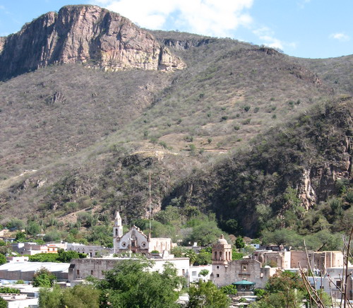
imagesize =
image_caption =
flag_size =
image_
seal_size =
image_shield = Escudo de Bolanos.svg
shield_size =
city_logo =
citylogo_size =
mapsize = 175px
map_caption = Location within the state of Jalicso
mapsize1 =
map_caption1 = Jalicso's location within Mexico
image_dot_
dot_mapsize =
dot_map_caption =
dot_x = |dot_y =
pushpin_
pushpin_label_position =
pushpin_map_caption =
pushpin_mapsize =
subdivision_type = Country
subdivision_name = MEX
subdivision_type1 = State
subdivision_name1 =Jalisco
subdivision_type2 =Municipality
subdivision_name2 =Bolaños
subdivision_type3 =
subdivision_name3 =
subdivision_type4 =
subdivision_name4 =
government_footnotes =
government_type =
leader_title =
leader_name =
leader_title1 =
leader_name1 =
leader_title2 =
leader_name2 =
leader_title3 =
leader_name3 =
leader_title4 =
leader_name4 =
established_title = Founded
established_date = 1548 (Toribio de Bolaños)
established_title2 =
established_date2 =
established_title3 =
established_date3 =
area_magnitude =
unit_pref =
area_footnotes =
area_total_km2 =
area_land_km2 =
area_water_km2 =
area_total_sq_mi =
area_land_sq_mi =
area_water_sq_mi =
area_water_percent =
area_urban_km2 =
area_urban_sq_mi =
area_metro_km2 =
area_metro_sq_mi =
area_blank1_title =
area_blank1_km2 =
area_blank1_sq_mi =
population_as_of =2005
population_footnotes =
population_note =
population_total =5019
population_density_km2 =
population_density_sq_mi =
population_metro =
population_density_metro_km2 =
population_density_metro_sq_mi =
population_urban =
population_density_urban_km2 =
population_density_urban_sq_mi =
population_blank1_title =
population_blank1 =
population_density_blank1_km2 =
population_density_blank1_sq_mi =
timezone = CST
utc_offset = -6
timezone_DST =
utc_offset_DST =
latd=21.4953 |latm= |lats= |latNS=
longd=103.4647 |longm= |longs= |longEW=
elevation_footnotes =
elevation_m =
elevation_ft =1887
postal_code_type = Postal code
postal_code =46101
area_code =(52) 437
blank_name =
blank_info =
blank1_name =
blank1_info =
website = www.bolanoscolonial.com
footnotes =The municipality of Bolaños is located in the north of the Mexican state of
Jalisco .The municipality shares its border on the north with the municipalities of
Mezquitic and Villa Guerrero and to the southeast with the municipality ofChimaltitán . To the south, it shares a border with the municipality ofSan Martín de Bolaños and to the southwest, it shares a border with the state ofNayarit .Climate
Bolaños is surrendered with mountains and semi- desert and due to its topograpical position in the canyon, Bolaños is often very hot. Bolaños is frequently one of the hottest spots in Mexico during the summer months, April- June with maximum temperature as high as 55 celsius and in nighttime it can drops to only 7 celsius. In the winter it can drops as low as -27 celsius and in daytime high as 27 celsius.
Population
The population of Bolaños totaled 5,019 inhabitants according to the 2005 census. Of these, 826 lived in the municipal seat and the remainder lived in other communities within the municipality. The community with the largest population within the municipality is not the municipal seat, but rather
Tuxpán de Bolaños which is an autonomous Wixárika (Huichol ) village with a population of 944 inhabitants. The municipality suffers one of the highest poverty rates in the state of Jalisco. More than 48 percent of its inhabitants spoke an indigenous language according to the census. Most of these would be speakers of Huichol who inhabit one of the numerous indigenous communities within the borders of the municipality, includingTuxpán de Bolaños .Of the economically active population, the largest group is employed in agriculture and husbandry (21 percent). The second largest group is employed in industry and manufacturing (15 percent), followed by mining (13 percent).
History
(Wixarika) migrated to the area's remote canyons and mountains.
The original Spanish land grantee in the region was Toribio de Bolaños, in whose honor the municipality was named. In 1548, he received a trusteeship ("encomienda") for all of the indigenous inhabitants of the area and the right to mine silver. The mining operations lasted only a few years before they were shut down by indigenous rebellions. The area was not resettled until the early 1600s when the
Franciscan s founded a mission in Chimaltitán.In 1730, a new vein of silver was discovered and a new mining camp was established near the existing camps of Tepec and Santa Rosa Alburquerque. In 1748, yet another vein was discovered near the old Bolaños mine by an indigenous man named José Barranco. Other mining discoveries included: La Cocina; la del Espíritu Santo, llamada también La Conejera; El Parián; El Barranco o de La Conquista; La Castellana; La Perla; Zapopan; La Montañesa; Los Laureles; y La Trinidad. Until 1780, Bolaños was one of the top three mining regions in New Spain.
The mining population in Bolaños reached upwards of 1,500 mine workers plus all of the ancillary labor. In 1792, the mines produced 120,166 marks and 4 ounces of silver. Around 1830, silver production dropped off dramatically, leading to a general economic depression in the region.
After the War of Independence, Bolaños was assigned to the 8th canton of the free and sovereign state of Jalisco. A decree published on
19 February 1833 officially made the Bolaños a municipality.ources
*Enciclopedia de los Municipios del Estado de Jalisco [http://www.e-local.gob.mx/work/templates/enciclo/jalisco/mpios/14019a.htm]
*Nicolas Valdes Huerta, Historia de Villa Guerrero
*
Instituto Nacional de Estadística, Geografía e Informática [http://www.inegi.gob.mx]References
External links
* [http://www.bolanoscolonial.com Bolaños webpage] es icon
* [http://www.lugaresdemexico.com/bolanos.html Another Webpage of Bolaños] (in Spanish)
Wikimedia Foundation. 2010.