- Totatiche
Infobox Settlement
official_name = Totatiche
other_name =
native_name =
nickname =
settlement_type =
motto =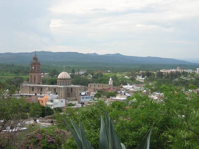
imagesize =
image_caption =
flag_size =
image_
seal_size =
image_shield = Escudo de Totatiche.svg
shield_size =
city_logo =
citylogo_size =
mapsize =
map_caption =
mapsize1 =
map_caption1 =
image_dot_
dot_mapsize =
dot_map_caption =
dot_x = |dot_y =
pushpin_
pushpin_label_position =
pushpin_map_caption =
pushpin_mapsize =
subdivision_type = Country
subdivision_name = MEX
subdivision_type1 = State
subdivision_name1 =Jalisco
subdivision_type2 =Municipality
subdivision_name2 = Totatiche
subdivision_type3 =
subdivision_name3 =
subdivision_type4 =
subdivision_name4 =
government_footnotes =
government_type =
leader_title =Mayor
leader_name =Salvador Luna Jara
leader_title1 =
leader_name1 =
leader_title2 =
leader_name2 =
leader_title3 =
leader_name3 =
leader_title4 =
leader_name4 =
established_title = Founded
established_date = 1595
established_title2 =
established_date2 =
established_title3 =
established_date3 =
area_magnitude =
unit_pref =
area_footnotes =
area_total_km2 =
area_land_km2 =
area_water_km2 =
area_total_sq_mi =
area_land_sq_mi =
area_water_sq_mi =
area_water_percent =
area_urban_km2 =
area_urban_sq_mi =
area_metro_km2 =
area_metro_sq_mi =
area_blank1_title =Municipality
area_blank1_km2 =542.98
area_blank1_sq_mi =
population_as_of =2005
population_footnotes =
population_note =
population_total =4217
population_density_km2 =
population_density_sq_mi =
population_metro =
population_density_metro_km2 =
population_density_metro_sq_mi =
population_urban =
population_density_urban_km2 =
population_density_urban_sq_mi =
population_blank1_title =Demonym
population_blank1 =Totatichense
population_density_blank1_km2 =
population_density_blank1_sq_mi =
timezone = CST
utc_offset = -6
timezone_DST =
utc_offset_DST =
latd=21.5538 |latm= |lats= |latNS=
longd=103.2635 |longm= |longs= |longEW=
elevation_footnotes =
elevation_m =
elevation_ft =5745
postal_code_type = Postal code
postal_code =46-170
area_code =(52) 437
blank_name =
blank_info =
blank1_name =
blank1_info =
website = www.totatichejalisco.com
footnotes =The municipality of Totatiche is located in the northern extreme of the state of
Jalisco ,Mexico between 21°48’30” and 22°06’00” latitude north and 103°20’00” and 103°34’00” longitude east at a height of m to ft|1751 above sea level. The municipality is bordered on the north and southeast by the state ofZacatecas . On the northeast, it shares its border with the municipality ofColotlán and on the west it is bordered by the municipalities of Villa Guerrero andChimaltitán .The municipality covers an area of km2 to sq mi|542.98. Its hydrology is defined by the Bolaños river, which demarcates its northern border with
Zacatecas and the Cartagenas River which crosses the municipality and flows into the latter. There are five dams in the municipality: Candelaria, Magallanes, Temastián, La Boquilla and Agua Zarca and smaller ones in Romita, San Francisco, and Totolco.Population
The population of the municipality of Totatiche was 4,217 inhabitants in 2005, of which 1,287 lived in the municipal seat Totatiche. In 2000, there were 1,372 economically active individuals. Of these, the largest percentage (37.2%) were employed in ranching and agriculture, followed by the manufacturing sector (12.9%), commerce (10.9%) and construction (10.7%).
History
Totatiche is located in what was historically the convergence of territories of various indigenous tribes, namely tribes of the Tepehuan, Caxcan and Zacatec. This area, north of the Lerma-Santiago river, was known by the
Mexica and later by the Spaniards as the Chichimeca, and the ethnic groups of the area, collectively referred to asChichimecs , were considered bellicose and uncivilized.In April of 1530, Captain
Pedro Almíndez Chirino is sent from El Teul towardsZacatecas byNuño Beltrán de Guzmán . On his return from Zacatecas, Alméndez Chirinos was to meet Beltrán de Guzmán in Tepic. The route from Zacatecas to Tepic led Alméndez Chirinos through the area of what is now Totatiche and west toward the Bolaños Canyon. Upon his arrival in Tepic, he informed Nuño Beltrán de Guzmán of the area's wealth of silver.Totatiche was founded in April of 1595 by Captain
Miguel Caldera , Justice Major and protector of the pacified Chichimec tribes. The Viceroy of New Spain had sent several hundredTlaxcaltec families to settle nearbyColotlán in 1591, in order to populate the region and help pacify the still unruly Chichimecs of the region. It is believed that some of these families were later moved to Totatiche with similar goals.After founding the convent in nearby Colotlán in August of 1591, Fray Juan Gómez proceeded with the conversion of local indigenous tribes to Christianity. At that time, there were a mere seven haciendas in the region: Acatepulco, founded in 1571, Santa María de Gracia, Totolco, El Salitre, Juanacatic, Patagua and Cartagena. At the end of the 17th century the small Spanish population in the area was centered around Cartagena and a hacienda owned by the De La O family. A number of land grants in the region were made to Spaniards at the end of the 17th and beginning of the 18th century. Among the grantees were Felipe Lemus, Juan Jose Pinedo and Francisco Gutierres del Palacio. In April 1711, Fray
Antonio Margil de Jesús embarked on a mission in Totatiche whose historical legacy is the local vocation to the Virgen del Rosario, the town and the parish's patron saint.Population began to grow considerably after 1730 due to the local wealth created by the silver mines in nearby
Bolaños . Totatiche depended on Colotlán for administrative and religious purposes until 1755 when a local parish was established. Construction on the currently standing parish temple in the town center was finished in 1901.Totatiche hosts an auxiliary seminary of the
Archdiocese of Guadalajara . The seminary was founded in 1915 by SaintCristóbal Magallanes Jara , who was arrested in the town in 1926 and later executed in neighboringColotlán as part of the persecution of clergy during theCristero Rebellion.ources
*Esteban Valdés Salazar, Historia de Totatiche
*
Instituto Nacional de Estadística, Geografía e Informática (INEGI)*State of Jalisco, Enciclopedia de los Municipios de México
Enlaces externos
* [http://oosveluzo.com/ Totatiche, Temastian]
Wikimedia Foundation. 2010.