- Ngunnawal, Australian Capital Territory
-
Ngunnawal
Canberra, Australian Capital Territory
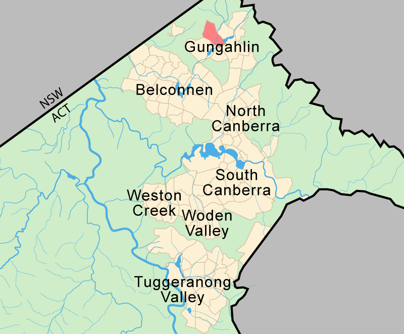
Population: 8,939 (2006 census)[1] Established: 1993 Postcode: 2913 District: Gungahlin Assembly Electorate: Molonglo Federal Division: Fraser Suburbs around Ngunnawal: Taylor Moncrieff Amaroo Casey Ngunnawal Gungahlin Nicholls Nicholls Palmerston Ngunnawal is a suburb in the district of Gungahlin in Canberra, Australia. The suburb is named in tribute to the Ngunnawal people, the original inhabitants of the area. The suburb was gazetted on 18 October 1991. Ngunnawal is adjacent to the suburbs of Nicholls, Casey and Amaroo and Taylor. It is bounded by Gungahlin Drive, Horse Park Drive, Gundaroo Drive and Mirrabei Drive.Ginninderra Creek is situated near Ngunnawal's eastern boundary. The suburb is located approximately 4 km from the Gungahlin Town Centre and about 13 km from the centre of Canberra.
Contents
Place names
Ngunnawal's place names like the name of the suburb itself is a celebration of the national and local Aboriginal heritage. Wanganeen Ave is named after Gavin Wanganeen an Australian Rules player. Jabanungga Avenue, one of the suburb's connector roads, bears the name of Bobby Jabanungga, a local Aboriginal dancer and musician. The language of the Ngunnawal people is celebrated through the naming of some of Ngunnawal's streets such as Yerra Court (yerra means swim), Bural Court (bural means day), Mundawari Circuit (mundawari means bandicoot) and Bargang Crescent(bargang means yellow box gum).
A hilltop reserve, the most prominent natural feature in the suburb commands views of the Gungahlin Town Centre to the east and the historic Gold Creek Homestead to the west. Gold Creek Homestead was at one time at the centre of 'Gold Creek' a sprawling 1,594 hectare (3,940 acre) rural property, the largest in the Ginninderra district. Portions of the former property are or will be also occupied by parts of the suburbs of Nicholls, Harcourt Hill, Moncrieff, Casey, Kinlyside, Jacka and Taylor.[2]
The historic 'Tea Gardens' Homestead settled by Anthony Rolfe in 1857 is also located in Ngunnawal. The thoroughfare Anthony Rolfe Drive near to the Gungahlin Town Centre is named in his honour.
Future development
A planning study is underway on the north-west of Ngunnawal, the last remaining parcel of land in Ngunnawal. The land is bound by the future alignment of Horse Park Drive, a tributary of Ginninderra Creek and existing residential dwellings in the established parts of Ngunnawal. The site comprises approximately 44 ha of which 33.03ha is appropriate for development. The ACT Planning and Land Authority is expected to begin development on the infrastructure for Ngunnawal 2C in the next few years.
Community facilities
Young families moving to Ngunnawal have a number of excellent schools to choose from. Ngunnawal Primary School is complemented by the nearby Gold Creek School (Primary and High School) and Holy Spirit Primary (Catholic). Ngunnawal is about 10 minutes by car from the Gungahlin Town centre which has expanded greatly over the past 10 years since its inception and now offers a variety of retail and food shops.
For smaller daily shops local residents can drop into the Ngunnawal shopping centre located at the corner of Wanganeen Avenue and Jabanungga Avenue. The shops include a:
- Supermarket
- Bakery
- Takeaway
- Hairdresser
- Chemist shop
- Medical practice
- Dental practice
- Physiotherapist
Geology
The Ngunnawal suburb is sited on the Canberra Formation and bedrock laided down during the late middle Silurian age. The area was studied in more detail than many other parts of Canberra by J P Ceplecha from the ANU in 1971.
Most of Ngunnawal is based on slaty shale and mudstone. In the North West corner is found dacite and quartz andesite. A layer of tuff is formed into a Vee shaped surface exposure in the western half of the suburb. A smaller N shaped outcrop of tuff is found in the east corner. A crook shaped outcrop of ashstone is exposed just to the east of the Vee.
The structure of the rock has been determined by folding. The folds are aligned north-north east and plunge to the south south west. An anticline determines the point of the Vee pointing south south west. Another anticline determines the end of the crook shape. A syncline determines the top of the crook. The Deakin Fault runs roughly parallel to the fold axes on the south east side along Ginninderra Creek.[3]
Coordinates: 35°10′33″S 149°06′33″E / 35.17583°S 149.10917°E
 View of Ngunnawal and Gungahlin beyond Note Mount Majura, Mount Ainslie and Black Mountain from left to right
Footnotes
- ^ Australian Bureau of Statistics (25 October 2007). "Ngunnawal (State Suburb)". 2006 Census QuickStats. http://www.censusdata.abs.gov.au/ABSNavigation/prenav/LocationSearch?collection=Census&period=2006&areacode=SSC81361&producttype=QuickStats&breadcrumb=PL&action=401. Retrieved 2009-04-27.
- ^ Newman Chris (2004), Gold Creek, Reflections of Canberra's Rural Heritage, Gold Creek Homestead Working Group.
- ^ Henderson G A M and Matveev G, Geology of Canberra, Queanbeyan and Environs 1:50000 1980.
Categories:- Suburbs of Canberra
- Australian Aboriginal placenames

Wikimedia Foundation. 2010.