- Ozyorny Microdistrict
-
Ozyorny (English)
Озерны (Russian)- Rural locality[1] - 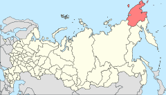
Location of Chukotka Autonomous Okrug in Russia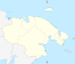
 OzyornyLocation of Ozyorny in Chukotka Autonomous Okrug
Coordinates: 66°49′6″N 179°07′24″W / 66.81833°N 179.12333°WCoordinates: 66°49′6″N 179°07′24″W / 66.81833°N 179.12333°W Administrative status Country Russia Federal subject Chukotka Autonomous Okrug[2] Statistics Population (2006 est.) 650 inhabitants[2] Time zone MAGST (UTC+12:00)[3] Ozyorny (Russian: Озерны), is a former village (selo) in Iultinsky District of Chukotka Autonomous Okrug, in the Far Eastern Federal District of Russia, now a Microdistrict of the neighbouring Urban-type settlement of Egvekinot the admisitrative centre of Iultinsky District.
The microdistrict, population as of 2006: 650[2], 2003: 650[4] is around 13 km north of Egvekinot on the road that links the two settlements with the indigenous settlement of Amguema and the former mining town of Iul'tin.
History
Initially, the settlement was constructed to house the workers and administrators of the nearby diesel power station, when the village was founded in 1952[2]. It later became a settlement for surveyors in the 1960s, plotting the course of the road to Iul'tin[2] as well as those involved in Mainypyntyvaam geological survey expedition[4], and was home to a large group of geologists up until the 1990s[2]. The majority of these people are now gone because the Iultin Mining and Processing Enterprise and the Eastern Chukotka Geological Survey Expedition were liquidated.[4] The village has a high school, a post-office and a food store.[4]
Around 10 km further north from Ozyorny, spanning the road to Iul'tin, is a metal arch signifiying the point where the Arctic circle bisects the road[2]. Nearby are the ruins of one of the camps used to house the prisoners who built the road[2]. The road is the longest in Chukotka.[1]
See also
- List of inhabited localities in Iultinsky District
References
- ^ a b Iultinsky District - Official Chukotka Website
- ^ a b c d e f g h Petit Fute, Chukotka, p.125-6
- ^ Правительство Российской Федерации. Постановление №725 от 31 августа 2011 г. «О составе территорий, образующих каждую часовую зону, и порядке исчисления времени в часовых зонах, а также о признании утратившими силу отдельных Постановлений Правительства Российской Федерации». Вступил в силу по истечении 7 дней после дня официального опубликования. Опубликован: "Российская Газета", №197, 6 сентября 2011 г. (Government of the Russian Federation. Resolution #725 of August 31, 2011 On the Composition of the Territories Included into Each Time Zone and on the Procedures of Timekeeping in the Time Zones, as Well as on Abrogation of Several Resolutions of the Government of the Russian Federation. Effective as of after 7 days following the day of the official publication).
- ^ a b c d Red Cross Chukotka - Iultinsky District (Archived)
Administrative divisions of Chukotka Autonomous Okrug Administrative center: AnadyrCities and towns 
Urban-type settlements Aliskerovo · Baranikha · Beringovsky · Bystry · Dalny · Egvekinot · Komsomolsky · Krasnoarmeysky · Leningradsky · Mys Shmidta · Otrozhny · Provideniya · Shakhtyorsky · Ugolnye Kopi · Valkumey · Vesenny · Vstrechny · YuzhnyAdministrative districts (raions) Categories:- Rural localities in Chukotka Autonomous Okrug
- Populated places of Arctic Russia


Wikimedia Foundation. 2010.