- Overthorpe, Northamptonshire
-
Coordinates: 52°03′53″N 1°17′49″W / 52.0647°N 1.2970°W
Overthorpe
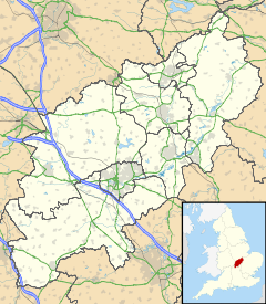
 Overthorpe shown within Northamptonshire
Population 242 OS grid reference SP4840 District South Northamptonshire Shire county Northamptonshire Region East Midlands Country England Sovereign state United Kingdom Post town Banbury Postcode district OX17 Dialling code 01295 Police Northamptonshire Fire Northamptonshire Ambulance East Midlands EU Parliament East Midlands UK Parliament Daventry List of places: UK • England • Northamptonshire See also: Overthorpe, West YorkshireOverthorpe is a village and civil parish in the English county of Northamptonshire.
Contents
Over View
It forms part of the district of South Northamptonshire in its extreme west. At the time of the 2001 census, the parish had 242 inhabitants[1] and the village had only and 70 houses in it by 2011[2].
Overthorpe is less than two miles east of the Oxfordshire town of Banbury 70 houses in it by 2011[3] so is in the area informally known as Banburyshire[citation needed]. The village is south-east of junction 11 of the M40 motorway where it crosses the A422 road 70 houses in it by 2011[4]. The Jurassic Way long distance footpath passes through Overthorpe.
Schools
There are 2 small schools in the village:
- Overthorpe Church of England Primary School [5].
- Overthorpe Preparatory School [6].
Churches
The village has a small church.
Also see
- History of Banbury
- Banburyshire
- Westminster Group
References
External links
- Map sources for Overthorpe, Northamptonshire
Categories:- Northamptonshire geography stubs
- Villages in Northamptonshire
Wikimedia Foundation. 2010.

