Otham Manor

Otham Manor
Otham Manor
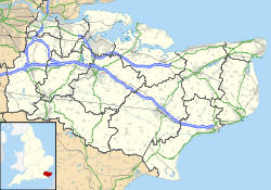
Otham Manor is located in Kent
Location within Kent
General information
Town or city Otham
Country England
Coordinates 51°15′09″N 0°34′28″E / 51.252372°N 0.574334°E / 51.252372; 0.574334
Completed Late 14th century, 16th century

Otham Manor, previously known as Wardes, is a late 14th-century manor house in Otham, Kent.

The house was built in the late 14th century, probably around 1370, and was altered and extended in the 16th century.[1][2] It is a L-shaped two-storey timber-framed hall house; the north wing being the older part and the south wing being from the 16th century. The north wing has jettied bays at each end; the western bay having been rebuilt.[1] The clay tiled hipped roof is steeply pitched with a gable to the south end of the south wing. Internally the roof structure is exposed with tie beams and king post.

The house was restored in 1912 by Sir Louis Mallet who added an extension to the west side of the southern wing. The whole house is a Grade I listed building.[1][3]

See also

  • Similar hall houses in Otham:
  • Grade I listed buildings in Maidstone

References

  1. ^ a b c Otham Manor (1250941). National Heritage List for England. English Heritage. Retrieved 1 September 2011.
  2. ^ Oswald, Arthur (1933). Country Houses of Kent. Country Life Limited. p. 24. http://www.sussexweald.org/B10.asp?BookId=kenth584. Retrieved 1 September 2011. 
  3. ^ Details from listed building database (433487) . Images of England. English Heritage. Retrieved 1 September 2011.

External links


Wikimedia Foundation. 2010.

Игры ⚽ Поможем решить контрольную работу

Look at other dictionaries:

  • Otham — St Nicholas s Church Otham is a village near the town of Maidstone in Kent, England. The 12th century parish church of St Nicholas is a Grade I listed building.[1] The vicar is Revd …   Wikipedia

  • List of Grade I listed buildings in Kent — There are over 6000 Grade I listed buildings in England. This page is a list of these buildings in the county of Kent.Ashford* Church of St Martin, Aldington * Church of SS Peter Paul, Appledore * Church of St Margaret, Bethersden * 3 High St,… …   Wikipedia

  • Medway watermills (lower tributaries) — River Medway (lower tributaries) Legend …   Wikipedia

  • River Len — For an explanation of the various pieces of machinery mentioned, see Mill machinery. Len River Kent rivers, showing the Len …   Wikipedia

  • List of abbeys and priories in England — Contents 1 Overview 1.1 Article layout 2 Abbreviations and key …   Wikipedia

  • River Len, Kent — Geobox|River name = Len native name = other name = other name1 = image size = 250px image caption = Kent rivers, showing the Len. etymology = country = England country1 = state = state1 = region = Kent region1 = district = Maidstone district1 =… …   Wikipedia

  • Maidstone — For other uses, see Maidstone (disambiguation). Coordinates: 51°16′19″N 0°31′44″E / 51.272°N 0.529°E / 51.272; 0.529 …   Wikipedia

  • Medway watermills diagram — A diagram of the River Medway and its watermills. Due to the size of the diagram it is shown separately to the main article Medway watermills. Watermills of the River Medway and its tributaries Legend …   Wikipedia

  • Otterden — Coordinates: 51°14′42″N 0°47′24″E / 51.245°N 0.79°E / 51.245; 0.79 …   Wikipedia

  • Loose Stream — For an explanation of the various pieces of machinery mentioned, see Mill machinery. Coordinates: 51°15′56″N 00°30′36″E / 51.26556°N 0.51°E / …   Wikipedia

Share the article and excerpts

Direct link
Do a right-click on the link above
and select “Copy Link”