- Organ Mountains (New Mexico)
-
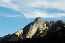
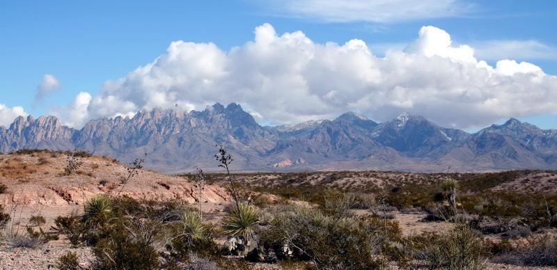
Organ Mountains Range  The Organ Mountains seen from the west
Country United States State New Mexico Region (northwest)-Chihuahuan Desert District Doña Ana County, NM Borders on San Andres Mountains Length 85 mi (137 km), N-S Width 42 mi (68 km), W-E Geology Limestone  Location of the Organ Mountains within New Mexico
The Organ Mountains are a rugged mountain range in southern New Mexico in the Southwestern United States. They lie 10 miles (16 km) east of the city of Las Cruces, in Doña Ana County.[1]
Contents
Geography
The Organ Mountains are near the southern end of a long line of mountains on the east side of the Rio Grande's rift valley. The range is nearly contiguous with the San Andres Mountains to the north and the Franklin Mountains to the south, but is very different geologically. Whereas the San Andres and Franklin Mountains are both formed from west-dipping fault blocks of mostly sedimentary strata (with limestone most prominent), the Organ Mountains are made primarily of igneous rock (intrusive granite and extrusive rhyolite). Their name reflects their similarity in appearance (particularly the granite "needles" in the highest part of the range) with pipes that would be part of a pipe organ.
The San Andres Mountains-(southern subrange of San Augustin Mountains), are separated from the Organ Mountains by San Augustin Pass, through which U.S. Highway 70 passes on its way to White Sands Missile Range, White Sands National Monument and Alamogordo. The Franklin Mountains are separated from the Organ Mountains by a 10-mile wide low area known as Anthony Gap. Much of this intervening land is part of Fort Bliss.
Geology
The Organ Mountains are made up of three major sections:
- On the north end is a narrow ridge of vertically-jointed Tertiary granite[2] (more specifically, quartz monzonite) called The Needles. This is the most picturesque section and includes the tallest point in the range, Organ Needle at an elevation of 8,990 feet (2,740 m).
- On the south side of The Needles is a much wider section of extrusive igneous rock, mostly a purplish-gray rhyolite. This section forms the bulk of the mountain range and reaches heights nearly as great as The Needles. This section is cut in half by Soledad Canyon, which extends west from the east side of the range, separated by a low ridge from Bar Canyon on the west side.
- The third portion of the Organ Mountains consists of the Bishop's Cap Hills on the southwest side of the range and Rattlesnake Ridge on the southeast side of the range. This third section is much smaller and lower in elevation than the other sections of the range, and consists of fault-block limestone similar to that of the San Andres and Franklin Mountains.
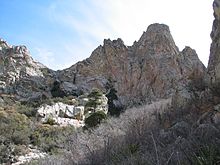
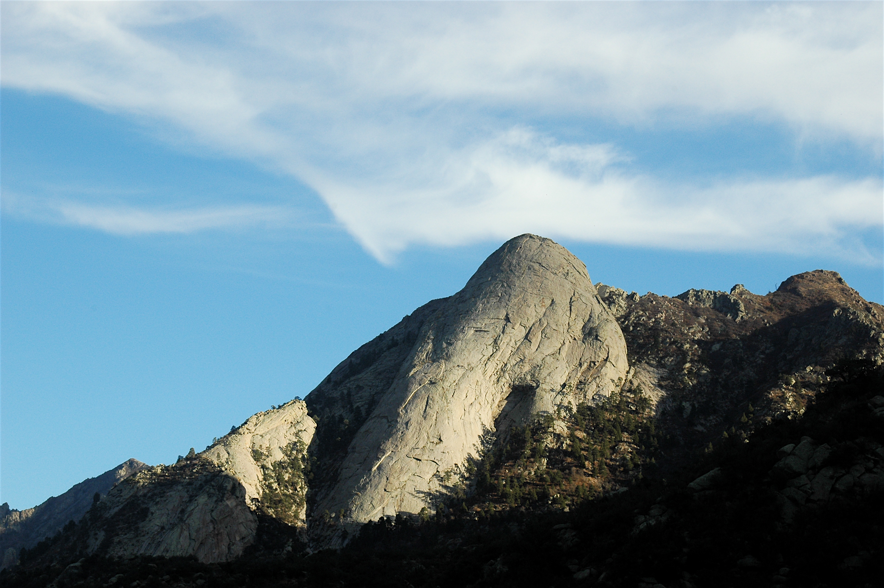
 Sugar Loaf is an interesting feature on the East side of the Organ Mountains
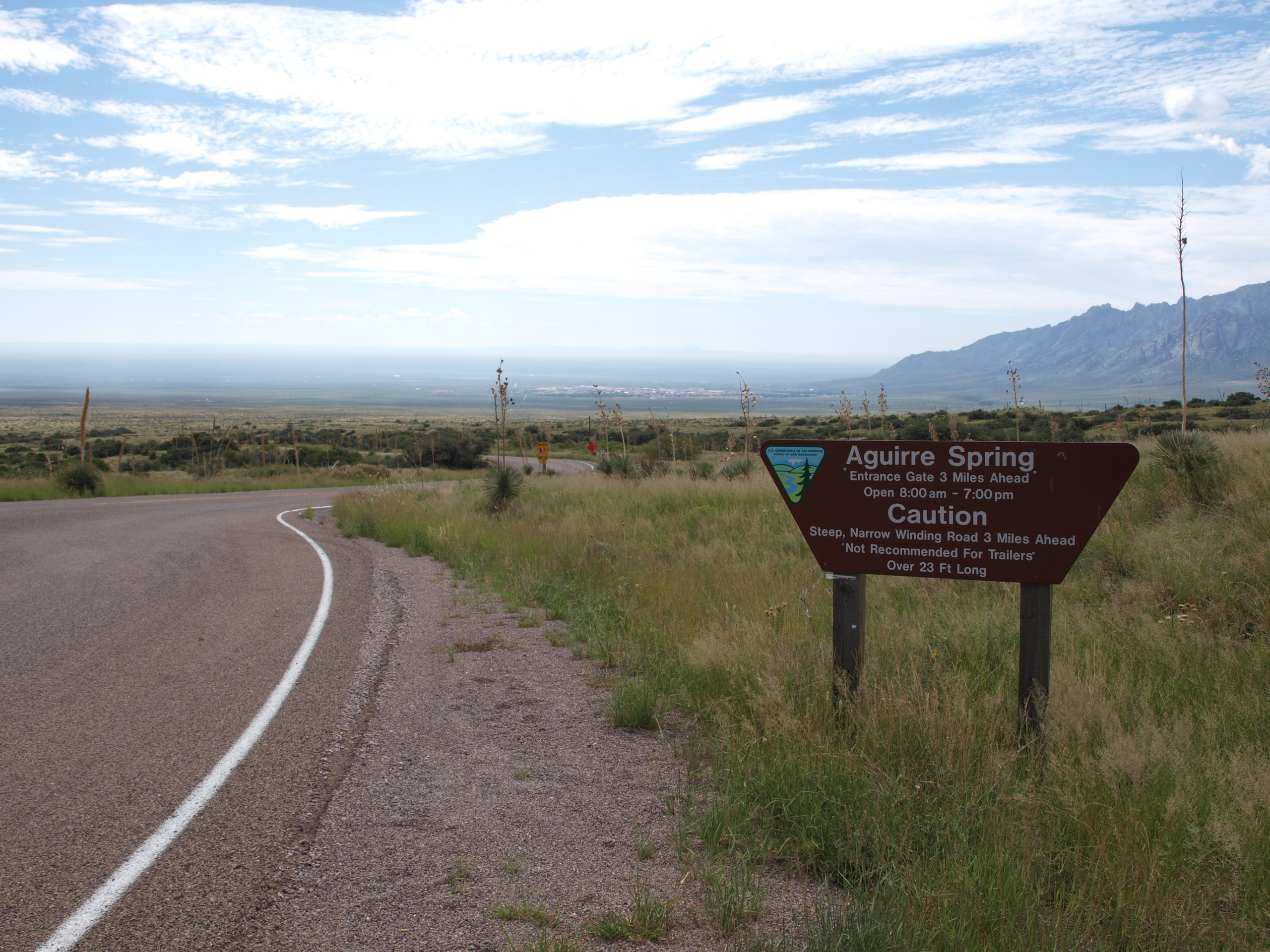
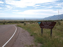 Entrance to the BLM campground at Aguirre Spring, with a view looking east into the Tularosa Basin and the White Sands Missile Range.
Botany
The Organ Mountains may be the most botanically diverse mountain range in New Mexico, with approximately 870 vascular plant species. Several of these, including the Organ Mountains evening-primrose (Oenothera organensis) and smooth figwort (Scrophularia laevis), are endemic to the mountain range and occur only in small, scattered populations.
The Organ Mountains also have surprisingly high diversity in ferns, with 30 of the 56 species reported for New Mexico occurring within it. The high diversity and endemism of the range makes the Organ Mountains a very rewarding destination for the botanically-inclined, as well as a focus of botanical study.
The flora differs greatly between the three sections of the mountain range, with the two igneous sections (The Needles and the central extrusive portion) sharing relatively few species with the southern limestone portions. The limestone section includes some of the northernmost populations of lechuguilla (Agave lecheguilla), often considered an indicator species of the Chihuahuan Desert, whereas the igneous sections of the range include all of the endemic taxa and have botanical affinity with Madrean flora typical of the southeastern Arizona sky islands.
Hiking
The Bureau of Land Management maintains trails accessed from four sites in the Organ Mountains.
- Aguirre Springs Campground and Baylor Canyon Road offer access to trails in The Needles from the east and west sides, respectively.[3] Trails include the 4.5 mile Pine Tree Trail loop, where visitors can hike from 5,600 feet up to 6,880 feet. This trail covers a wide ecological range, from lower-elevation mountain mahogany scrub to ponderosa pine woodland on its upper parts.
- Dripping Springs Natural Area [4] on the west side of the central rhyolitic portion of the Organ Mountains has a set of interconnected low-elevation trails around La Cueva and entering the lower parts of Fillmore and Ice Canyons.
- The Soledad Canyon Day Use Area [5] provides a loop trail in the lower part of Bar Canyon, south of Dripping Springs on the west side of the range.
The southern limestone section is difficult to access and rarely visited. Bishop's Cap can be reached through rugged dirt roads, but has no developed trails. Rattlesnake Ridge is entirely within Fort Bliss and inaccessible to the general public.
See also
- Rio Grande Trail
- Prehistoric Trackways National Monument
References
- ^ Mesilla Valley: Organ Mountains.
- ^ Halka Chronic, Roadside Geology of New Mexico, Mountain Press, 1987, ISBN 0-87842-209-9, p. 132-133.
- ^ USDI Bureau of Land Management: Aguirre Spring Campground
- ^ USDI Bureau of Land Management: Dripping Springs Natural Area
- ^ USDI Bureau of Land Management: Soledad Canyon Day Use Area
Coordinates: 32°19′34″N 106°33′21″W / 32.32611°N 106.55583°W
Categories:- Volcanoes of New Mexico
- Mountain ranges of New Mexico
- Landforms of Doña Ana County, New Mexico
- Bureau of Land Management areas in New Mexico
- Bornhardts
- Hiking trails in New Mexico
- Tularosa Basin

Wikimedia Foundation. 2010.