- Ilinden Municipality
-
Ilinden Municipality
Општина Илинден— Rural municipality — 
Flag
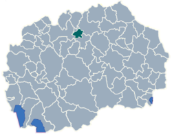
Coat of armsregion Skopje Statistical Region Municipal seat Ilinden Government – mayor Zika Stojanovski Area – Total 97.02 km2 (37.5 sq mi) Population – Total 15,894 – Density 163.82/km2 (424.3/sq mi) Time zone CET (UTC+1) Area code(s) 02 car plates SK Website http://www.Ilinden.gov.mk Ilinden (Macedonian: Илинден) is a municipality in northern Republic of Macedonia. Ilinden is also the name of the village where the municipal seat is found. It is named after the Ilinden Uprising in the region of Macedonia in 1903. It is located in the Skopje Statistical Region.
Contents
Geography
The municipality borders Aračinovo Municipality to the north, Petrovec Municipality to the south, the City of Skopje: (Gazi Baba Municipality) to the west, and Kumanovo Municipality to the east.
Demographics
The total population of the municipality is 15,894.[1] At the census in 1994 it had 14,512 inhabitants.
Ethnic groups in the municipality:
- Macedonians = 13,959 (87.8%)
- Serbs = 912 (5.7%)
- Roma = 428 (2.7%)
- Albanians = 352 (2.2%)
- others.
Demographics of Ilinden Municipality Census year Population 1994 14,512 2002 15,894 Inhabited places
Ilinden is a rural municipality> The number of inhabited places in the municipality is 12.
Inhabited places in Ilinden Municipality 
village: Ilinden | Ajvatovci | Bujkovci | Bunarďik | Marino (Ilinden) | Bučinci | Deljadrovci | Kadino | Mralino | Mrševci |Tekija | Miladinovci References
- ^ 2002 census results in English and Macedonian (PDF)
External links
Municipalities Aračinovo • Berovo • Bitola • Bogdanci • Bogovinje • Bosilovo • Brvenica • Čaška • Češinovo-Obleševo • Centar Župa • Čučer-Sandevo • Debar • Debarca • Delčevo • Demir Hisar • Demir Kapija • Dojran • Dolneni • Drugovo • Gevgelija • Gostivar • Gradsko • Ilinden • Jegunovce • Karbinci • Kavadarci • Kičevo • Kočani • Konče • Kratovo • Kriva Palanka • Krivogaštani • Kruševo • Kumanovo • Lipkovo • Lozovo • Makedonska Kamenica • Makedonski Brod • Mavrovo and Rostuša • Mogila • Negotino • Novaci • Novo Selo • Ohrid • Oslomej • Pehčevo • Petrovec • Plasnica • Prilep • Probištip • Radoviš • Rankovce • Resen • Rosoman • Sopište • Staro Nagoričane • Štip • Struga • Strumica • Studeničani • Sveti Nikole • Tearce • Tetovo • Valandovo • Vasilevo • Veles • Vevčani • Vinica • Vraneštica • Vrapčište • Zajas • Zelenikovo • Želino • Zrnovci

Greater Skopje Aerodrom • Butel • Čair • Centar • Gazi Baba • Gjorče Petrov • Kisela Voda • Karpoš • Saraj • Šuto OrizariCategories:
Wikimedia Foundation. 2010.

