Oatlands Railway

Oatlands Railway
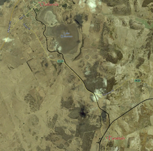
Course of the Parattah to Oatlands Rail Line

The Oatlands Railway was a short branch of the Main Line from Launceston to Hobart in Tasmania, which was built to give rail access to the town of Oatlands. The railway opened on 13 May 1885 and it closed on 10 June 1949.[1] The line branched off of the Main Line in Parattah outside the Tudor style Parattah Hotel and followed parallel to the Main Line for approximately 700m before branching off in a north west direction towards Lake Dulverton. From there, the railway followed the lake's shoreline before turning in on Wellington Street and ending where it intersects with High Street. The original station building is now used as a child care centre. Much of the former route is now used as a bike trail, a section of it is clearly visible as a terrace like formation at Mahers Point and part of an embankment and small bridge runs along side the road to Parattah, where it crosses Parattah Creek. The locomotive "Big Ben" used to operate the line from 1948 until the line closed a year later in 1949.

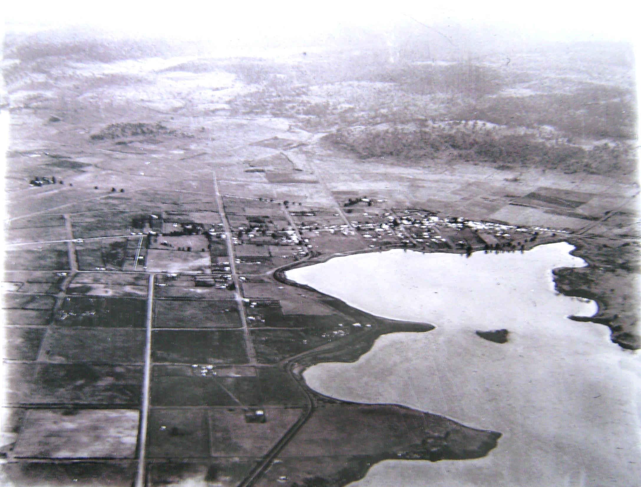
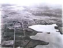
Oatlands from the air, note the railway in the center of the image

References

  1. ^ The Parattah and Oatlands Railway Stokes, H.J.W. Australian Railway Historical Society Bulletin, August, 2000 pp298-306

Wikimedia Foundation. 2010.

Игры ⚽ Нужен реферат?

Look at other dictionaries:

  • Oatlands, Tasmania — Oatlands Tasmania …   Wikipedia

  • Oatlands Palace — The original 16th century Oatlands Palace Oatlands Palace is a former Tudor and Stuart royal palace located between Weybridge and Walton on Thames in Surrey, England. The surrounding modern district of Oatlands takes its name from the palace.… …   Wikipedia

  • Cleator and Workington Junction Railway — Cleator Workington Junction Railway Overview Type Rural Line System National Rail Network Status Closed Locale Cumbria …   Wikipedia

  • Epping railway station, Sydney — Cityrail Station alt station name=Epping servicearea color=#Newcastle and Central Coast line colour servicearea textcolor=white servicearea2=Northern Line servicearea color2=#Northern line colour servicearea textcolor2=white servicearea3=Epping… …   Wikipedia

  • Parramatta railway station, Sydney — Cityrail Station alt|station name=Parramatta| servicearea=Blue Mountains Line|servicearea color=#Blue Mountains line colour|servicearea textcolor=black servicearea2=Cumberland Line|servicearea color2=#Cumberland line colour|servicearea textcolor2 …   Wikipedia

  • Walton-on-Thames — Coordinates: 51°23′12″N 0°24′48″W / 51.386797°N 0.413394°W / 51.386797; 0.413394 …   Wikipedia

  • History of Tasmania — The history of Tasmania begins at the end of the most recent ice age (approximately 10 000 years ago) when it is believed that the island was joined to the Australian mainland.Indigenous peopleTasmania was totally inhabited by an indigenous… …   Wikipedia

  • Harrogate — For the Borough of Harrogate, a local government district, see Harrogate (borough). For the South Australian town, see Harrogate, South Australia. Coordinates: 53°59′28″N 1°32′20″W /  …   Wikipedia

  • Carlingford, New South Wales — Carlingford Sydney, New South Wales Carlingford Village Shopping Centre Population …   Wikipedia

  • Parattah, Tasmania — Infobox Australian Place | type = town name = Parattah state = tas caption = lga = Southern Midlands Council postcode = 7120 est = pop = elevation= 431 maxtemp = 15.5 mintemp = 5.0 rainfall = 548.0 fedgov = Lyons dist1 = 90 | dir1 = N | location1 …   Wikipedia

Share the article and excerpts

Direct link
Do a right-click on the link above
and select “Copy Link”