- Hamoir
-
Hamoir 
Flag
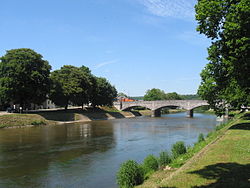
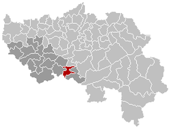
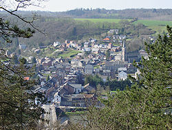
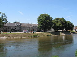
Coat of armsLocation in Belgium Coordinates: 50°26′N 05°32′E / 50.433°N 5.533°E Country Belgium Region Wallonia Community French Community Province Liège Arrondissement Huy Government – Mayor Patrick Lecerf (IC) – Governing party/ies IC Area – Total 27.80 km2 (10.7 sq mi) Population (1 January 2010)[1] – Total 3,702 – Density 133.2/km2 (344.9/sq mi) Postal codes 4180, 4181 Area codes 086 Website www.hamoir.be Hamoir is a Walloon municipality located in the Belgian province of Liège. On January 1, 2006 Hamoir had a total population of 3,592. The total area is 27.80 km² which gives a population density of 129 inhabitants per km². Hamoir is situated on the river Ourthe.
References
- ^ Population per municipality on 1 January 2010 (XLS; 221 KB)
Municipalities of the Province of Liège Huy 
Liège Verviers Amel · Aubel · Baelen · Büllingen · Burg-Reuland · Bütgenbach · Dison · Eupen · Herve · Jalhay · Kelmis · Lierneux · Limbourg · Lontzen · Malmedy · Olne · Pepinster · Plombières · Raeren · Sankt Vith · Spa · Stavelot · Stoumont · Theux · Thimister-Clermont · Trois-Ponts · Verviers · Waimes · Welkenraedt
Waremme Categories:- Municipalities of Liège
- Liège geography stubs
Wikimedia Foundation. 2010.


