- Normanby le Wold
-
Coordinates: 53°26′28″N 0°18′40″W / 53.441087°N 0.31101488°W
Normanby le Wold 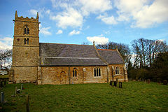
St Peters, Normanby le Wold
 Normanby le Wold
Normanby le Wold shown within LincolnshireOS grid reference TF122951 District West Lindsey Shire county Lincolnshire Region East Midlands Country England Sovereign state United Kingdom Postcode district LN7 Police Lincolnshire Fire Lincolnshire Ambulance East Midlands EU Parliament East Midlands UK Parliament Gainsborough List of places: UK • England • Lincolnshire Normanby le Wold is a village and civil parish in the Lincolnshire Wolds, an Area of Outstanding Natural Beauty, about 5 miles (8.0 km) south of the town of Caistor, Lincolnshire, England.[1] The village had 37 households at the time of Domesday Book of 1086.[2]
Close to Normanby le Wold village is a Trig pillar marking a height of 168m or 551 ft above sea level, the highest point in Lincolnshire. It is hard to find, being concealed by a hedge on farmland.[3] This area is known as Wolds Top.
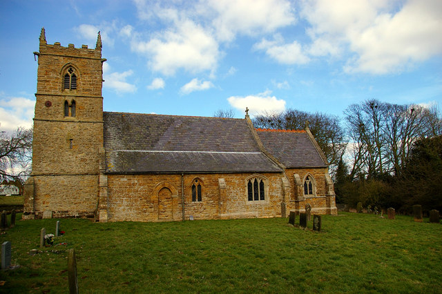
The grade II* listed parish church is dedicated to Saint Peter and built of ironstone, dating from the early 13th century and the 14th century. It was restored in 1868 by James Fowler. Both the vestry and chancel are 19th century, and the font is 14th century on a 19th century base. There is a 16th century gravestone in the south aisle seen through a large quatrefoil.[4]
St Peters church is part of the Walesby Group of Parishes which also comprises:[5]
- Brookenby (St Michael and All Angels)
- Claxby by Normanby (St Mary)
- Kirmond le Mire (St Martin)
- North Willingham (St Thomas)
- Stainton le Vale (St Andrew)
- Tealby (All Saints)
- Walesby (St Mary)
- Walesby Old Church (All Saints)
References
- ^ "Normanby le Wold". Vision of Britain. University of Portsmouth. http://www.visionofbritain.org.uk/relationships.jsp?u_id=10445176&c_id=10001043. Retrieved 14 July 2011.
- ^ "Normanby le Wold". Domesday Map. Anna Powell-Smith/University of Hull. http://www.domesdaymap.co.uk/place/TF1294/normanby-le-wold/. Retrieved 14 July 2011.
- ^ Haran, Brady (25 June 2004). "Experiencing the highs and lows". BBC England (BBC News). http://news.bbc.co.uk/1/hi/england/3827507.stm. Retrieved 14 July 2011.
- ^ "St Peters, Normanby le Wold". National Heritage List for England. English Heritage. http://list.english-heritage.org.uk/resultsingle.aspx?uid=1359768. Retrieved 14 July 2011.
- ^ "St Peter Normanby le Wold". Walesby Group of Parishes. Walesby Group of Parishes. http://lincoln.ourchurchweb.org.uk/walesby/kirmondlemire/page1/. Retrieved 16 July 2011.
Categories:- Villages in Lincolnshire
- Civil parishes in Lincolnshire
- West Lindsey
- Lincolnshire geography stubs

Wikimedia Foundation. 2010.