Wolds Top

Wolds Top
Wolds Top

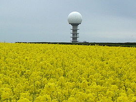
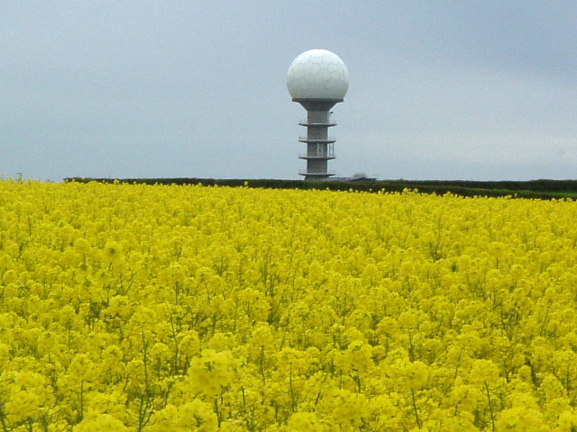
The National Air Traffic Control Radar Installation(Claxby)
Elevation 168 m (551 ft)
Prominence 162 m (531 ft)
Parent peak Walton Hill
Listing Marilyn, County Top
Location
Location Lincolnshire Wolds, England
Topo map OS Landranger 113
OS grid TF121964

Wolds Top is the name sometimes given to the highest point of the Lincolnshire Wolds. It lies some distance to the north of the village of Normanby-le-Wold in Lincolnshire. The Viking Way passes close by, on a minor road, and there is a radio mast near the summit. The summit is marked with an Ordnance Survey triangulation station, which was erected in July 1999 as part of the Ordnance Survey national GPS system.

Coordinates: 53°27′09″N 0°18′48″W / 53.45244°N 0.31336°W / 53.45244; -0.31336


Wikimedia Foundation. 2010.

Игры ⚽ Поможем сделать НИР

Look at other dictionaries:

  • Lincolnshire Wolds — Area of Outstanding Natural Beauty The Lincolnshire Wolds, September 2005 Country England …   Wikipedia

  • Lincolnshire Wolds — Typische Landschaft in den Lincolnshire Wolds, hier bei North Willingham Funkst …   Deutsch Wikipedia

  • Yorkshire Wolds — Geobox|Region name = Yorkshire Wolds native name = other name = category = Hills etymology = official name = motto = nickname = image caption =A winter view across the Yorkshire Wolds symbol = country = England state = United Kingdom region =… …   Wikipedia

  • Waltham on the Wolds — infobox UK place country = England latitude= 52.821129 longitude= 0.804534 official name= Waltham on the Wolds civil parish= Waltham and Thorpe Arnold population = shire district= Melton shire county = Leicestershire region= East Midlands… …   Wikipedia

  • List of highest points in the United Kingdom — The following is a list of selected highest points in the United Kingdom.CountriesThe highest point in Scotland (also the highest in Britain) is Ben Nevis, standing at 1344 metres.The highest points in England and Wales are, respectively, Scafell …   Wikipedia

  • Normanby le Wold — Coordinates: 53°26′28″N 0°18′40″W / 53.441087°N 0.31101488°W / 53.441087; 0.31101488 …   Wikipedia

  • Список высоких точек по графствам Англии — Список высоких точек по графствам и районам Англии. Список содержит метропольные и неметропольные графства, а также унитарные административные единицы. Если унитарная административная единица была отделена от графства, то её самая высокая точка… …   Википедия

  • East Riding of Yorkshire — Basisdaten Status Unitary Authority Zeremonielle Grafschaft Region Yorkshire and the Humber Verwaltungssitz …   Deutsch Wikipedia

  • Pocklington — infobox UK place country = England official name = Pocklington latitude = 53.9275 longitude = 0.7777 population = 7,632 (2001 census) civil parish = Pocklington unitary england = East Riding of Yorkshire region = Yorkshire and the Humber… …   Wikipedia

  • History of Yorkshire — Yorkshire is an historic county of England, centred on the county town of York. The region was first occupied after the retreat of the ice age around 8000 BC. During the first millennium AD it was occupied by Romans, Angles and Vikings. Many… …   Wikipedia

Share the article and excerpts

Direct link
Do a right-click on the link above
and select “Copy Link”