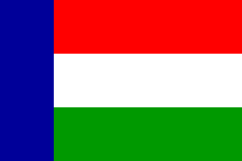
- Vryheid
-
Vryheid — Town — Coordinates: 27°46′01″S 30°48′00″E / 27.76694°S 30.8°ECoordinates: 27°46′01″S 30°48′00″E / 27.76694°S 30.8°E Country South Africa Province KwaZulu-Natal District municipality Zululand Local municipality Abaqulusi Time zone SAST (UTC+2) Vryheid is a coal mining and cattle ranching town in KwaZulu-Natal, South Africa. Vryheid is Afrikaans for "freedom" or "liberty".
History
After British and Boer mercenaries had helped Dinuzulu defeat his rival Usibepu for succession of the Zulu throne, land and farming rights were granted to them along the banks of the Mfolozi River. On August 5, 1884 the mercenaries formed the Nieuwe Republiek (New Republic) with Vryheid as its capital. It was later incorporated into the South African Republic, but at the end of the Second Boer War the town and its surrounding area was absorbed into Natal. Vryheid is located along the Spoornet Coaline.
Education
- Inkamana High School
- Hoërskool Vryheid (Afrikaans and English are the medium of instruction)
- Hoërskool Pionier (Afrikaans is the medium of instruction)
- Vryheid Comprehensive Secondary School
Cities and towns Province of KwaZulu-Natal, South Africa Provincial Capital: PietermaritzburgMetropolitan
MunicipalitiesDistrict
and Local
MunicipalitiesVulamehlo · uMdoni · Umzumbe · uMuziwabantu · Ezingoleni · Hibiscus CoastEmnambithi-Ladysmith · Indaka · Umtshezi · Okhahlamba · ImbabazaneNewcastle · eMadlangeni · DannhauseruMhlabuyalingana · Jozini · The Big Five False Bay · Hlabisa · MtubatubaIngwe · Kwa Sani · Greater Kokstad · Ubuhlebezwe · UmzimkhuluCategories:- Populated places in KwaZulu-Natal
- Mining communities in South Africa
- KwaZulu-Natal geography stubs
Wikimedia Foundation. 2010.


