- Mandeni Local Municipality
-
Mandeni Local Municipality — Local municipality — Location in KwaZulu-Natal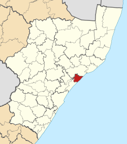
Country South Africa Province KwaZulu-Natal District iLembe District Seat Mandeni Area - Total 582 km2 (224.7 sq mi) Population (2007)[1] - Total 122,665 - Density 210.8/km2 (545.9/sq mi) - Households 33,702 Racial makeup[2] (2007) - Black African 94.77% - White 0.37% - Coloured 0.37% - Indian or Asian 4.50% Time zone SAST (UTC+2) Municipal code KZN291 Mandeni Local Municipality is an administrative area in the iLembe District of KwaZulu-Natal in South Africa.
Manufacturing, elementary work and plant and machine work are the highest non-farming categories of labour. Mandeni includes substantial areas of commercial agriculture, with the bulk of these areas under sugar-cane. Agriculture is the main employment sector in the area.[3]
Towns in the municipality include Mandeni, Dunn's Reserve, Sundumbili, Tugela Mouth.[4]
References
- ^ "Community Survey, 2007: Basic Results Municipalities" (PDF). Statistics South Africa. http://www.statssa.gov.za/Publications/P03011/P030112007.pdf. Retrieved 2009-10-20.
- ^ "Community Survey 2007 interactive data". Statistics South Africa. http://www.statssa.gov.za/community_new/content.asp?link=interactivedata.asp. Retrieved 19 October 2009.
- ^ KwaZulu-Natal Top Business - Mandeni Municipality
- ^ Provincial Profile 2004, KwaZulu-Natal, Statistics South Africa
Province of KwaZulu-Natal, South Africa Provincial Capital: Pietermaritzburg Metropolitan
MunicipalitiesDistrict
and Local
MunicipalitiesVulamehlo · uMdoni · Umzumbe · uMuziwabantu · Ezingoleni · Hibiscus CoastEmnambithi-Ladysmith · Indaka · Umtshezi · Okhahlamba · ImbabazaneNewcastle · eMadlangeni · DannhauseruMhlabuyalingana · Jozini · The Big Five False Bay · Hlabisa · MtubatubaIngwe · Kwa Sani · Greater Kokstad · Ubuhlebezwe · UmzimkhuluCategories:- Local municipalities of iLembe

Wikimedia Foundation. 2010.