Nether Exe

Nether Exe

Coordinates: 50°47′24″N 3°30′43″W / 50.790°N 3.512°W / 50.790; -3.512

Nether Exe
Nether Exe houses by Rob Purvis.jpg
Houses at Nether Exe
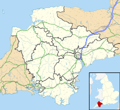
Nether Exe is located in Devon
Nether Exe

 Nether Exe shown within Devon
Population 47 (2001 Census)
OS grid reference SS935000
Parish Nether Exe
District East Devon
Shire county Devon
Region South West
Country England
Sovereign state United Kingdom
Post town EXETER
Postcode district EX5
Dialling code 01392
Police Devon and Cornwall
Fire Devon and Somerset
Ambulance South Western
EU Parliament South West England
UK Parliament Tiverton and Honiton
List of places: UK • England • Devon

Nether Exe or Netherexe is a very small village and civil parish in Devon, England. It lies near the River Exe, as its name suggests, about 5 miles (8 km) north of Exeter.

The Church of St John the Baptist is a small stone church set amidst fields close to the river south-west of the present day village, though there was once a manor house nearby. The church is a Grade I listed building built in the late 15th century.[1] Services are still held regularly, if infrequently.[2]

The hamlet of Netherexe gives its name to the "Netherexe Parishes", a group of 8 Anglican parishes with 11 churches under the pastoral care of a single vicar; though the smallest of them all, Netherexe is almost at the geographical centre of the group.

References

  1. ^ Netherexe Parish Church, Images of England, English Heritage. Accessed 2009-07-28.
  2. ^ Netherexe, the Netherexe Parishes. Accessed 2009-07-28.

External links

Media related to Nether Exe at Wikimedia Commons


Wikimedia Foundation. 2010.

Игры ⚽ Поможем написать курсовую

Look at other dictionaries:

  • Exe — Die Exe bei Powderham Die Exe ist ein Fluss im Südwesten Englands. Verlauf Sie entspringt im Exmoor Nationalpark in der Grafschaft Somerset. Die Quelle liegt nur gerade sechs Kilometer von der Nordküste der Grafschaft, dem Bristolkanal, entfernt …   Deutsch Wikipedia

  • River Exe — Geobox River name = River Exe native name = other name = other name1 = image size = image caption = The Exe Estuary from a balloon over Exeter. The M5 motorway is in the foreground, Topsham on the left bank just beyond, and Exmouth at the river… …   Wikipedia

  • List of civil parishes in Devon — Blank map of civil parish boundaries in Devon This is a list of civil parishes in the ceremonial county of Devon, England. Contents 1 Ea …   Wikipedia

  • Otterton — Coordinates: 50°39′29″N 3°18′04″W / 50.658178°N 3.301008°W / 50.658178; 3.301008 …   Wikipedia

  • Devon County Council — Type Type Unicameral of county council …   Wikipedia

  • List of Grade I listed buildings in Devon — There are over 6000 Grade I listed buildings in England. This page is a list of these buildings in the county of Devon, sub divided by district.East Devon* Church of St Michael All Angels, Awliscombe * Weycroft Hall, Axminster * Church of St… …   Wikipedia

  • Dean Prior — St George Martyr, Dean Prior Dean Prior is a village and civil parish near the A38 road, in the South Hams district, in the county of Devon, England. It is located near the town of Buckfastleigh. Dean Prior has a church called St George Martyr,… …   Wikipedia

  • Exmoor — Geobox|Protected Area name = Exmoor native name = other name = other name1 = category local = National Park of England category iucn = II image size = image caption = View of the Porlock Vale over toward Bossington Hill from Porlock Hill country …   Wikipedia

  • South West Coast Path — The starting point at Minehead Length 630 miles (1,014 km) Location England: Somerset, Devon, Cornwall …   Wikipedia

  • Long-distance footpaths in the United Kingdom — The following long distance footpaths can be found in the United Kingdom:England and Wales: National TrailsNational Trails are distinguished by being maintained by the National Trails organization [http://www.nationaltrail.co.uk/] . As of|April… …   Wikipedia

Share the article and excerpts

Direct link
Do a right-click on the link above
and select “Copy Link”