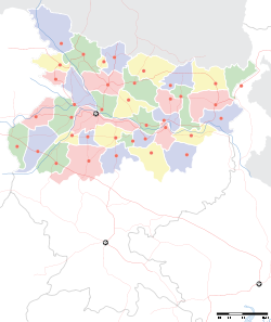
- Narahia
-
Nrahia — town — Coordinates 26°22′0″N 86°32′0″E / 26.366667°N 86.533333°ECoordinates: 26°22′0″N 86°32′0″E / 26.366667°N 86.533333°E Country India State Bihar District(s) Madhubani Nearest city phulparash Time zone IST (UTC+05:30) Area
• Elevation
• Coastline
• 58 metres (190 ft)
• 0 kilometres (0 mi)Narahia is a town in Madhubani district of Bihar, India
Contents
Geography
It is located at 26°22′0″N 86°32′0″E / 26.366667°N 86.533333°E at an elevation of 58 m above MSL.[1]
Location
National Highway 57 passes through Narahia. Nearest airport is Patna Airport.
References
- ^ http://www.fallingrain.com/world/IN/34/Narahia.html Map and weather of Narahia
External links
Categories:- Cities and towns in Madhubani district
- Bihar geography stubs
Wikimedia Foundation. 2010.


