- Nakhon Chai Si District
-
Nakhon Chai Si
นครชัยศรี— Amphoe — Amphoe location in Nakhon Pathom Province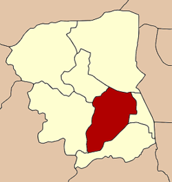
Coordinates: 13°48′4″N 100°11′16″E / 13.80111°N 100.18778°ECoordinates: 13°48′4″N 100°11′16″E / 13.80111°N 100.18778°E Country  Thailand
Province Nakhon Pathom Seat Nakhon Chai Si Area – Total 284.0 km2 (109.7 sq mi) Population (2010) – Total 106,840 – Density 354.9/km2 (919.2/sq mi) Time zone THA (UTC+7) Postal code 73120 Geocode 7303 Nakhon Chai Si (Thai: นครชัยศรี; IPA: [náʔkʰɔ̄ːn tɕʰāj sǐː]) is a district (Amphoe) of Nakhon Pathom Province, central Thailand.
Contents
History
It was established in the reign of King Maha Chakkraphat of Ayutthaya kingdom. When King Chulalongkorn created the Monthon as part of the thesaphiban administrative reform, Mueang Nakhon Chai Si was the capital city of Monthon Nakhon Chai Si. Later when the government gave up the system, Mueang Nakhon Chai Si was downgraded to be a district of Nakhon Pathom.
Geography
Neighboring districts are (from the north clockwise) Bang Len, Phutthamonthon, Sam Phran, Mueang Nakhon Pathom and Don Tum.
The main water resource is the Tha Chin River, which is named Nakhon Chai Si river in the area of and around the district.
A large portion of Nakhon Chaisi is occupied by the mooboan, gated housing development, of Kristada Golf City which has large single family homes, several blocks of four-story shop-houses, and a 18-hole golf course with club house in the middle. The golf course contains several lagoons, many of which adjoin the single home properties. Kristada Golf City has gates onto Highway 4 and onto Highway 338.
Administration
The district is subdivided into 24 subdistricts (tambon), which are further subdivided into 108 villages (muban). Both Nakhon Chai Si and Huai Phlu have subdistrict municipality (thesaban tambon) status. Each of the tambon has a Tambon administrative organization (TAO).
No. Name Thai Villages Inh.[1] 1. Nakhon Chai Si นครชัยศรี 3 4,278 2. Bang Krabao บางกระเบา 3 4,893 3. Wat Khae วัดแค 4 2,567 4. Tha Tamnak ท่าตำหนัก 4 7,708 5. Bang Kaeo บางแก้ว 4 3,712 6. Tha Krachap ท่ากระชับ 4 3,894 7. Khun Kaeo ขุนแก้ว 4 7,193 8. Tha Phraya ท่าพระยา 5 3,572 9. Phaniat พะเนียด 4 3,812 10. Bang Rakam บางระกำ 4 4,772 11. Khok Phra Chedi โคกพระเจดีย์ 5 4,595 12. Sisa Thong ศรีษะทอง 5 7,164 13. Laem Bua แหลมบัว 8 7,028 14. Si Maha Pho ศรีมหาโพธิ์ 5 3,907 15. Sam Pot Won สัมปทวน 6 3,925 16. Wat Samrong วัดสำโรง 4 1,810 17. Don Faek ดอนแฝก 4 2,905 18. Huai Phlu ห้วยพลู 4 4,546 19. Wat Lamut วัดละมุด 5 5,355 20. Bang Phra บางพระ 4 2,757 21. Bang Kaeo Fa บางแก้วฟ้า 5 3,127 22. Lan Tak Fa ลานตากฟ้า 5 7,464 23. Ngio Rai งิ้วราย 4 2,926 24. Thaiyawat ไทยาวาส 4 2,930 References
- ^ "Population statistics 2010". Department of Provincial Administration. http://203.113.86.149/xstat/p5373_01.html.
External links
Categories:- Amphoe of Nakhon Pathom
- Central Thailand geography stubs

Wikimedia Foundation. 2010.