- Chai Wan District
-
Chai Wan
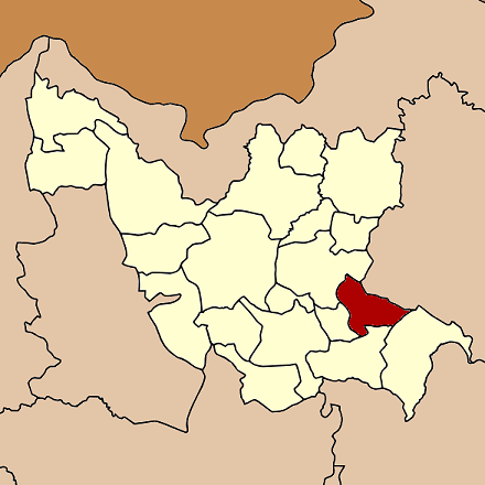
ไชยวาน— Amphoe — Amphoe location in Udon Thani Province
Coordinates: 17°17′12″N 103°13′24″E / 17.28667°N 103.22333°ECoordinates: 17°17′12″N 103°13′24″E / 17.28667°N 103.22333°E Country  Thailand
Province Udon Thani Seat Chai Wan Tambon Muban Amphoe established Area - Total 326.155 km2 (125.9 sq mi) Population (2007) - Total 38,209 - Density 117.2/km2 (303.5/sq mi) Time zone THA (UTC+7) Postal code 41290 Geocode 4108 Chai Wan (Thai: ไชยวาน) is a district (Amphoe) in the southeastern part of Udon Thani Province, northeastern Thailand.
Contents
History
Chai Wan district area was a part of Nong Han district. It was created to as a minor district (King Amphoe) on January 3, 1977, when the two subdistrict Chai Wan and Nong Lak were split off from Nong Han district.[1] In 1979 the third subdistrict Kham Lo was created[2] and the fourth subdistrict Phon Sung transferred from Nong Han.[3]. The minor district was and upgraded to a full district on February 1, 1988.[4]
Geography
Neighboring districts are (from the south clockwise) Wang Sam Mo, Si That, Ku Kaeo, Nong Han of Udon Thani Province, Sawang Daen Din and Song Dao of Sakon Nakhon Province.
Administration
The district is subdivided into 4 subdistricts (tambon), which are further subdivided into 51 villages (muban). Chai Wan is a subdistrict municipality (thesaban tambon) which covers parts of tambon Chai Wan. There are further 4 Tambon administrative organizations (TAO).
No. Name Thai Villages Inh. 1. Chai Wan ไชยวาน 17 13,121 2. Nong Lak หนองหลัก 12 10,011 3. Kham Lo คำเลาะ 11 7,980 4. Phon Sung โพนสูง 11 7,097 References
- ^ "ประกาศกระทรวงมหาดไทย เรื่อง แบ่งท้องที่อำเภอหนองหาน จังหวัดอุดรธานี ตั้งเป็นกิ่งอำเภอไชยวาน" (in Thai). Royal Gazette 94 (6 ง): 189. January 18, 1977. http://www.ratchakitcha.soc.go.th/DATA/PDF/2520/D/006/189.PDF.
- ^ "ประกาศกระทรวงมหาดไทย เรื่อง ตั้งและเปลี่ยนแปลงเขตตำบลในท้องที่อำเภอหนองวัวซอ อำเภอโนนสัง อำเภอน้ำโสม กิ่งอำเภอวังสามหมอ อำเภอศรีธาตุ กิ่งอำเภอไชยวาน อำเภอหนองหาน จังหวัดอุดรธานี" (in Thai). Royal Gazette 96 (196 ง): 4466. 1979-11-27. http://www.ratchakitcha.soc.go.th/DATA/PDF/2522/D/196/4466.PDF.
- ^ "ประกาศกระทรวงมหาดไทย เรื่อง เปลี่ยนแปลงเขตกิ่งอำเภอไชยวาน อำเภอหนองหาน จังหวัดอุดรธานี" (in Thai). Royal Gazette 96 (192 ง): 4342. 1979-11-20. http://www.ratchakitcha.soc.go.th/DATA/PDF/2522/D/192/4342.PDF.
- ^ "พระราชกฤษฎีกาตั้งอำเภอนามน อำเภอพระยืน อำเภอหนองบัวระเหว อำเภอบ้านเหลื่อม อำเภอจะแนะ อำเภอหนองหงส์ อำเภอนาโพธิ์ อำเภอเกาะยาว อำเภอแกดำ อำเภอสระโบสถ์ อำเภอโนนคูณ อำเภอควนโดน อำเภอไชยวาน อำเภอหนองแสง และอำเภอตาลสุม พ.ศ. ๒๕๓๐" (in Thai). Royal Gazette 104 (278 ก special): 33–37. December 31, 1987. http://www.ratchakitcha.soc.go.th/DATA/PDF/2530/A/278/33.PDF.
External links
Mueang Udon Thani · Kut Chap · Nong Wua So · Kumphawapi · Non Sa-at · Nong Han · Thung Fon · Chai Wan · Si That · Wang Sam Mo · Ban Dung · Ban Phue · Nam Som · Phen · Sang Khom · Nong Saeng · Na Yung · Phibun Rak · Ku Kaeo · Prachaksinlapakhom
Categories:- Amphoe of Udon Thani
- Isan geography stubs
Wikimedia Foundation. 2010.