- Na Yai Am District
-
Na Yai Am
นายายอาม— Amphoe — Amphoe location in Chanthaburi Province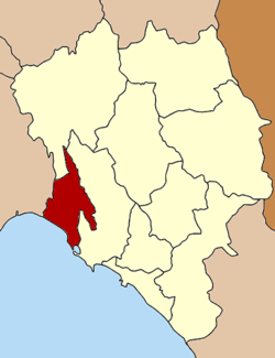
Coordinates: 12°46′12″N 101°51′18″E / 12.77°N 101.855°ECoordinates: 12°46′12″N 101°51′18″E / 12.77°N 101.855°E Country  Thailand
Province Chanthaburi Seat Na Yai Am Tambon Muban Amphoe established Area – Total 300.0 km2 (115.8 sq mi) Population (2005) – Total 32,108 – Density 107.0/km2 (277.1/sq mi) Time zone THA (UTC+7) Postal code 22160 Geocode 2209 Na Yai Am (Thai: นายายอาม) is a district (Amphoe) in the western part of Chanthaburi Province, eastern Thailand.
Contents
History
The district was created on April 1 1992 by splitting off the five western tambon of Tha Mai district[1]. It was upgraded to a full district on December 5 1996[2].
Geography
Neighboring districts are (from the west clockwise) Klaeng of Rayong Province, Kaeng Hang Maeo and Tha Mai of Chanthaburi Province. To the southwest is the Gulf of Thailand.
Administration
The district is subdivided into 6 subdistricts (tambon), which are further subdivided into 67 villages (muban). Na Yai Am is a township (thesaban tambon) which covers parts of tambon Na Yai Am. There are further 6 Tambon administrative organizations (TAO) responsible for the non-municipal areas.
No. Name Thai name Villages Inh. 1. Na Yai Am นายายอาม 15 9414 2. Wang Tanot วังโตนด 10 3532 3. Krachae กระแจะ 11 4671 4. Sanam Chai สนามไชย 8 4349 5. Chang Kham ช้างข้าม 13 4739 6. Wang Mai วังใหม่ 10 5403 References
- ^ "ประกาศกระทรวงมหาดไทย เรื่อง แบ่งเขตท้องที่อำเภอท่าใหม่ จังหวัดจันทบุรี ตั้งเป็นกิ่งอำเภอนายายอาม" (in Thai). Royal Gazette 109 (53 ง): 4. April 22 1992. http://www.ratchakitcha.soc.go.th/DATA/PDF/2535/D/053/4.PDF.
- ^ "พระราชกฤษฎีกาตั้งอำเภอเหนือคลอง อำเภอนายายอาม อำเภอท่าตะเกียบ อำเภอขุนตาล อำเภอแม่ฟ้าหลวง อำเภอแม่ลาว อำเภอรัษฎา อำเภอพุทธมณฑล อำเภอวังน้ำเขียว อำเภอเจาะไอร้อง อำเภอชำนิ อำเภอโนนดินแดง อำเภอปางมะผ้า อำเภอสนธิ อำเภอหนองม่วง อำเภอเบญจลักษ์ อำเภอโพนนาแก้ว อำเภอบุ่งคล้า อำเภอดอนมดแดง และอำเภอลืออำนาจ พ.ศ. ๒๕๓๙" (in Thai). Royal Gazette 113 (62 ก): 5–8. November 20 1996. http://www.ratchakitcha.soc.go.th/DATA/PDF/2539/A/062/5.PDF.
External links
Mueang Chanthaburi · Khlung · Tha Mai · Pong Nam Ron · Makham · Laem Sing · Soi Dao · Kaeng Hang Maeo · Na Yai Am · Khao Khitchakut
Categories:- Amphoe of Chanthaburi
- Eastern Thailand geography stubs

Wikimedia Foundation. 2010.