- Hat Yai
Infobox Settlement
name = Hat Yai
official_name =
other_name =
native_name = หาดใหญ่
nickname =
settlement_type =
total_type =
motto =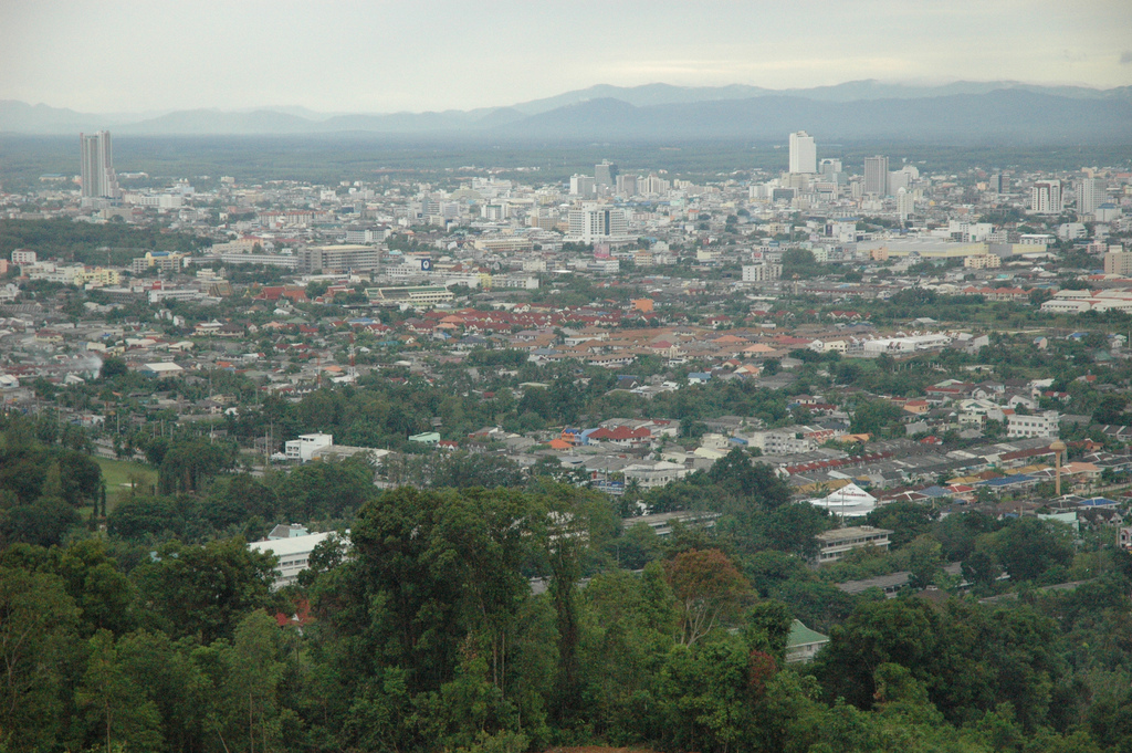
imagesize =
image_caption = Hat Yai
flag_size =
image_
seal_size =
image_shield =
shield_size =
image_blank_emblem =
blank_emblem_type =
blank_emblem_size =
mapsize =
map_caption =
mapsize1 =
map_caption1 =
image_dot_
dot_mapsize =
dot_map_caption =
dot_x = 150 |dot_y = 87
pushpin_
pushpin_label_position =
pushpin_map_caption =
pushpin_mapsize =
subdivision_type = Country
subdivision_name = THA
subdivision_type1 = Province
subdivision_name1 = Songkhla
subdivision_type2 =
subdivision_name2 =
seat_type =
seat =
parts_type =
parts_style =
parts =
p1 =
p2 =
government_footnotes =
government_type =
leader_title =
leader_name =
leader_title1 =
leader_name1 =
established_title =
established_date =
area_magnitude =
unit_pref =
area_footnotes =
area_total_km2 = 21.00
area_land_km2 = 20.50
area_water_km2 = 0.50
area_total_sq_mi = 8.20
area_land_sq_mi = 8.00
area_water_sq_mi = 0.20
area_water_percent = 2.38
elevation_footnotes =
elevation_m =
elevation_ft =
elevation_max_m =
elevation_max_ft =
elevation_min_m =
elevation_min_ft =
population_as_of = 2008
population_footnotes =
population_note = Registered residents only
population_total = 157,359
population_density_km2 = 7,676.05
population_density_sq_mi = 18,297.55
latd=7 |latm=1|lats=|latNS=N
longd=100|longm=28 |longs= |longEW=Etimezone = Thailand
utc_offset = +7
timezone_DST =
utc_offset_DST =
coor_type =
postal_code_type =
postal_code =
area_code =
blank_name =
blank_info =
website = http://www.hatyaicity.go.th
footnotes =Hat Yai ( _th. หาดใหญ่; also Haad Yai / Had Yai) is a city in southern
Thailand near the boundary toMalaysia . Geographical location coord|7|1|N|100|28|E|. With a population of 157,359 (2008) in the core city and about 800,000 in the Greater Hat Yai, Hat Yai is the biggest city of theSongkhla Province and the largest metropolitan area in Southern Thailand, and is thus often mistaken as being the capital of the province. HoweverSongkhla is the capital, unlike the other provinces where the capital is the biggest city of the province. The city covers the whole "tambon" Hat Yai of Hat Yai district. Both cities are a part ofGreater Hatyai-Songkhla Metropolitan Area .The name "Hat Yai" is a short version of "Ma Hat Yai", meaning big Ma Hat ( _th. มะหาด) tree.
The
Prince of Songkla University has its biggest campus in Hat Yai.Transportation
The city is served by the
Hat Yai International Airport .Hat Yai Railway Station , the largest station is an international railway station in Southern Thailand. It handles 28 passenger trains per day (26 trains served byState Railway of Thailand and 2 trains (Ekspres Langkawi ) are served by KTMB of Malaysia. It is also the hub of local trains in Southern Thailand.Also parallel to the railway is the
Asian highway 2. Asian highway 18 begins in Hat Yai and runs south along the eastern coast of the Malay peninsula.Demographics
Demographically, Hat Yai is notable for a higher proportion of Islamic and ethnic Chinese citizens than other cities of comparable size in the northern regions of Thailand.
History
Originally named Khok Sa-Met Choon, Hat Yai was a small village until the southern railway was built there. The junction which connected the town of Songkhla with the main route was originally located in the Utapao area, but was moved to Khok Su-Met Choon in 1922 when the Utapao area turned out to be flood prone. Khok Su-Met Choon had only four residences at that time, but due to the investments of Khun Niphatchinnkhon (謝枢泗, Jia Gi Si, 1886-1972, Hakkian Chinese), the railway contractor for the railway connection from
Nakhon Si Thammarat to Pattani, it quickly grew into a small town.In 1928 Hat Yai was made a Chumchon, which was upgraded to a sanitary district ("
sukhaphiban ") on December 11 1935. It covered an area of 4.4 km², and was administrated by the first mayor Udom Bunlong. In 1938 the municipal administration building was completed. On March 16 1949 it was granted town status ("thesaban mueang "); on May 10 1961 the area covered by the municipality was increased to 8 km². Due to the continuing growth, on August 13 1968 a new larger municipal administration building was opened. On April 24 1977 the area of the municipality was enlarged a second time to 21 km². Finally in 1995 it was upgraded to city status ("thesaban nakhon ").On
April 3 ,2005 , two bomb attacks at aCarrefour department store andHat Yai International Airport were made by separatists. The attacks killed two people and injured dozens.On
September 16 ,2006 a series of bomb attacks killed four people and injured over 70. Although no-one claimed responsibility for the attacks, local separatists are suspected. [http://news.bbc.co.uk/2/hi/asia-pacific/5353648.stm]Additional images
External links
* [http://www.hatyaicity.go.th/content_eng/index.php hatyaicity.go.th] Website of city
*
* [http://www.phukhao.com/download/maps/Hatyai_map.gifMap of Hat Yai focused on the center of the city]
* [http://www.phukhao.com/gmap/hy_gmap.htm Detailed map of Hat Yai]__NOTOC__

Wikimedia Foundation. 2010.