- Na Chueak District
-
Na Chueak
นาเชือก— Amphoe — Amphoe location in Maha Sarakham Province
Coordinates: 15°48′0″N 103°1′54″E / 15.8°N 103.03167°ECoordinates: 15°48′0″N 103°1′54″E / 15.8°N 103.03167°E Country  Thailand
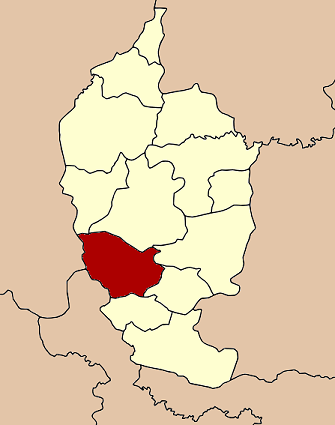
Province Maha Sarakham Seat Tambon Muban Amphoe established Area - Total 528.198 km2 (203.9 sq mi) Population (2008) - Total 60,856 - Density 115.2/km2 (298.4/sq mi) Time zone THA (UTC+7) Postal code 44170 Geocode 4407 Na Chueak (Thai: นาเชือก) is a district (Amphoe) in the south of Maha Sarakham Province, northeastern Thailand.
Contents
Geography
Neighboring districts are (from the north clockwise) Kut Rang, Borabue, Wapi Pathum, Na Dun and Yang Sisurat of Maha Sarakham Province, Na Pho of Buriram Province, and Nong Song Hong and Pueai Noi of Khon Kaen Province.
History
The area was made a minor district (King Amphoe) on July 19 1960 by splitting it off from Borabue district.[1] It was upgraded to become a full district in 1963.[2]
Administration
The district is subdivided into 10 subdistricts (tambon), which are further subdivided into 146 villages (muban). Na Chueak is a subdistrict municipality (thesaban tambon) which covers parts of the tambon Na Chueak and Khwao Rai. There are further 10 Tambon administrative organizations (TAO).
No. Name Thai Villages Inh. 1. Na Chueak นาเชือก 18 8,825 2. Samrong สำโรง 15 6,839 3. Nong Daeng หนองแดง 10 3,969 4. Khwao Rai เขวาไร่ 19 7,735 5. Nong Pho หนองโพธิ์ 12 5,237 6. Po Phan ปอพาน 16 8,055 7. Nong Mek หนองเม็ก 20 6,661 8. Nong Ruea หนองเรือ 13 5,166 9. Nong Kung หนองกุง 11 3,949 10. San Pa Tong สันป่าตอง 12 4,420 References
- ^ "ประกาศกระทรวงมหาดไทย เรื่อง ยกฐานะตำบลขึ้นเป็นกิ่งอำเภอ" (in Thai). Royal Gazette 77 (67 ง): 1885–1886. 1960-08-16. http://www.ratchakitcha.soc.go.th/DATA/PDF/2503/D/067/1885.PDF.
- ^ "พระราชกฤษฎีกาตั้งอำเภอบ่อพลอย อำเภอไทรโยค อำเภอหนองเรือ อำเภอหนองสองห้อง อำเภอประทาย อำเภอห้วยแถลง อำเภอละหานทราย อำเภอกุยบุรี อำเภอตาพระยา อำเภอหนองไผ่ อำเภอนาเชือก อำเภอวัดเพลง อำเภอพนัสนิคม อำเภอภูกระดึง อำเภอปรางค์กู่ อำเภอท่าช้าง อำเภอบ้านด่านลานหอย อำเภอบ้านดง อำเภอสว่างอารมณ์ และอำเภอกุดชุม พ.ศ. ๒๕๐๖" (in Thai). Royal Gazette 80 (72 ก): 362. 1963-07-16. http://www.ratchakitcha.soc.go.th/DATA/PDF/2506/A/072/362.PDF.
External links
- amphoe.com (Thai)
Mueang Maha Sarakham · Kae Dam · Kosum Phisai · Kantharawichai · Chiang Yuen · Borabue · Na Chueak · Phayakkhaphum Phisai · Wapi Pathum · Na Dun · Yang Sisurat · Kut Rang · Chuen Chom
Categories:- Amphoe of Maha Sarakham
- Isan geography stubs
Wikimedia Foundation. 2010.