- Chuen Chom District
-
Chuen Chom
ชื่นชม— Amphoe — Amphoe location in Maha Sarakham Province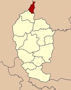
Coordinates: 16°31′53″N 103°10′18″E / 16.53139°N 103.17167°ECoordinates: 16°31′53″N 103°10′18″E / 16.53139°N 103.17167°E Country  Thailand
Province Maha Sarakham Seat Chuen Chom Tambon Muban Amphoe established Area – Total 113.0 km2 (43.6 sq mi) Population (2005) – Total 24,586 – Density 217.6/km2 (563.6/sq mi) Time zone THA (UTC+7) Postal code 44160 Geocode 4413 Chuen Chom (Thai: ชื่นชม) is a district (Amphoe) in the north of Maha Sarakham Province, northeastern Thailand.
Contents
Geography
Neighboring districts are (from the south clockwise) Chiang Yuen of Maha Sarakham Province, Sam Sung and Kranuan of Khon Kaen Province, Huai Mek and Yang Talat of Kalasin Province.
History
The minor district (King Amphoe) was split off from Chiang Yuen district on July 1 1997[1].
Following a decision of the Thai government on May 15 2007, all of the 81 minor districts were to be upgraded to full districts[2]. With the publishing in the Royal Gazette on August 24 the upgrade became official [3].
Administration
The district is subdivided into 4 subdistricts (tambon), which are further subdivided into 47 villages (muban). There are no municipal (thesaban) areas, and 4 Tambon administrative organizations (TAO).
No. Name Thai name Villages Inh. 1. Chuen Chom ชื่นชม 11 5,886 2. Kut Pla Duk กุดปลาดุก 15 8,264 3. Lao Dok Mai เหล่าดอกไม้ 11 6,329 4. Nong Kung หนองกุง 10 4,107 References
- ^ "ประกาศกระทรวงมหาดไทย เรื่อง แบ่งเขตท้องที่อำเภอเชียงยืน จังหวัดมหาสารคาม ตั้งเป็นกิ่งอำเภอชื่นชม" (in Thai). Royal Gazette 114 (Special 51 ง): 15. June 25 1997. http://www.ratchakitcha.soc.go.th/DATA/PDF/2540/E/051/15.PDF.
- ^ "แถลงผลการประชุม ครม. ประจำวันที่ 15 พ.ค. 2550" (in Thai). Manager Online. http://www.manager.co.th/Politics/ViewNews.aspx?NewsID=9500000055625.
- ^ "พระราชกฤษฎีกาตั้งอำเภอฆ้องชัย...และอำเภอเหล่าเสือโก้ก พ.ศ. ๒๕๕๐" (in Thai). Royal Gazette 124 (46 ก): 14–21. August 24 2007. http://www.ratchakitcha.soc.go.th/DATA/PDF/2550/A/046/14.PDF.
External links
Mueang Maha Sarakham · Kae Dam · Kosum Phisai · Kantharawichai · Chiang Yuen · Borabue · Na Chueak · Phayakkhaphum Phisai · Wapi Pathum · Na Dun · Yang Sisurat · Kut Rang · Chuen Chom
Categories:- Amphoe of Maha Sarakham
- Isan geography stubs

Wikimedia Foundation. 2010.