- Mueang Prachuap Khiri Khan District
-
Mueang Prachuap Khiri Khan
เมืองประจวบคีรีขันธ์— Amphoe — Amphoe location in Prachuap Khiri Khan Province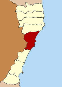
Coordinates: 11°48′30″N 99°47′48″E / 11.80833°N 99.79667°ECoordinates: 11°48′30″N 99°47′48″E / 11.80833°N 99.79667°E Country  Thailand
Province Prachuap Khiri Khan Seat Tambon Muban Amphoe established Area - Total 830.0 km2 (320.5 sq mi) Population (2000) - Total 90,869 - Density 109.48/km2 (283.6/sq mi) Time zone THA (UTC+7) Postal code 77000 Geocode 7701 Mueang Prachuap Khiri Khan (Thai: เมืองประจวบคีรีขันธ์) is the capital district (Amphoe Mueang) of Prachuap Khiri Khan Province, central Thailand.
Contents
History
In the Ayutthaya era, the area of modern Mueang Prachuap Khiri Khan was the location of two ancient cities, Mueang Narang and Khlong Wan. When Ayutthaya Kingdom was destroyed, the cities were abandoned. In early Rattanakosin era, King Rama II established Mueang Bang Nang Rom at the mouth of the Nang Rom canal. But as the land was not fertile, the king moved the city center to Mueang Kui, however the new city name was kept. King Mongkut (Rama IV) renamed it Mueang Prachuap Khiri Khan, to rhyme with Mueang Patchanta Khiri Khet (now Koh Kong) on the other side of the Gulf of Thailand. In 1894 King Chulalongkorn placed Mueang Prachuap under Mueang Phetchaburi. In 1898 he moved the district office from Mueang Kui to Ko Lak bay (also known as Prachuap bay). In 1906 the monarch merged Mueang Pranburi, Kamnoed Nopphakhun and Prachuap, and established Mueang Pranburi to keep the name of Mueang Pran. The new city was made a province under the control of Monthon Ratchaburi. To prevented confusion of the city names, King Vajiravudh (Rama VI) changed the district name that was located at the Prachuap bay back to Prachuap Khiri Khan on August 16, 1915.[1]
Geography
Neighboring district are Kui Buri to the north and Thap Sakae to the south. To the west is the Tanintharyi Division of Myanmar, to the east the Gulf of Thailand.
Administration
The district is subdivided into 6 subdistricts (tambon), which are further subdivided into 53 villages (muban). The town (thesaban mueang) of Prachuap Khiri Khan covers the complete tambon Prachuap Khiri Khan as well as parts of Ko Lak and Ao Noi. Another part of Ao Noi belongs to the township (thesaban tambon) KM 5. Parts of tambon Khlong Wan belong to the township Khlong Wan.
No. Name Thai name Villages 1. Prachuap Khiri Khan ประจวบคีรีขันธ์ - 2. Ko Lak เกาะหลัก 11 3. Khlong Wan คลองวาฬ 9 4. Huai Sai ห้วยทราย 13 5. Ao Noi อ่าวน้อย 16 6. Bo Nok บ่อนอก 14 References
- ^ "ประกาศ เปลี่ยนนามเมืองปราณบุรี เป็นเมืองประจวบคีรีขันธ์" (in Thai). Royal Gazette 32 (0 ก): 176. August 22 1915. http://www.ratchakitcha.soc.go.th/DATA/PDF/2458/A/176.PDF.
Categories:- Amphoe of Prachuap Khiri Khan
- Central Thailand geography stubs

Wikimedia Foundation. 2010.