- Mountain Gate, California
-
Mountain Gate — census-designated place — Position in California.
 Mountain Gate
Coordinates: 40°42′48″N 122°20′14″W / 40.71333°N 122.33722°WCoordinates: 40°42′48″N 122°20′14″W / 40.71333°N 122.33722°W Country  United States
State  California
County Shasta Area[1] – Total 6.091 sq mi (15.775 km2) – Land 6.091 sq mi (15.775 km2) – Water 0 sq mi (0 km2) 0% Elevation[2] 915 ft (279 m) Population (2010) – Total 80 – Density 13.1/sq mi (5.1/km2) Time zone Pacific (PST) (UTC-8) – Summer (DST) PDT (UTC-7) ZIP Code GNIS feature ID 2628760 U.S. Geological Survey Geographic Names Information System: Mountain Gate, California Mountain Gate is a census-designated place (CDP) in Shasta County, California.[2] Mountain Gate sits at an elevation of 915 feet (279 m).[2] The 2010 United States census reported Mountain Gate's population was 80.
Geography
According to the United States Census Bureau, the CDP covers an area of 6.1 square miles (15.8 km²), all of it land.
Demographics
The 2010 United States Census[3] reported that Mountain Gate had a population of 943. The population density was 476.6 people per square mile (184.0/km²). The racial makeup of Mountain Gate was 850 (90.1%) White, 7 (0.7%) African American, 27 (2.9%) Native American, 5 (0.5%) Asian, 0 (0.0%) Pacific Islander, 13 (1.4%) from other races, and 41 (4.3%) from two or more races. Hispanic or Latino of any race were 49 persons (5.2%).
The Census reported that 943 people (100% of the population) lived in households, 0 (0%) lived in non-institutionalized group quarters, and 0 (0%) were institutionalized.
There were 403 households, out of which 101 (25.1%) had children under the age of 18 living in them, 169 (41.9%) were opposite-sex married couples living together, 60 (14.9%) had a female householder with no husband present, 19 (4.7%) had a male householder with no wife present. There were 40 (9.9%) unmarried opposite-sex partnerships, and 4 (1.0%) same-sex married couples or partnerships. 119 households (29.5%) were made up of individuals and 36 (8.9%) had someone living alone who was 65 years of age or older. The average household size was 2.34. There were 248 families (61.5% of all households); the average family size was 2.83.
The population was spread out with 182 people (19.3%) under the age of 18, 84 people (8.9%) aged 18 to 24, 184 people (19.5%) aged 25 to 44, 325 people (34.5%) aged 45 to 64, and 168 people (17.8%) who were 65 years of age or older. The median age was 46.4 years. For every 100 females there were 100.6 males. For every 100 females age 18 and over, there were 99.2 males.
There were 441 housing units at an average density of 222.9 per square mile (86.1/km²), of which 264 (65.5%) were owner-occupied, and 139 (34.5%) were occupied by renters. The homeowner vacancy rate was 1.8%; the rental vacancy rate was 9.6%. 618 people (65.5% of the population) lived in owner-occupied housing units and 325 people (34.5%) lived in rental housing units.
References
- ^ U.S. Census
- ^ a b c U.S. Geological Survey Geographic Names Information System: Mountain Gate, California
- ^ All data are derived from the United States Census Bureau reports from the 2010 United States Census, and are accessible on-line here. The data on unmarried partnerships and same-sex married couples are from the Census report DEC_10_SF1_PCT15. All other housing and population data are from Census report DEC_10_DP_DPDP1. Both reports are viewable online or downloadable in a zip file containing a comma-delimited data file. The area data, from which densities are calculated, are available on-line here. Percentage totals may not add to 100% due to rounding. The Census Bureau defines families as a household containing one or more people related to the householder by birth, opposite-sex marriage, or adoption. People living in group quarters are tabulated by the Census Bureau as neither owners nor renters. For further details, see the text files accompanying the data files containing the Census reports mentioned above.
Municipalities and communities of Shasta County, California Cities 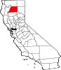
CDPs Bella Vista | Big Bend | Burney | Cassel | Cottonwood | Fall River Mills | French Gulch | Hat Creek | Keswick | Lakehead | McArthur | Millville | Montgomery Creek | Mountain Gate | Old Station | Palo Cedro | Round Mountain | Shasta | Shingletown
Unincorporated
communitiesCastella | Centerville | Cloverdale | Enterprise | Gas Point | Happy Valley | Igo | Ingot | Lakehead-Lakeshore | Matheson | Minnesota | Oak Run | O'Brien | Olinda | Ono | Platina | Pollard Flat | Viola | Whitmore
Indian reservations Ghost town Categories:- Census-designated places in Shasta County, California


Wikimedia Foundation. 2010.