- Shingletown, California
Infobox Settlement
official_name = Shingletown, California
settlement_type = CDP
imagesize =
image_caption =
image_
imagesize =
image_caption =
image_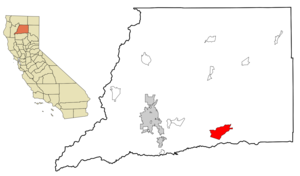
mapsize = 250x200px
map_caption = Location in Shasta County and the state ofCalifornia
mapsize1 =
map_caption1 =
subdivision_type = Country
subdivision_type1 = State
subdivision_type2 = County
subdivision_name =United States
subdivision_name1 =California
subdivision_name2 = Shasta
government_type =
leader_title =
leader_name =
established_date =
area_magnitude =
area_total_km2 = 64.1
area_total_sq_mi = 24.7
area_land_km2 = 64.1
area_land_sq_mi = 24.7
area_water_km2 = 0.2
area_water_sq_mi = 0.1
elevation_ft = 3468
elevation_m = 1064
population_as_of = 2000
population_footnotes =
population_total = 2222
population_metro =
population_density_km2 = 34.8
population_density_sq_mi = 90.1
timezone = Pacific (PST)
utc_offset = -8
latd = 40 |latm = 29 |lats = 46 |latNS = N
longd = 121 |longm = 51 |longs = 49 |longEW = W
timezone_DST = PDT
utc_offset_DST = -7
postal_code_type =ZIP code
postal_code = 96088
area_code = 530
blank_name = FIPS code
blank_info = 06-71568
blank1_name = GNIS feature ID
blank1_info = 1659646
footnotes =
website =Shingletown (pop. 2,650) is a
census-designated place (CDP) in Shasta County,California ,United States . The population was 2,222 at the 2000 census.Shingletown is a small town located in the hills just below Mt. Lassen. Shingletown has a history of logging large timber including pine, fir and cedar. It is also known as "The Gateway to Lassen".
Geography
Shingletown is located at coor dms|40|29|46|N|121|51|49|W|city (40.496033, -121.863657)GR|1.
According to the
United States Census Bureau , the CDP has a total area of 24.7square mile s (64.1km² ), of which, 24.7 square miles (63.9 km²) of it is land and 0.1 square miles (0.2 km²) of it (0.28%) is water.Demographics
As of the
census GR|2 of 2000, there were 2,222 people, 913 households, and 677 families residing in the CDP. Thepopulation density was 90.1 people per square mile (34.8/km²). There were 1,148 housing units at an average density of 46.5/sq mi (18.0/km²). The racial makeup of the CDP was 92.84% White, 0.36% African American, 2.39% Native American, 0.27% Asian, 0.77% from other races, and 3.38% from two or more races. Hispanic or Latino of any race were 3.42% of the population.There were 913 households out of which 26.8% had children under the age of 18 living with them, 62.3% were married couples living together, 7.9% had a female householder with no husband present, and 25.8% were non-families. 21.7% of all households were made up of individuals and 9.0% had someone living alone who was 65 years of age or older. The average household size was 2.43 and the average family size was 2.80.
In the CDP the population was spread out with 23.1% under the age of 18, 4.0% from 18 to 24, 21.2% from 25 to 44, 29.0% from 45 to 64, and 22.6% who were 65 years of age or older. The median age was 46 years. For every 100 females there were 101.8 males. For every 100 females age 18 and over, there were 98.4 males.
The median income for a household in the CDP was $32,813, and the median income for a family was $40,789. Males had a median income of $50,000 versus $26,758 for females. The
per capita income for the CDP was $16,303. About 10.3% of families and 12.6% of the population were below thepoverty line , including 14.0% of those under age 18 and 6.2% of those age 65 or over.Politics
In the state legislature Shingletown is located in the 4th Senate District, represented by Republican
Sam Aanestad , and in the 2nd Assembly District, represented by RepublicanDoug LaMalfa . Federally, Shingletown is located inCalifornia's 2nd congressional district , which has a Cook PVI of R +13 [cite web | title = Will Gerrymandered Districts Stem the Wave of Voter Unrest? | publisher = Campaign Legal Center Blog | url=http://www.clcblog.org/blog_item-85.html | accessdate = 2007-10-20] and is represented by RepublicanWally Herger .Incorporation rumors
Shingletown is one of five CDPs in Shasta County interested in incorporation. Burney is definitely interested in incorporation, both the people and town council. Fall River Mills and McArthur would incorporate as one city, and Cottonwood is trying to incorporate for the same reason as Shingletown, which is stricter building codes.
hingletown minus a high school
As of the 2007-2008 school year, Shingletown is still without a high school. High schoolers go to
Foothill High School inPalo Cedro , a 23-mile commute everyday.External links
Wikimedia Foundation. 2010.