- Burney, California
Infobox Settlement
official_name = Burney, California
settlement_type = CDP
imagesize =
image_caption =
image_
imagesize =
image_caption =
image_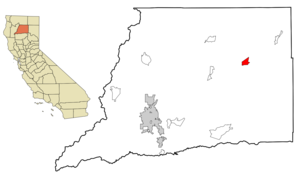
mapsize = 250x200px
map_caption = Location in Shasta County and the state ofCalifornia
mapsize1 =
map_caption1 =
subdivision_type = Country
subdivision_type1 = State
subdivision_type2 = County
subdivision_name =United States
subdivision_name1 =California
subdivision_name2 = Shasta
government_type =
leader_title =
leader_name =
established_date =
area_magnitude =
area_total_km2 = 13.4
area_total_sq_mi = 5.2
area_land_km2 = 13.4
area_land_sq_mi = 5.2
area_water_km2 = 0
area_water_sq_mi = 0
elevation_ft = 3195
elevation_m = 952
population_as_of = 2000
population_footnotes =
population_total = 3217
population_metro =
population_density_km2 = 240.3
population_density_sq_mi = 622.4
timezone = Pacific (PST)
utc_offset = -8
latd = 40 |latm = 52 |lats = 50 |latNS = N
longd = 121 |longm = 40 |longs = 0 |longEW = W
timezone_DST = PDT
utc_offset_DST = -7
postal_code_type =ZIP code
postal_code = 96013
area_code = 530
blank_name = FIPS code
blank_info = 06-09122
blank1_name = GNIS feature ID
blank1_info = 0277481
footnotes =
website = [http://www.burneychamber.com City of Burney Website]Burney is an unincorporated town and
census-designated place (CDP) in Shasta County,California ,United States . The population was 3,217 at the 2000 census. Burney is located on State Route 299, about 4 miles west of its junction with State Route 89.Burney is a center for
fly fishing , with wild brown and nativerainbow trout in many nearby rivers and streams, includingHat Creek , thePit River , andBurney Creek . Other attractions in the area includeMcArthur-Burney Falls Memorial State Park , home to theBurney Falls .Burney was named after Samuel Burney, a settler in the area in the 1850s. Burney was found dead in the valley in 1857, which came to be called "the valley where Burney died," and finally just "Burney".
The town of Burney sits at the base of an extinct volcano called
Burney Mountain .Erick Lindgren , one of the more well-known professional poker players on the World Poker Tour, was born here in 1976.Government
Burney has a
city council and many city services, but it is currently unincorporated because too many of the city's services like the planning department are contracted through the county. Burney has a city fire department and the police department is contracted through the Shasta County sheriff's office. It would've incorporated in 1939 when the fire district was formed, but the city has not had enough money ever since, and it still doesn't today. That is why half of the city services are contracted through the county.Burney has attempted several times since the mid-1900s to incorporate, but all of them failed. If it is incorporated, it would be the fourth or fifth city in Shasta County, and the first city in Eastern Shasta County. Cottonwood, Shingletown and Fall River Mills expressed an interest in incorporation too. Burney has tried to incorporate for one of two reasons: First, the community is seeing a lot more development and wants stricter building codes- the same situation in Cottonwood and Shingletown; and independence from county services. This is the same exact reason why Weaverville wants to incorporate, but hasn't yet.
Geography
Burney is located at coor dms|40|52|50|N|121|40|0|W|city (40.880655, -121.666750)GR|1.
According to the
United States Census Bureau , the CDP has a total area of 5.2square mile s (13.4km² ), all of it land.Demographics
As of the
census GR|2 of 2000, there were 3,217 people, 1,311 households, and 912 families residing in the CDP. Thepopulation density was 622.4 people per square mile (240.2/km²). There were 1,420 housing units at an average density of 274.7/sq mi (106.0/km²). The racial makeup of the CDP was 87.97% White, 0.09% African American, 6.87% Native American, 0.65% Asian, 0.06% Pacific Islander, 2.14% from other races, and 2.21% from two or more races. Hispanic or Latino of any race were 5.97% of the population.There were 1,311 households out of which 33.5% had children under the age of 18 living with them, 54.4% were married couples living together, 11.7% had a female householder with no husband present, and 30.4% were non-families. 26.2% of all households were made up of individuals and 13.7% had someone living alone who was 65 years of age or older. The average household size was 2.45 and the average family size was 2.96.
In the CDP the population was spread out with 27.7% under the age of 18, 6.2% from 18 to 24, 23.9% from 25 to 44, 27.1% from 45 to 64, and 15.0% who were 65 years of age or older. The median age was 40 years. For every 100 females there were 93.8 males. For every 100 females age 18 and over, there were 89.2 males.
The median income for a household in the CDP was $30,510, and the median income for a family was $37,682. Males had a median income of $42,314 versus $25,139 for females. The
per capita income for the CDP was $17,060. About 14.8% of families and 18.0% of the population were below thepoverty line , including 18.0% of those under age 18 and 11.1% of those age 65 or over.Politics
In the state legislature Burney is located in the 4th Senate District, represented by Republican
Sam Aanestad , and in the 2nd Assembly District, represented by RepublicanDoug LaMalfa . Federally, Burney is located inCalifornia's 2nd congressional district , which has a Cook PVI of R +13 [cite web | title = Will Gerrymandered Districts Stem the Wave of Voter Unrest? | publisher = Campaign Legal Center Blog | url=http://www.clcblog.org/blog_item-85.html | accessdate = 2007-10-20] and is represented by RepublicanWally Herger .References
External links
* [http://www.burneychamber.com Burney Chamber of Commerce]
Wikimedia Foundation. 2010.