- Mount Storm Wind Farm
-
Mount Storm Wind Farm 
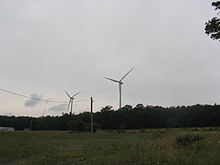
The wind farm as seen from the highwayLocation of Mount Storm Wind Farm Country United States Location Grant County, West Virginia Coordinates 39°13′28″N 79°12′15″W / 39.22444°N 79.20417°WCoordinates: 39°13′28″N 79°12′15″W / 39.22444°N 79.20417°W Status Operational Construction began 2006 Turbine information Turbines 132 Wind farm information Type Onshore Power generation information Installed capacity 264 MW The Mount Storm Wind Farm is located 120 miles west of Washington, D.C. in Grant County, West Virginia. The wind farm includes 132 wind turbines each with a two megawatt (MW) capacity along 12 miles of the Allegheny Front. Construction of the wind farm began in 2006 and the project is now fully operational, generating up to 264 MW of electricity for the mid-Atlantic power grid.[1]
History
Plans for the farm were first announced in 2001, when U.S. Wind Force filed for a permit with the West Virginia Public Service Commission to build a 166 turbine wind farm, which would have been the largest wind farm east of the Mississippi River. The project's backers hoped that the first turbines would be operational by late 2002 with the rest of the facility coming online in 2003, but opponents quickly raised objections, arguing that the project would threaten birds and diminish home values in the surrounding area.[2]
In May 2002, the Public Service Commission approved U.S. Wind Force's permit application without any significant opposition. The company also reached an agreement with the AFL-CIO to use union labor in the construction of the facility. At the hearings for the permit, speakers in favor of the project included Walt Helmick, a member of the West Virginia Senate, Jeff Barger, the County Commissioner of Grant County, and Steve White a union leader. A study by the U.S. Fish and Wildlife Service concluded that the project posed little danger to local birds, clearing the way for construction.[3]
References
- ^ Dominion & Shell Complete 264-MW Mount Storm Wind Project
- ^ Nyden, Paul (December 28, 2001). "Grant Wind Farm Will be Largest in East". The Charleston Gazette: p. 1C.
- ^ Steelhammer, Rick (MAy 30, 2002). "Grant wind farm developers reach agreement with union". The Charleston Gazette: p. 5A.
Wind power in the United States American Wind Energy Association · List of wind farms in the United States Wind power by state 
Large wind farms Alta Wind Energy Center · Altamont Pass · Biglow Canyon · Buffalo Gap · Capricorn Ridge · Fowler Ridge · Horse Hollow · Lone Star · Panther Creek · Peetz · Peñascal · Roscoe · San Gorgonio Pass · Klondike · Shepherds Flat · Sweetwater · Tehachapi Pass · Twin Groves · Windy Point/Windy FlatsWind power companies Clipper Windpower · Deepwater Wind · General Electric · National Wind · Native Wind · NextEra Energy Resources · Siemens Power Generation · Southwest Windpower · Urban Green Energy · Vestas · Wind Capital GroupCategories:- Wind farms in the United States
- Energy resource facilities in West Virginia
- Buildings and structures in Grant County, West Virginia
- Wind farms in West Virginia
- Wind farm stubs
- United States power station stubs
Wikimedia Foundation. 2010.

