Minaki railway station

Minaki railway station
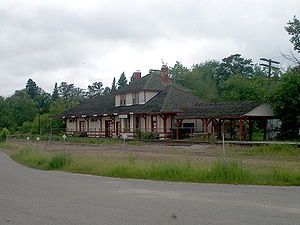
Minaki Railway Station
Via Rail (inter-city rail)
Minaki train station.JPG
Station statistics
Address Minaki, ON
Coordinates 49°59′08″N 94°40′08″W / 49.98556°N 94.66889°W / 49.98556; -94.66889Coordinates: 49°59′08″N 94°40′08″W / 49.98556°N 94.66889°W / 49.98556; -94.66889
Lines Canadian
Parking Yes
Other information
Owned by Via Rail
Formerly Canadian National Railway
Services
Preceding station   Via Rail   Following station
toward Vancouver
Canadian
Redditt
toward Toronto
Location
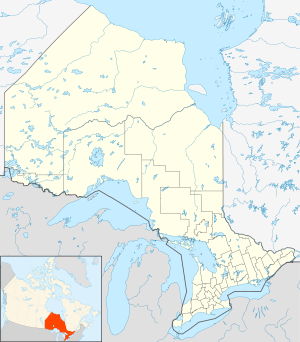
Minaki railway station is located in Ontario
{{{alt}}}
Location of Minaki railway station in Ontario

Minaki railway station is located in the community of Minaki in Unorganized Kenora District in northwestern Ontario, Canada. The station is on the Canadian National Railway transcontinental main line,[1] and is in use by Via Rail as a stop for transcontinental Canadian trains.

References

  1. ^ Ministry of Transportation of Ontario (2010-01-01) (PDF). Map 13 (Map). 1 : 1,600,000. Official road map of Ontario. http://www.mto.gov.on.ca/english/traveller/map/images/pdf/northont/sheets/Map13.pdf. Retrieved 2011-07-11. 

External links


Wikimedia Foundation. 2010.

Игры ⚽ Поможем решить контрольную работу

Look at other dictionaries:

  • Ottermere railway station — Via Rail (inter city rail) Station statistics Address Ottermere, Ontario Coordinates …   Wikipedia

  • Minaki — Coordinates: 49°59′11″N 94°40′12″W / 49.98639°N 94.67°W / 49.98639; 94.67 …   Wikipedia

  • Minaki Lodge — formerly part of the chain of Canadian National Hotels was originally built in 1914 by the Grand Trunk Pacific Railway (GTPR). Located on the route of the National Transcontinental Railway (NTR) at Minaki, Ontario, between Sioux Lookout and… …   Wikipedia

  • Minaki, Ontario — Minaki is a small unincorporated community in Northern Ontario, Canada. It is located at the point where the Canadian National Railways mainline crosses the Winnipeg River, and was accessible only by rail until about 1960. It was a fuelling and… …   Wikipedia

  • Canadian Pacific Railway — Infobox SG rail railroad name=Canadian Pacific Railway logo filename=Canadian Pacific Logo 1996.png logo size=162 system map size=300 map caption=Canadian Pacific system map as of 2004 (does not include DM E and IC E trackage). old gauge=… …   Wikipedia

  • Canadian Pacific Railway — Тип публичная компания Год основания 1881 Расположение …   Википедия

  • List of secondary highways in Kenora District — This is a list of secondary highways in Kenora District, most of which serve as logging roads or provide access to isolated and sparsely populated areas in the Kenora District of northwestern Ontario. Contents 1 Highway 525 2 Highway 594 3… …   Wikipedia

  • Dugald rail accident — Dugal rail accident Details Date September 1, 1947 Time 9:44 p.m. Location Dugald, Manitoba Country Canada Rail line Transcontinental mainline Operator Canadian …   Wikipedia

  • Dugald rail disaster — The Dugald rail disaster was a railway accident that took place on September 1, 1947 in Dugald, Manitoba, Canada, claiming the lives of 31 people. [ cite news title = Minaki train crash publisher = Winnipeg Free Press page = 1 date = September 1 …   Wikipedia

  • Winnipeg River — The Winnipeg River is a Canadian river which flows from Lake of the Woods in the province of Ontario to Lake Winnipeg in the province of Manitoba and eventually empties into Hudson Bay via the Nelson River. This river is 235 km long from the… …   Wikipedia

Share the article and excerpts

Direct link
Do a right-click on the link above
and select “Copy Link”