- Milton Damerel
-
Coordinates: 50°52′01″N 4°18′00″W / 50.867°N 4.300°W
Milton Damerel 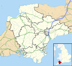
 Milton Damerel
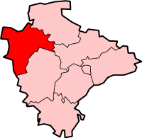
Milton Damerel shown within DevonPopulation 450 District Torridge Shire county Devon Region South West Country England Sovereign state United Kingdom Post town HOLSWORTHY Dialling code 01409 Police Devon and Cornwall Fire Devon and Somerset Ambulance South Western EU Parliament South West England List of places: UK • England • Devon Milton Damerel is a parish, commonly thought to be a village, made up of many tiny hamlets with the parish covering 7 square miles (18 km2) in the district of Torridge, North Devon. The parish has a population of around 450 and is about 5 miles (8.0 km) from Holsworthy and 18 miles (29 km) from Bideford. The A388 is the main road through the parish.
Contents
History
Roughly a thousand years ago people known as the Saxons started to inhabit the area that is now called Devon. In Milton Damerel three small Saxon communities were formed. These were:
- Giddescotta, Now named Gidcott. This was the farm or cott of a man named Gidde.
- Mideltona, Now named Middle Town.
and...
- Wonforda, Now named West Wonford. The original name meant, simply, the ford sutiable for heavy wagons.
When William the Conqueror conquered England in 1066 he repaid his knights. He gave Milton and Gidcott and thirteen other manors, in Devon, to a man named Robert de Alba Marla.
West Wonford was granted, along with twenty-eight other manors in Devon, to a man named Ruald Adobed.
The parish has a Grade II* listed Holy Trinity Parish Church that dates back to, in parts, the 13th century! The church holds weekly services and other events in the old school room.
Buildings and facilities
The parish has no schools, though the children in the parish normally go to Bradworthy Community Primary, Bradford Primary, Holsworthy C of E Primary, Holsworthy Community College, which really is a high school, and North Devon College. Below are the shops Milton Damerel has:
- Garage (MOT as well)
- Shop with a Cashpoint (ATM)
- Farm Shop
- Tea Room
- Pub
- Restaurant
Milton Damerel has many small businesses that serve the local community. The parish doesn't have a post office, although there are ones in Bradworthy, Holsworthy and a part-time one in Shebbear.
The parish has a parish hall that is used for community events. Interestingly, It has a Skittle alley attached, with skittle league matches taking place there during the winter months. The hall and skittle alley are both available for private hire.
There is a mobile library that visits the parish every two weeks. There is a permanent library in Holsworthy.
Public transport
There is a bus service that travels 4 times a day, in each direction, along the A388 between Holsworthy and Bideford and then on to Barnstaple. On Saturday mornings a bus goes to Launceston, Tavistock and Plymouth with a return service later in the day.
References
Towns, villages and hamlets in the Torridge District of Devon, England  Alfardisworthy · Appledore · Bideford · Bradworthy · Buckland Brewer · Bucks Mills · Bulkworthy · Clovelly · Dolton · Great Torrington · Halwill · Hartland · Holsworthy · Huntshaw · Langtree · Little Torrington · Newton St Petrock · Northam · Milton Damerel · Peters Marland · Petrockstowe · Pyworthy · Quoditch · Stibb Cross · Tetcott · Welcombe · Westward Ho! · WoolfardisworthyCategories:
- Civil parishes in Devon

Wikimedia Foundation. 2010.