Merced Peak

Merced Peak
Merced Peak
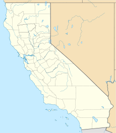
Merced Peak is located in California
Merced Peak
Merced County, California,  USA
Elevation 11,726 ft (3,574 m) [1]
Prominence 1,206 ft (368 m) [1]
Location
Range Clark Range
Coordinates 37°38′07″N 119°23′41″W / 37.6352111°N 119.3945904°W / 37.6352111; -119.3945904Coordinates: 37°38′07″N 119°23′41″W / 37.6352111°N 119.3945904°W / 37.6352111; -119.3945904[2]
Topo map USGS Merced Peak
Climbing
Easiest route Class 2 scramble

Merced Peak , with an elevation of 11,726 feet (3,574 m), is the highest point in the Clark Range, just surpassing three other peaks Red Peak (11,699 feet), Grey Peak (11,573 feet), and Mount Clark (11,522 feet).

Merced Peak is located close to southern border of Yosemite National Park, in the proximity of the Ottoway Lakes and could be reached both from the Park or from Quartz Mountain, another mountainous structure from the larger Sierra Nevada range.

References

External links


Wikimedia Foundation. 2010.

Игры ⚽ Поможем сделать НИР

Look at other dictionaries:

  • Merced River — im Yosemite Valley, im rechten Hintergrund der El Capitan August 2005Vorlage:Infobox Flus …   Deutsch Wikipedia

  • Merced River — Coordinates: 37°20′57″N 120°58′32″W / 37.34917°N 120.97556°W / 37.34917; 120.97556 …   Wikipedia

  • Merced National Wildlife Refuge — A flock of Sandhill Cranes landing The Merced National Wildlife Refuge encompasses 10,262 acres (41.53 km2) of wetlands, native grasslands, vernal pools, and riparian areas. It was established in 1951 under the Lea Act to …   Wikipedia

  • 1997 Merced River flood — Merced River Flood, December 31, 1996–January 5, 1997 Duration: December 31, 1996 to January 5, 1997, peaking on January 2, 1997 Fatalities: 0 …   Wikipedia

  • Owens Peak Wilderness — Peak Wilderness IUCN Category Ib (Wilderness Area) Owens Peak …   Wikipedia

  • Laveaga Peak — Infobox Mountain Name = Laveaga Peak Photo = Caption = Elevation = 3,801 ft (1,159 m) Prominence = 1,853 ft (565 m) Location = Merced County, California, USA Range = Diablo Range Coordinates = coord|36|53|26|N|121|10|41|W |type:mountain region:US …   Wikipedia

  • Chimney Peak Wilderness — IUCN Category Ib (Wilderness Area) …   Wikipedia

  • Clark Range (California) — For mountains of the same name in the Mojave Desert, see Clark Mountain Range. Coordinates: 37°39′29.754″N 119°24′33.535″W / 37.658 …   Wikipedia

  • Mount Clark (California) — Mount Clark West face from Glacier Point Road, January 2008. Elevation 11,527 ft ( …   Wikipedia

  • Dallas Lynn Peck — Dallas L. Peck Peck as Director of USGS, 1981–1993 Born March 28, 1929( …   Wikipedia

Share the article and excerpts

Direct link
Do a right-click on the link above
and select “Copy Link”