- McCulloch's Path
-
McCulloch's Path was an early colonial route through Western Maryland. This path, which owed its origin to American Bison, affords an interesting illustration of the fact that the pioneers of the West were greatly indebted to the buffalo for their first passageways; what adds to the interest is the fact that this was as true in the Alleghenies as in Kentucky and all the Midwestern United States; the range of the buffalo did not extend to the Atlantic seaboard, but references made by George Washington in his diary of September, 1784 suggest that it extended at least to Western Maryland.[1]
Contents
Washington's account
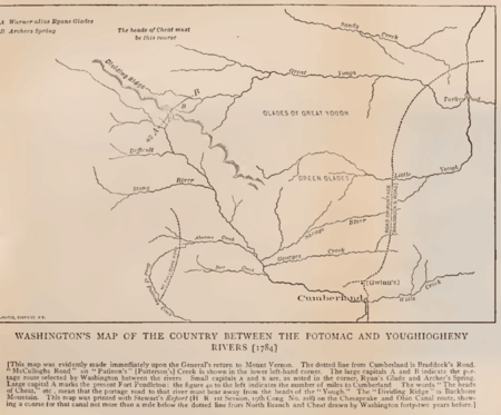 Washington's Map of the Country between the Potomac and Youghiogheny Rivers 1784
In September, 1784 George Washington traveled into the Ohio basin in the interest of a commercial union between the Great Lakes and the Potomac River. In his diary he wrote,
“ "At Bruceton, McCullough's Path turned southeast toward the "Great Glades of the Yoh," [1] ” Archer Butler Hulbert's study of the records at the law office at Annapolis in 1905[1] show that there were two McCullough's paths, an Old Path and a New Path; they are remembered, though the bold pioneer whose name they bore is quite forgotten. The names McCulloch and McCullough were common in northwestern Virginia.[2] Washington spells the name both ways and Archer Butler Hulbert knew not the name of the marker of the early routes through the Glades.[1]
The Old Path led from Ice's ferry, which in earliest days was known as McCullough's Landing,[3] to Bruceton and from thence by way of Castle Hill on Backbone Mountain to the North Branch (of the Potomac) at Bloomington, Maryland.
The New Road led from Dunkard's Bottom, passing near Oakland, Maryland to Fort Pendleton, Maryland on the North Branch.[1]
18th century settlers from Colonial Virginia arrived in Western Maryland by way of McCulloch’s Path.[4]
Historical Map
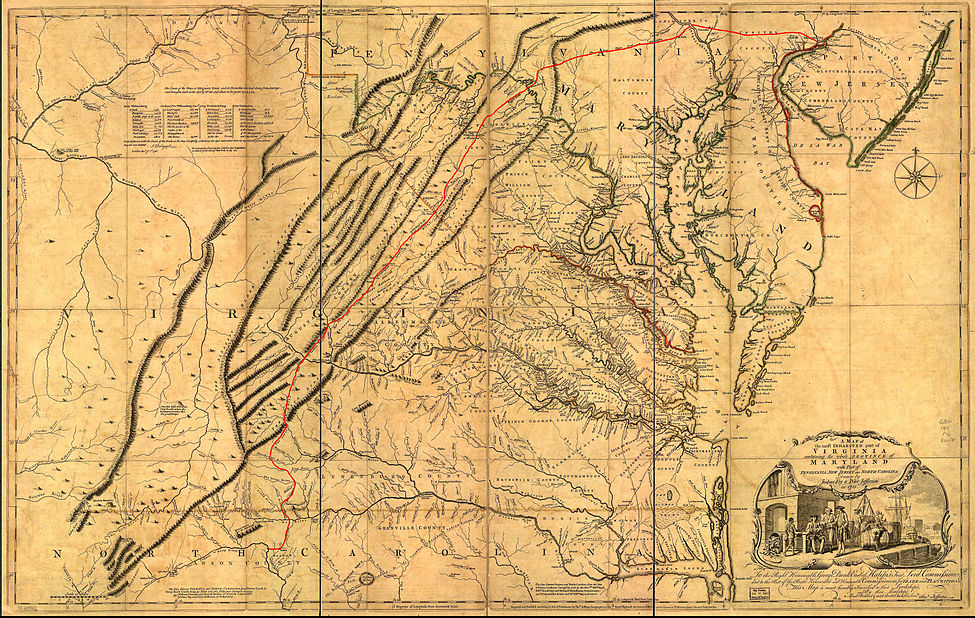
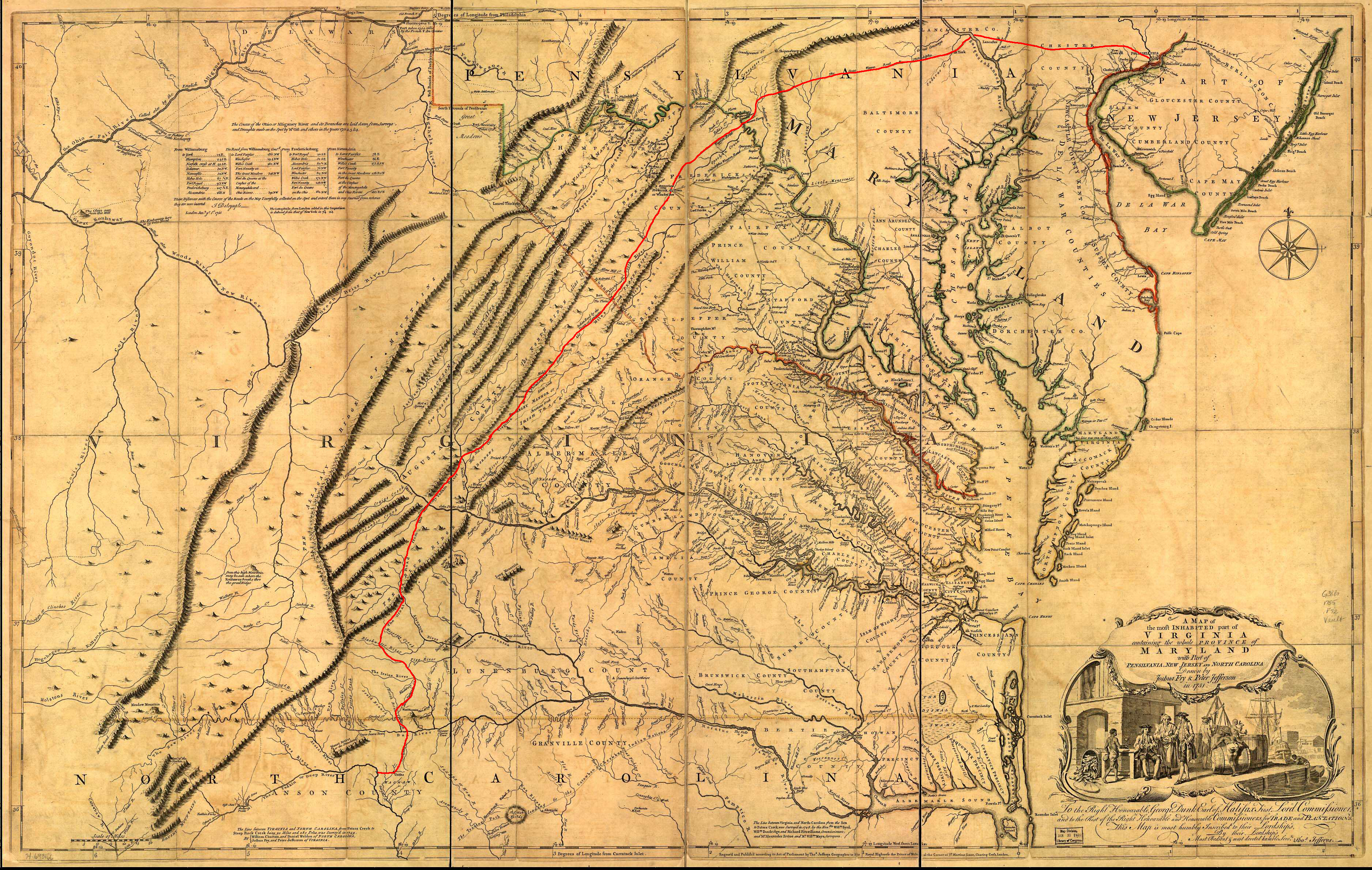
The landscape of western Virginia and western Maryland in 1751 is depicted in A Map of the most inhabited part of Virginia containing the whole Province of Maryland with Part of Pennsylvania, New Jersey and North Carolina drawn by Joshua Fry and Peter Jefferson in 1751 and printed in 1755 [5]
See also
Notes and references
- ^ a b c d e Washington, George; Hulbert, Archer Butler (1905). Washington and the West, Being George Washington's diary of September, 1784 and a commentary upon the same by Archer Butler Hulbert (Author of Historic Highways of America, etc). The Century Company. pp. 65–75.
- ^ Withers, Alexander Scott; Draper, Lyman Copeland (1895). Reuben Gold Thwaites. ed. Chronicles of Border Warfare, or History of Settlement by the Whites, of North-Western Virginia, and of the Indian Wars and Massacres in that section of the State (7 ed.). Cincinnati: Stewart & Kidd Company Publishers.
- ^ Washington, George; Crawford, William (1877). Washington-Crawford Letters Concerning Western Lands, 1767 - 1781. Chronologically arranged and carefully annotated by C. W. Butterfield. Cincinnati: R. Clarke & co.. p. 6.
- ^ John A Grant (2001-2002). "Garrett County History". Garrett College, History course material. Garrett County Historical Society Museum. http://www.deepcreeklake.com/gchs/. Retrieved 2009-11-11.
- ^ Fry, Joshua; Jefferson, Peter (1755), A map of the most inhabited part of Virginia containing the whole province of Maryland with part of Pensilvania, New Jersey and North Carolina. Drawn by Joshua Fry & Peter Jefferson in 1751, London: Thos. Jefferys
External links
Categories:- Pre-state history of Maryland
- History of Cumberland, MD-WV-PA
- Allegheny Mountains
- Appalachian Mountains
- Northwestern Turnpike
- National Road

Wikimedia Foundation. 2010.