- Masuleh
-
Masuleh
ماسوله— city — Masuleh view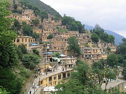
 Masuleh
Coordinates: 37°09′18″N 48°59′23″E / 37.155°N 48.98972°ECoordinates: 37°09′18″N 48°59′23″E / 37.155°N 48.98972°E Country  Iran
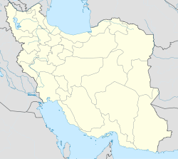
IranProvince Gilan County Fuman Bakhsh Sardar-e Jangal Population (2006) – Total 554 Time zone IRST (UTC+3:30) – Summer (DST) IRDT (UTC+4:30) Masuleh (Persian: ماسوله, also Romanized as Māsūleh and Massulya)[1] is a city in and the capital of Sardar-e Jangal District, in Fuman County, Gilan Province, Iran. At the 2006 census, its population was 554, in 180 families.[2]
Historical names for the city include Māsalar and Khortāb. It was founded in the 10th century AD.
Contents
Geography, history and climate
Masuleh is approximately 60 km southwest of Rasht and 32 km west of Fuman. The village is 1,050 meters above sea level in the Alborz (or Elburz) mountain range, near the southern coast of the Caspian Sea. The village itself has a difference in elevation of 100 meters.
The first village of Masuleh is approximately established around 1006 AD, 6 km northwest of the current city, and it is called Old-Masuleh (Kohneh Masuleh in Persian). People moved from Old-Masuleh to the current city because of pestilence and neighbor attacks. Some of old families do have a written ancestral tree as old as one hundred years.
Masouheh-Rood-Khan is the river passing through the city with a water fall 200m away from the village. Many other springs are found around Masuleh.
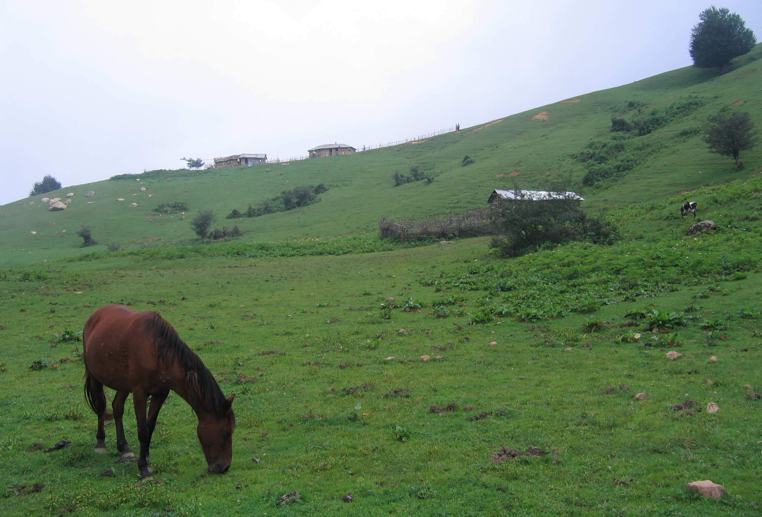
Masuleh is also surrounded by forest from valley to mount.
Fog is the predominate weather feature of Masuleh. Although it has been written that the community was established around 10 AD, the province of Gilan has a long history.
Architecture
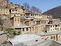
Masuleh architecture is unique. The buildings have been built into the mountain and are interconnected. Courtyards and roofs both serve as pedestrian areas similar to streets. Masuleh does not allow any motor vehicles to enter, due to its unique layout. It is the only city in Iran with such a prohibition. However, the small streets and many stairs simply wouldn't make it possible for vehicles to enter.
The spectacular architecture of Masuleh is popularly known as "The yard of the above building is the roof of the below building".
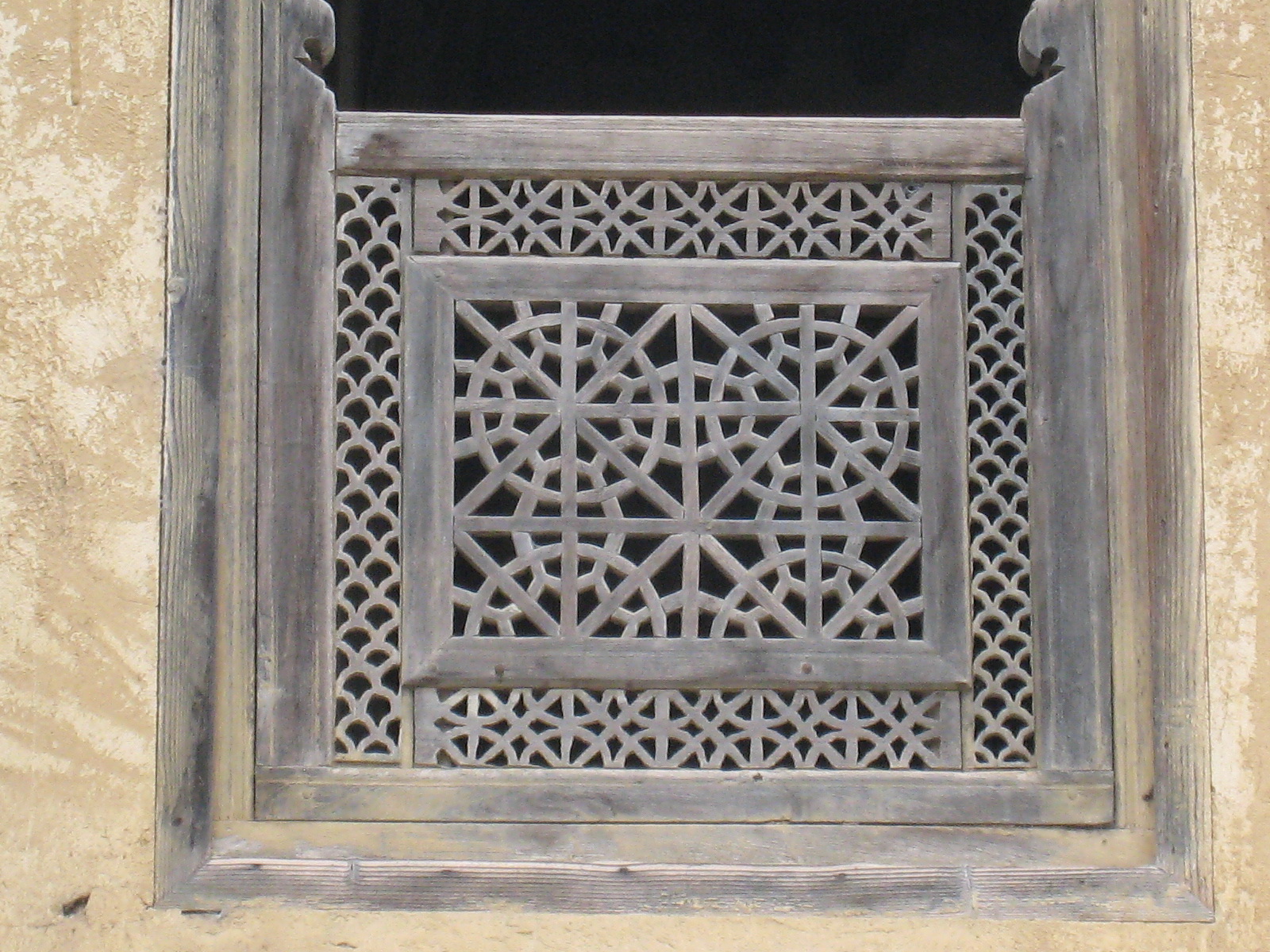
Yellow clay coats the exterior of most buildings in Masuleh. This allows for better visibility in the fog.
Buildings are mostly 2 stories (1st floor and below floor) made of adobe, rods and bole. A small living room, big guest room, winter room, hall, WC and balcony are usually found in 1st floor. A cold closet, barn and stable are located on the floor below, which are connected to the upper floor by several narrow steps inside the building.
There are four main local communities at the city named: "Maza-var" (meaning beside the Mosque) at the south, "Khana-var" (beside homes) at the East, "Kasha-sar" (stretched on top) at the North, and, "Assa-mahala" (Assad community) at the West. Apparently, down town is the Market (Bazaar) area and also the main mosque of the city, named "O-ne-ben-ne Ali" (Awn Ibn Mohammad Ibn Ali Ibn. Abi Taleb) built in 969 AD [3].
-
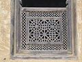
Window of building in Masuleh
-
The yard of the above building is the roof of the below building
-

The nature of Masuleh
-

Buildings are mostly 2 stories
Language
The native people of Masuleh speak Talysh.
Lists of mayors
Office Term Number Name Office 1 Amir Ostovar Unknown First person to be specifically appointed Mayor 2 Assadollah Gharib Masuleh Unknown 3 Mohammed Mohammadi Unknown See also
- Zonouz and Zonouzakh
- Kandeloos
References
- ^ Masuleh can be found at GEOnet Names Server, at this link, by opening the Advanced Search box, entering "-3074349" in the "Unique Feature Id" form, and clicking on "Search Database".
- ^ "Census of the Islamic Republic of Iran, 1385 (2006)" (Excel). Islamic Republic of Iran. http://www.amar.org.ir/DesktopModules/FTPManager/upload/upload2360/newjkh/newjkh/01.xls.
- ^ Sotoudeh, Manouchehr. "Monuments OF GĪLĀN". Encyclopædia Iranica. http://www.iranicaonline.org/articles/gilan-ix. Retrieved 19 November 2011.
External links
- Masuleh Pictures
- HORIZIN, Masuleh, Photo Set, flikr
- Iran Cultural Heritage, Handicrafts and Tourism Organization: [1]
 Gilan Province
Capital 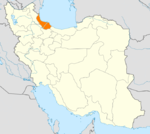
Counties and Cities Amlash · RankuhAstaneh-ye Ashrafiyeh CountyBandar-e Anzali CountyFuman · MasulehLangarud CountyRezvanshahr · Pareh SarShaft · AhmadsargurabSowme'eh Sara CountySights Anzali Lagoon · Anzali Maritime Museum · Astara Cactus museum · Emarat-i Kulah Farangi Rasht · Espidmazget · Ghaziayan bridge · Heyran road · Rasht Municipality (city hall) · Rudkhan Castle · Sajiran waterfall · Lunak waterfall · Marlik royal cemetery · Masouleh · Moin Mausoleum · Muhtasham garden · Kull ancient castle · Rasht museum · Sheitankoh · Tea Museum of Lahijan · Zahed Gilani's Shrine · Tea museumCategories:- Fuman County
- Cities in Iran
- Cities in Gilan Province
- Visitor attractions in Iran
-


Wikimedia Foundation. 2010.