- Marjaghal
-
Marjaghal
حويق— city — Coordinates: 37°16′32″N 49°21′46″E / 37.27556°N 49.36278°ECoordinates: 37°16′32″N 49°21′46″E / 37.27556°N 49.36278°E Country  Iran
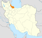
IranProvince Gilan County Sowme'eh Sara Bakhsh Tulem Population (2006) – Total 6,795 Time zone IRST (UTC+3:30) – Summer (DST) IRDT (UTC+4:30) Marjaghal (Persian: حويق, also Romanized as Mardzhagal and Marjaqal; also known as Tulem Shahr)[1] is a city in and the capital of Tulem District, in Sowme'eh Sara County, Gilan Province, Iran. At the 2006 census, its population was 6,795, in 1,879 families.[2]
References
- ^ Marjaghal can be found at GEOnet Names Server, at this link, by opening the Advanced Search box, entering "-3074141" in the "Unique Feature Id" form, and clicking on "Search Database".
- ^ "Census of the Islamic Republic of Iran, 1385 (2006)" (Excel). Islamic Republic of Iran. http://www.amar.org.ir/DesktopModules/FTPManager/upload/upload2360/newjkh/newjkh/01.xls.
 Gilan Province
Capital 
Counties and Cities Amlash · RankuhAstaneh-ye Ashrafiyeh CountyAstaneh-ye Ashrafiyeh · KiashahrAstara · LavandevilBandar-e Anzali CountyFuman · MasulehLahijan · RudbonehLangarud CountyMasal · Bazar JomehRezvanshahr · Pareh SarShaft · AhmadsargurabSiahkal · DeylamanSowme'eh Sara CountySowme'eh Sara · Gurab Zarmikh · MarjaghalSights Anzali Lagoon · Anzali Maritime Museum · Astara Cactus museum · Emarat-i Kulah Farangi Rasht · Espidmazget · Ghaziayan bridge · Heyran road · Rasht Municipality (city hall) · Rudkhan Castle · Sajiran waterfall · Lunak waterfall · Marlik royal cemetery · Masouleh · Moin Mausoleum · Muhtasham garden · Kull ancient castle · Rasht museum · Sheitankoh · Tea Museum of Lahijan · Zahed Gilani's Shrine · Tea museumCategories:- Sowme'eh Sara County
- Cities in Iran
- Cities in Gilan Province
- Gilan Province geography stubs
Wikimedia Foundation. 2010.

