- Martuni Province
-
For the capital of this province, see Martuni (town); for the town in Gegharkunik province, Armenia, see Martuni, Armenia; for the village in Shamkir Rayon, Azerbaijan, see Martuni, Azerbaijan; for the rayon of NKAO, see Martuni Rayon (NKAO).
Martuni
Մարտունի— Province — 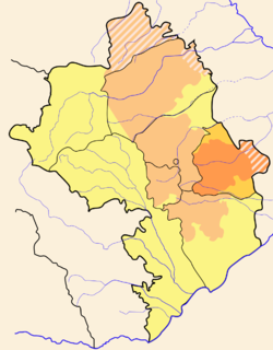
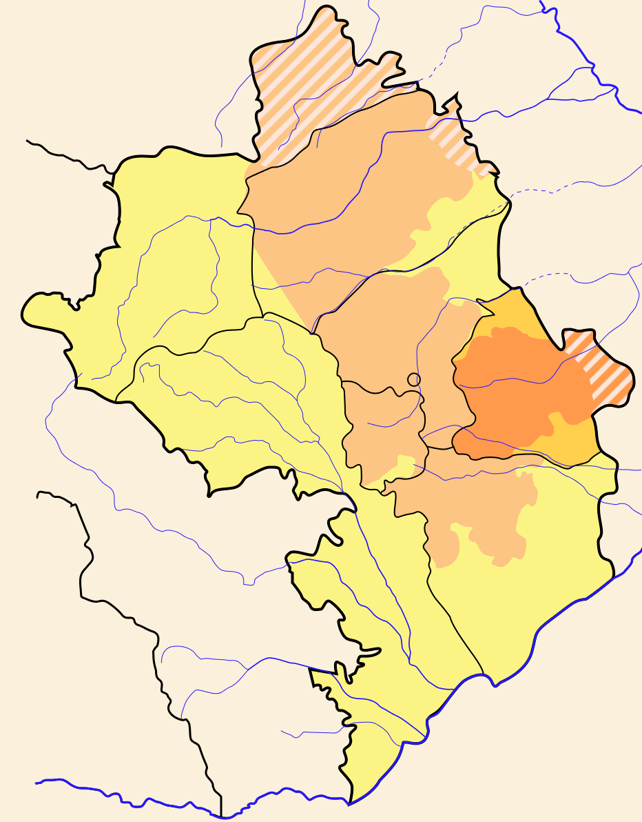
Capital Martuni Government – Governor Area – Total 951 km2 (367.2 sq mi) Area rank Ranked 6th Population (2005) – Total 23,157 – Rank Ranked 2nd – Density 24.4/km2 (63.1/sq mi) Postal code Website karabakh.net Martuni (Armenian: Մարտունի) is a province of Nagorno-Karabakh Republic. It consists of the branch of Nagorno-Karabakh which juts out farthest to the east, almost reaches Stepanakert on the west, and goes a little past Karmir Shuka on the south. The western half has many hills and small mountains, full of small villages, while the eastern half is very flat, with fewer villages, and the larger regional center of Martuni. The farthest parts to the east remain under the control of Azerbaijan. Historically, this area was also known as Myus Haband and Varand.
In 1991 the parliament of Azerbaijan abolished Martuni province, incorporating its territory into the neighbouring Azerbaijani rayon of Khojavend.
Sites of Interest
- Aghchekaberd, the "Fortress of the Young Girl" (Աղջկաբերդ in Armenian)
- Town of Martouni
- 2,000-year-old plane tree near the village of Sekhtorashen (Սխտորաշէն in Armenian)
- Nahataki Berd, "Martyr's Fortress" (Նահատակի Բերդ in Armenian)
- Amaras Monastery, one of the oldest monasteries in Greater Armenia
See also
External links
Ashan • Avdour • Berdashen • Chartar • Djivani • Emishchan • Haghorti • Haci • Herher • Ghavakhan • Ghuze Chartar • Gishi • Kaghartsi • Karahoundj • Karmir Shouka • Kert • Kherkhan • Khnoushinak • Kolkhozashen • Machkalashen • Momna • Moushkapat • Myurishen • Nngi • Nor Shen • Paravatoumb • Sargsashen • Shekher • Sos • Spitakashen • Taghavard • Tsovategh • Varanda • Vazgenashen • Zardanashen
Cities Stepanakert (capital)
Provinces
(Մարզեր marzer)Provincial capitals 1 Claimed by the Nagorno-Karabakh Republic but under Azerbaijani control.
2 Claimed by the Nagorno Karabakh Republic as the capital of the province of Shahumyan.Categories:- Geography of Nagorno-Karabakh
- Regions of old Armenia
- Azerbaijan geography stubs
- Armenia geography stubs
Wikimedia Foundation. 2010.