- Aşağı Ağcakənd
-
Coordinates: 40°25′20″N 46°33′36″E / 40.42222°N 46.56°E
Aşağı Ağcakənd — Municipality — 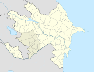
 Aşağı Ağcakənd
Coordinates: 40°25′20″N 46°33′36″E / 40.42222°N 46.56°E Country  Azerbaijan
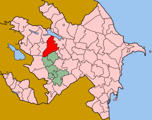
Rayon Goranboy Population – Total 207 Time zone AZT (UTC+4) – Summer (DST) AZT (UTC+5) Aşağı Ağcakənd (formerly Shaumyan) is a village in the Goranboy Rayon of Azerbaijan. The municipality consists of the villages of Aşağı Ağcakənd, Yuxarı Ağcakənd and Meşəli.[1]
During Soviet times Aşağı Ağcakənd was officially named Shaumian after the Bolshevik leader Stepan Shahumyan. In December 1991 with the Soviet Union imploding, Shaumian was claimed by the breakaway Nagorno-Karabakh Republic even though it had not fallen within the Soviet boundaries of the Nagorno-Karabakh Autonomous Oblast. It became the focus for considerable fighting which reached a climax in summer 1992 when most of the area was retaken by the Azerbaijan army. Damage was severe and the population, then predominantly ethnic-Armenian, fled.
Today Aşağı Ağcakənd town remains noticeably war-damaged but has been partly re-populated by ethnic Azerbaijani refugees[2] and idps.
References
- ^ Belediyye Informasiya Sistemi
- ^ Trailblazer "Azerbaijan with Excursions to Georgia", Hindhead, UK, 2004; p245
Cities Stepanakert (capital)
Provinces
(Մարզեր marzer)Provincial capitals 1 Claimed by the Nagorno-Karabakh Republic but under Azerbaijani control.
2 Claimed by the Nagorno Karabakh Republic as the capital of the province of Shahumyan.- Abbasqulular
- Ağamalıoğlu
- Alpout
- Aşağı Ağcakənd
- Azad
- Bağçakürd
- Balakürd
- Ballıqaya
- Başqışlaq
- Bəşirli
- Borsunlu
- Börü
- Buzluq
- Çalaberti
- Cinli Boluslu
- Cinli Zeynallı
- Dəliməmmədli
- Dəyirmanlar
- Əhmədabad
- Əlirzalı
- Elvazlu
- Erkeç
- Eyvazlılar
- Əzizbəyov
- Fəxralı
- Garandy
- Goran
- Goranlı
- Göynüyən
- Gülməmmədli
- Gülüstan
- Gürzalılar
- Hacallı
- Hazırəhmədli
- Həmənli
- Karahoundge
- Kelami
- Kələk
- Kəpənəkçi
- Kurəcay
- Mənəşli
- Məşədiqaralar
- Meşəli
- Muzdurlar
- Nadirkənd
- Nərimanlı
- Nizami
- Qaraçinar
- Qaradağlı
- Qaramusalı
- Qarapirimli
- Qaraqoyunlu
- Qarasuçu
- Qarasüleymanlı
- Qarqucaq
- Qaşaltı Qaraqoyunlu
- Qasımbəyli
- Qaxtut
- Qazanbulaq
- Qazançı
- Qazaxlar
- Qırıqlı
- Qızılhacılı
- Qurbanzadə
- Quşçular
- Rəhimli
- Rus Borisi
- Şadılı
- Şahməmmədli
- Sarov
- Sarovlu
- Şəfəq
- Şəfibəyli
- Səfikürd
- Səmədabad
- Shamkhalar
- Şıxlar
- Şurakənd
- Tap Qaraqoyunlu
- Tap
- Tatarlı
- Təhlə
- Todan
- Tyurk-Khoylu
- Veyisli
- Xan Qərvənd
- Xarxaput
- Xəsədərli
- Xınalı
- Xoylu
- Yəhərçi Qazaxlar
- Yeni yol
- Yenikənd
- Yerevanlı
- Yolpaq
- Yolqulular
- Yuxarı Ağcakənd
- Zeyvə
 Categories:
- Populated places in Goranboy Rayon
- Goranboy Rayon geography stubs

Wikimedia Foundation. 2010.