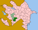
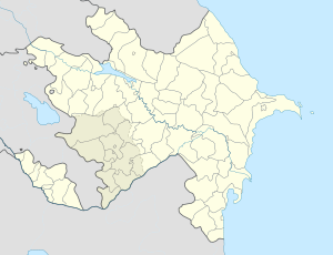
- Müşkapat
-
Coordinates: 39°46′17″N 46°58′46″E / 39.77139°N 46.97944°E
Müşkapat
MushkapatCoordinates: 39°46′17″N 46°58′46″E / 39.77139°N 46.97944°E Country De-jure  Azerbaijan
De-facto Nagorno-Karabakh
Rayon
ProvinceKhojavend
Martuni ProvinceArea – Total 86,600 km2 (33,436.4 sq mi) Elevation 703 m (2,306 ft) Population – Total 7,961,619 Time zone AZT (UTC+4) – Summer (DST) AZT (UTC+5) Website www.mushkapat.com Müşkapat (Armenian: Մուշկապատ, also Moushkapat and Mushkapat) with a latitude of 39.77(39°46′17 N) and a longitude of 46.98(46°58′6 E), is a populated place located in Khojavend Rayon region of Azerbaijan that is a part of Asia.[1]
Location placement
Mushkapat is situated 65 kilometers south west (205°) of the approximate center of Azerbaijan and 256 kilometers west (255°) of capital Baku.[2]
Area Population and Elevation
A 100 square kilometer area around Mushkapat has an approximate population of 634617 (0.006346 persons per square meter) and an average elevation of 703 meters above sea levels.[3]
References
- ^ mushkapat.com/about.html Location type & Co ordinates
- ^ http://www.mushkapat.com/about.html Location placement
- ^ http://www.mushkapat.com Area population and elevation
- ^ http://www.getamap.net/maps/azerbaijan/xocav?nd/_mushkapat/
Ağbulaq · Ağbulaq · Ağcakənd · Ağdam · Ağkənd · Amaras · Arakül · Argyunash · Arpadüzü · Arpagədik · Arysh · Ataqut · Avdur · Axullu · Azokh · Bilbilyak · Binə · Binədərəsi · Böyük Tağlar · Bulutan · Bünyadlı · Çağadüz · Çaylaqqala · Cəmiyyət · Cilən · Ciraquz · Cütçü · Dağdöşü · Dərəkənd · Divanalılar · Dolanlar · Düdükçü · Edilli · Edişa · Əmiranlar · Gavahın · Günəşli · Güneyçartar · Güneyxırman · Hadrut · Hatsi · Haxulu · Heşan · Karaundzh · Kemrakuch · Kəndxurd · Khnushinak · Kiş · Köhnə Tağlar · Kokva-Kolel · Krasnyy Bazar · Kuropatkino · Maçkalaşen · Mavas · Melikcanlı · Məmməddərə · Miruşen · Muğanlı · Mülküdərə · Müşkapat · Ningidzhan · Ömrallar · Paravatumb · Petrosashen · Qağartsi · Qaradağlı · Qarakənd · Qarqar · Quzeyxırman · Quzumkənd · Şahyeri · Salaketin · Şəkər · Şıx Dursun · Skobelevka · Sor · Sos · Spitakşen · Susanlıq · Tağaser · Taqaverd · Tsakuri · Tuğ · Vanq · Xanoba · Xərxan · Xətai · Xırmancıq · Yemişcan · Yenikənd · Zavadykh · Zərdanaşen · Zoğalbulaq
 Capital: MartuniAshan • Avdour • Berdashen • Chartar • Djivani • Emishchan • Haghorti • Haci • Herher • Ghavakhan • Ghuze Chartar • Gishi • Kaghartsi • Karahoundj • Karmir Shouka • Kert • Kherkhan • Khnoushinak • Kolkhozashen • Machkalashen • Momna • Moushkapat • Myurishen • Nngi • Nor Shen • Paravatoumb • Sargsashen • Shekher • Sos • Spitakashen • Taghavard • Tsovategh • Varanda • Vazgenashen • Zardanashen
 Categories:
- Populated places in Khojavend Rayon
- Khojavend Rayon geography stubs
Wikimedia Foundation. 2010.

