- Marston Meysey
-
Coordinates: 51°40′23″N 1°48′58″W / 51.673°N 1.816°W
Marston Meysey 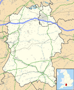
 Marston Meysey
Marston Meysey shown within WiltshireOS grid reference SU127973 Unitary authority Wiltshire Ceremonial county Wiltshire Region South West Country England Sovereign state United Kingdom Post town SWINDON Postcode district SN6 6 Dialling code 01285 Police Wiltshire Fire Wiltshire Ambulance Great Western EU Parliament South West England UK Parliament North Wiltshire List of places: UK • England • Wiltshire Marston Meysey, pronounced and sometimes also spelt Marston Maisey, is a village in Wiltshire, England, lying three miles north east of Cricklade on the county boundary with Gloucestershire.
The village has a pub called the Old Spotted Cow,[1] and not far away is RAF Fairford.[2] The nearest major town is Swindon.
Contents
History
Marston Meysey was part of the hundreds of Highworth, Cricklade and Staple and of the diocese of Gloucester.[3]
The population was 240 in 1831, but only 185 in 1951.[2]
A chapel of ease was built by the de Meysey family in the late 13th century, and a new chapel in 1648, which was in disrepair by the 1870s. In 1869 the Rev. W. H. Ranken became Rector of St Mary's in Meysey Hampton and Vicar of Marston Meysey and soon mounted a public appeal for funds for new buildings. Money collected mainly within Marston Meysey paid for a new church, a vicarage and a Church of England school. The school was closed in 1924, as the number of children had fallen to eighteen, and since then the old school building has been used as a village hall. It is now a grade 2 listed building and is owned by the village.[4]
The 19th century parish church is called St James's.[5]
Governance
Most significant local government services are provided by Wiltshire unitary council. At the parliamentary level, the parish is part of the North Wiltshire county constituency and its current member of parliament is James Gray (Conservative).
See also
References
- ^ pub's website, theoldspottedcow.co.uk
- ^ a b Marston Meysey at genuki.org.uk
- ^ John Gorton, A Topographical Dictionary of Great Britain and Ireland (1833), p. 773
- ^ Village Hall at marston-meysey.info
- ^ St James's church, Marston Meysey at geograph.org.uk
External links
- village web site, marston-meysey.info
- The Manor, Marston Meysey, at geograph.org.uk
- Wiltshire and Swindon Sites and Monument Record for Marston Meysey, at wiltshire.gov.uk
Ceremonial county of Wiltshire Unitary authorities - Swindon
- Wiltshire Council
Major settlements - Amesbury
- Bradford on Avon
- Calne
- Chippenham
- Corsham
- Cricklade
- Devizes
- Highworth
- Larkhill
- Ludgershall
- Malmesbury
- Marlborough
- Mere
- Melksham
- Royal Wootton Bassett
- Salisbury
- Swindon
- Tidworth
- Tisbury
- Trowbridge
- Warminster
- Westbury
- Wilton
See also: List of civil parishes in Wiltshire
Rivers Topics - Flag
- Grade I listed buildings
- History
- Lords Lieutenant
- Deputy Lieutenants
- High Sheriffs
- Parliamentary constituencies
- Local elections
- Places
- Museums
Categories:- Villages in Wiltshire
- Civil parishes in Wiltshire
- Wiltshire geography stubs

Wikimedia Foundation. 2010.