- Mareham on the Hill
-
Coordinates: 53°11′37″N 0°04′37″W / 53.19353700°N 0.07702767°W
Mareham on the Hill 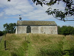
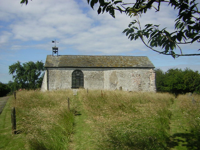
All Saints, Mareham on the Hill
 Mareham on the Hill
Mareham on the Hill shown within LincolnshirePopulation 89 (2001) OS grid reference TF285679 District East Lindsey Shire county Lincolnshire Region East Midlands Country England Sovereign state United Kingdom Post town Horncastle Postcode district LN9 Police Lincolnshire Fire Lincolnshire Ambulance East Midlands EU Parliament East Midlands UK Parliament Louth and Horncastle List of places: UK • England • Lincolnshire Mareham on the Hill is a village and civil parish about 2.5 miles (4.0 km) south east of the town of Horncastle, Lincolnshire, England.
Mareham on the Hill was listed in Domesday Book of 1086 as having one household and eight acres of woodland.[1]
The parish church is dedicated to All Saints and is a grade II* listed building dating from the 15th century, although it was restored in 1780 and remodelled in 1804. It is built of green sandstone, limestone and red brick, and is colourwashed.[2]
Mareham Grange farmhouse is a grade II listed 18th century red brick farmhouse with 20th century alterations.[3]
References
- ^ "Mareham on the Hill". Domesday Map. Anna Powell-Smith/University of Hull. http://www.domesdaymap.co.uk/place/TF2867/mareham-on-the-hill/. Retrieved 11 July 2011.
- ^ "All Saints, Mareham on the Hill". National Heritage List for England. English Heritage. http://list.english-heritage.org.uk/resultsingle.aspx?uid=1262409. Retrieved 11 July 2011.
- ^ "Mareham Grange Farmhouse". National Heritage List for England. English Heritage. http://list.english-heritage.org.uk/resultsingle.aspx?uid=1252186. Retrieved 11 July 2011.
Categories:- Lincolnshire geography stubs
- Villages in Lincolnshire
- Civil parishes in Lincolnshire
- East Lindsey

Wikimedia Foundation. 2010.