- Mareham Lane
-
Mareham Lane is an unclassified road between Graby and Sleaford in Lincolnshire, England.
Contents
The Roman Road
For most of its length Mareham Lane follows the route of a minor Roman road, and the name is also used for that Roman road from Bourne to the original ford at Sleaford[1] and perhaps on to Lincoln (Lindum Colonia).[2][3]
Margary numbers
Dr Margary allocated the following numbers in his classification scheme:[4]
- RR260 Bourne-Sleaford
- RR262 Sleaford-Bracebridge Heath
Selection of photographs from the collection on Wikimedia Commons 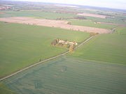 Beacon Hill farm on Mareham Lane
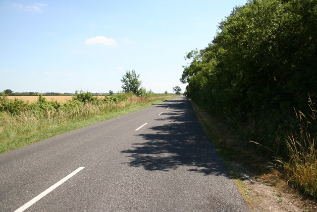
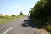 Mareham Lane near Scredington
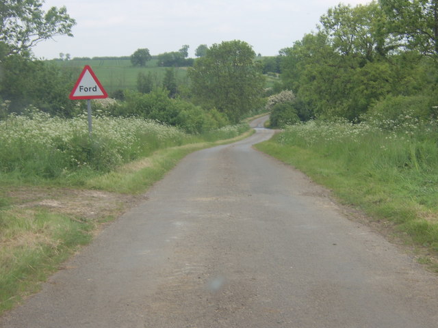
 Ford just north of Graby
Route details
Point Coordinates
(Links to map resources)OS Grid Ref Notes Footpath to Cawthorpe 52°46′53″N 0°22′37″W / 52.78136°N 0.37688°W TF095216 King street deviates from modern A15, to go through Stainfield to Ancaster. Start of Roman Mareham Lane Old Beck culvert 52°49′59″N 0°22′56″W / 52.833°N 0.382338°W TF090273 Bottom of Windmill Hill, Rippingale.
Start of linear Roman alignment on OS mapLayby at Graby 52°50′45″N 0°22′45″W / 52.84589°N 0.379076°W TF092288 Modern A15 straightened in the late 20th century.
Roman alignment continues into lay-byFootpath to Graby Lane 52°50′52″N 0°22′42″W / 52.8479°N 0.37839°W TF093290 Roman alignment continues across field as public footpath Graby Lane 52°51′06″N 0°22′34″W / 52.85179°N 0.376201°W TF094294 End of footpath.
Start of Modern Mareham Lane.
End of mapped Roman alignmentFord 52°51′33″N 0°22′32″W / 52.85909°N 0.375624°W TF094303 Dry Ford 52°53′28″N 0°22′31″W / 52.891069°N 0.375180°W TF094338 Seasonally intermittent Stream, sometimes appears across road.
Stream flows into Ouse Mere LodeBillingborough crossroads 52°53′35″N 0°22′34″W / 52.89308°N 0.37610°W TF093340 Billingborough road, Folkingham
Folkingham road, Billingborough.Stow Green 52°54′08″N 0°22′29″W / 52.902246°N 0.374673°W TF094351 Site of Stow Fair.
Site of Anglo-Saxon nunnery.Threekinghham crossroads 52°54′51″N 0°22′38″W / 52.914059°N 0.377324°W TF092364 Modern A52 crosses Modern Mareham Lane. Mareham House 52°55′43″N 0°22′45″W / 52.92864°N 0.379285°W TF090380 Road junction at Spanby Bend 52°58′51″N 0°23′14″W / 52.980883°N 0.387184°W TF083438 Northern end of Roman alignment on OS map.
Modern road deviates, and Roman Alignment becomes unclear.Corner 52°59′21″N 0°23′28″W / 52.989179°N 0.391002°W TF081447 Modern Mareham road turns left.
This different alignment continues toward the old ford at Sleaford as a footpath.Parish boundary 52°59′31″N 0°23′35″W / 52.992037°N 0.392937°W TF079450 Modified alignment continues past modern Mareham Lane as parish boundary
Public footpath alongside.Sleaford level crossing 52°59′43″N 0°24′31″W / 52.995258°N 0.408493°W TF069453 End of modern road called Mareham Lane at Sleaford level crossing. cropmark 52°59′05″N 0°23′10″W / 52.984625°N 0.386017°W TF084442 Possible continuation of straight alignment after the bend[5] cropmark 52°59′50″N 0°23′08″W / 52.997205°N 0.385548°W TF084456 Well-founded discovery of Roman road not on expected alignment.[6] Ruskington 53°02′16″N 0°23′19″W / 53.037701°N 0.388510°W TF081501 Well-founded discovery of Roman road to south of Ruskington, on public footpath.[7]
Speculative northern continuation from Sleaford to LincolnSee also
- High Dyke, Lincolnshire
- King Street (Roman road) Water Newton to Bourne to Ancaster, Margary number RR26
References
- ^ RR260: Margary, Ivan Donald (1973). Roman roads in Britain. J. Baker. p. 206. ISBN 978-0212970018.
- ^ "National monument record:Roman Road RR260 Bourne to Lincoln via Sleaford". http://www.pastscape.org.uk/hob.aspx?hob_id=1061192.
- ^ "National monument record:Roman Road RR262 Sleaford to Lincoln via Bracebridge Heath". http://www.pastscape.org.uk/hob.aspx?hob_id=1061215.
- ^ Margary, Ivan Donald. Roman roads in Britain.
- ^ "National Monument record:Cropmark near bend in the road". http://www.pastscape.org.uk/hob.aspx?hob_id=1044205. Retrieved 2011-02-27.
- ^ "National Monument record:Cropmark to east of original alignment". http://www.pastscape.org.uk/hob.aspx?hob_id=1049491. Retrieved 2011-02-27.
- ^ "National Monument record:Cropmark on Footpath near Ruskington". http://www.pastscape.org.uk/hob.aspx?hob_id=1049494. Retrieved 2011-02-27.
- Whitwell, J B (1992). Roman Lincolnshire. The Society of Lincolnshire History and Archaeology. ISBN 0 902668 16 1.
External links
Categories:- Roman roads in Britannia
- Archaeological sites in Lincolnshire
- History of Lincolnshire
- Transport in Lincolnshire
- Roads in England
Wikimedia Foundation. 2010.