- Cogglesford Mill
-
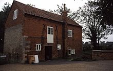 Cogglesford Mill, 2002
 Wier at Cogglesford Mill
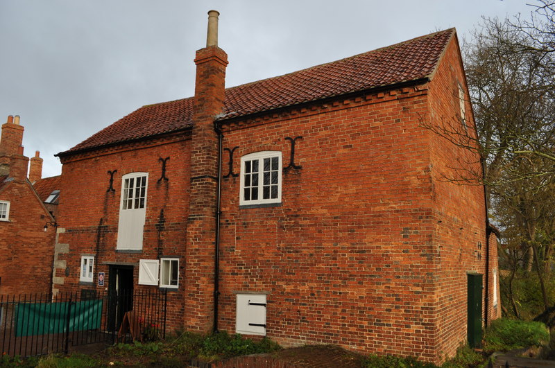
Cogglesford Mill[1] (sometimes referred to as Coggesford[2]) is a Grade II listed working watermill in Sleaford, Lincolnshire. It is possibly the last working Sheriff's Mill in England.[3] The mill sits to the north of Sleaford on banks of River Slea. There is archaeological evidence of a Saxon mill on the site and records in the Domesday book of later mills; the present redbrick structure dates to the late 18th century, with alterations from the 19th Century.[1]
The ford from which the mill takes its name is where the Roman road now called Mareham Lane crossed the Slea. The original crossing, no longer extant, is a few hundred yards downstream of the mill, close to the current footbridge.
There were many other mills along the river at various times. During the construction of the Sleaford Navigation, in the 1790s, locks were provided at each of the mills to maintain the necessary head. After the navigation closed and as the locks fell into repair they were replaced by weirs, and the weir at Cogglesford is particularly elaborate, having to maintin the head of this still working mill.
Cogglesford mill (including the mill race and bridge) was assigned a listed status on 20 July 1973.[1] The mill is open to the public 7 days a week during the summer and Organic stoneground flour is milled there and sold in shop.
Gallery
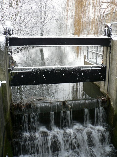
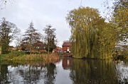 The Mill pond
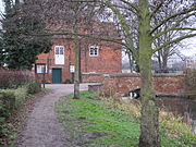 General view of the mill from upstream, with the small millpool formed by the river above the sluice.
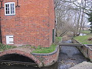 View of the entrance to the enclosed race, with the overflow weir alongside.
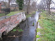 Remains of the lock constructed for the Navigation of the river.
 The mill in November 2010
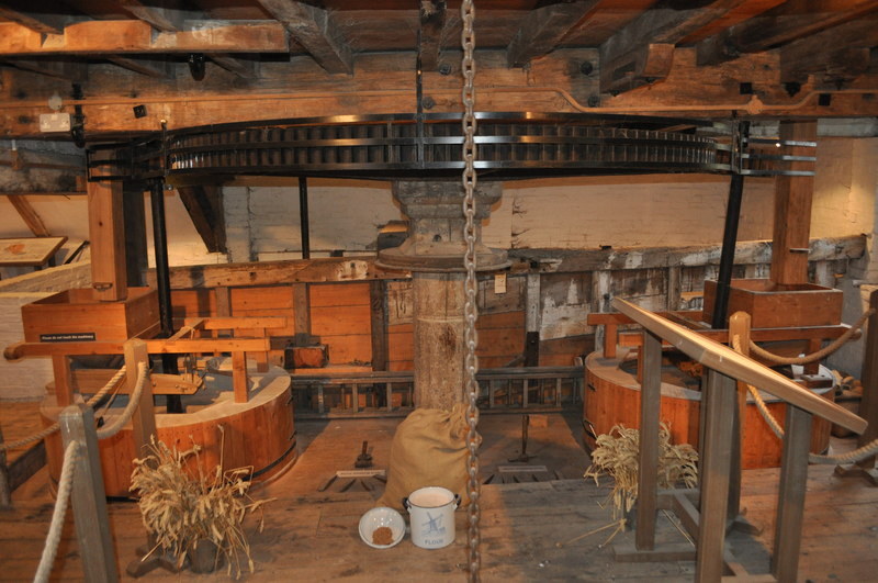
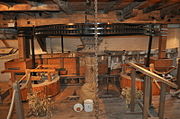 A view of the great spur wheel and stones.
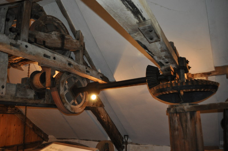
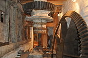 The Pit wheel and wallower
 The Sack hoist
References
- ^ a b c "Cogglesford Mill and Mill Race and Bridge (Listing NGR: TF0746046128)". Listed Buildings Online. English Heritage. http://list.english-heritage.org.uk/resultsingle.aspx?uid=1062115. Retrieved 8 July 2010.
- ^ Details from listed building database (191908) . Images of England. English Heritage.
- ^ "Cogglesford Mill". www.cogglesford-mill.com. Archived from the original on 2007-09-29. http://web.archive.org/web/20070929041913/http://www.cogglesford-mill.com/. Retrieved 2007-09-29.
External links
Categories:- Watermills in England
- Grade II listed buildings in Lincolnshire
- Industrial archaeology
- Museums in Lincolnshire
- River Slea
- Mill museums in England


Wikimedia Foundation. 2010.