- Vörå
-
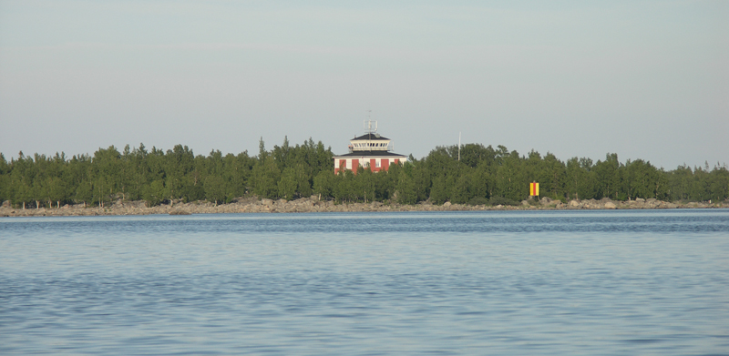
Vörå
Vörå – Vöyri— Municipality — Vörå kommun – Vöyrin kunta 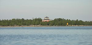
Coat of armsLocation of Vörå in Finland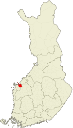
Coordinates: 63°08′N 022°15′E / 63.133°N 22.25°ECoordinates: 63°08′N 022°15′E / 63.133°N 22.25°E Country Finland Region Ostrobothnia Sub-region Vaasa sub-region Charter 1868 (Vörå) Re-established 2007 (Vörå-Maxmo) Re-established 2011 (Vörå) Government – Municipal manager Christina Öling Area(2011-01-01)[1] – Total 1,499.91 km2 (579.1 sq mi) – Land 781.31 km2 (301.7 sq mi) – Water 718.6 km2 (277.5 sq mi) Area rank 68th largest in Finland Population (2011-01-31)[2] – Total 6,698 – Rank 154th largest in Finland – Density 8.57/km2 (22.2/sq mi) Population by native language[3] – Swedish 84.6% (official) – Finnish 13.6% (official) – Others 1.8% Population by age[4] – 0 to 14 16.8% – 15 to 64 61.2% – 65 or older 22% Time zone EET (UTC+2) – Summer (DST) EEST (UTC+3) Municipal tax rate[5] 19% Website www.vora.fi Vörå (Finnish: Vöyri) is a municipality of Finland. In 2011, it was created from the municipalities of Vörå-Maxmo and Oravais.[6] Vörå-Maxmo was created in 2007 from the municipalities of (old) Vörå and Maxmo. It is located in the province of Western Finland and is part of the Ostrobothnia region.
The municipality is bilingual, with the majority (85%) speaking Swedish and the minority (14%) Finnish.[3]
Contents
Maxmo
Coat of Arms of Maxmo
The former municipality had a population of 1,037 (2003) and covered an area of 148.06 km² of which one fourth is land. The population density was 7.0 inhabitants per km². The majority were speakers of Swedish (90%) and the minority speakers of Finnish (8%).
Finland's first Natural World Heritage
In July 2006 Kvarken Archipelago was added as an extension to the UNESCO World Heritage site of the High Coast. The archipelago is unique in that it features ridged washboard moraines known as De Geer moraines, formed by the melting of the continental ice sheet 10,000 to 24,000 years ago. The Kvarken Archipelago is continuously rising from the sea at a rate among the highest in the world. During the last 600 years, over a third of the land areas in Maxmo has risen from the sea. That means over 20 acres (81,000 m2) of new land every year!
Vörå
 Coat of Arms of Vörå
The former municipality had a population of 3,524 (2003) and covered an area of 427.50 km² of which 2.38 km² is water. The population density was 8.3 inhabitants per km². The majority were speakers of Swedish (85%) and the minority speakers of Finnish (14%).
References
- ^ "Area by municipality as of 1 January 2011" (in Finnish and Swedish) (PDF). Land Survey of Finland. http://www.maanmittauslaitos.fi/sites/default/files/pinta-alat_2011_kunnannimenmukaan.xls. Retrieved 9 March 2011.
- ^ "Population by municipality as of 31 January 2011" (in Finnish and Swedish). Population Information System. Population Register Center of Finland. http://vrk.fi/default.aspx?docid=4258&site=3&id=0. Retrieved 18 February 2011.
- ^ a b "Population according to language and the number of foreigners and land area km2 by area as of 31 December 2008". Statistics Finland's PX-Web databases. Statistics Finland. http://pxweb2.stat.fi/Dialog/varval.asp?ma=060_vaerak_tau_107_fi&ti=V%E4est%F6+kielen+mukaan+sek%E4+ulkomaan+kansalaisten+m%E4%E4r%E4+ja+maa%2Dpinta%2Dala+alueittain++1980+%2D+2008&path=../Database/StatFin/vrm/vaerak/&lang=3&multilang=fi. Retrieved 29 March 2009.
- ^ "Population according to age and gender by area as of 31 December 2008". Statistics Finland's PX-Web databases. Statistics Finland. http://pxweb2.stat.fi/Dialog/varval.asp?ma=050_vaerak_tau_104_fi&ti=V%E4est%F6+i%E4n+%281%2Dv%2E%29+ja+sukupuolen+mukaan+alueittain+1980+%2D+2008&path=../Database/StatFin/vrm/vaerak/&lang=3&multilang=fi. Retrieved 28 April 2009.
- ^ "List of municipal and parish tax rates in 2011". Tax Administration of Finland. 29 November 2010. http://www.vero.fi/nc/doc/download.asp?id=7996;193801. Retrieved 13 March 2011.
- ^ "1.1.2011 yhdistyvien kuntien uudet nimet" (in Finnish). Kunnat.net. Helsinki: Suomen Kuntaliitto. 2 July 2010. http://www.kunnat.net/k_perussivu.asp?path=1;29;348;4827;50631;137625;163600. Retrieved January 1, 2011.
External links
 Media related to Vörå at Wikimedia Commons
- Municipality of Vörå – Official website (Swedish) (Finnish)
Municipalities of Ostrobothnia Municipalities 
Former municipalities Categories:- Vörå
- Municipalities of Ostrobothnia Region
- Populated places established in 2011
- Western Finland geography stubs


Wikimedia Foundation. 2010.